How to get to Rac One by bus?
Click on the bus route to see step by step directions with maps, line arrival times and updated time schedules.
From Westland Hialeah Senior High School, Hialeah
73 minFrom Amelia Earhart Park, Miami
61 minFrom Pembroke Lakes Mall Shopping Center, Miramar-Pembroke Pines
96 minFrom Miami Station Amtrak, Miami
69 minFrom Amtrak, Miami
68 minFrom Ives Dairy Road & 441, Miami
29 minFrom The Home Depot, Miami
47 minFrom Hialeah Gardens, Hialeah
67 minFrom Walmart (Walmart Supercenter Hollywood - State Rd 7), Hollywood
52 minFrom Miami Dade College Hialeah Campus, Hialeah
58 min
Bus stops near Rac One in Miami Gardens
Bus lines to Rac One in Miami Gardens
What are the closest stations to Rac One?
The closest stations to Rac One are:
- Nw 183 St & # 4500 (Top Value) is 61 yards away, 1 min walk.
- Nw 47 Av & Nw 181 Te is 301 yards away, 4 min walk.
Which bus lines stop near Rac One?
These bus lines stop near Rac One: 183, 32.
What’s the nearest bus station to Rac One in Miami Gardens?
The nearest bus station to Rac One in Miami Gardens is Nw 183 St & # 4500 (Top Value). It’s a 1 min walk away.
What time is the first bus to Rac One in Miami Gardens?
The 183 is the first bus that goes to Rac One in Miami Gardens. It stops nearby at 4:50 AM.
What time is the last bus to Rac One in Miami Gardens?
The 32 is the last bus that goes to Rac One in Miami Gardens. It stops nearby at 12:15 AM.
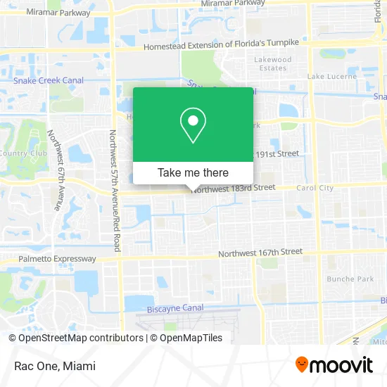
See Rac One, Miami Gardens, on the map
Public Transit to Rac One in Miami Gardens
Wondering how to get to Rac One in Miami Gardens? Moovit helps you find the best way to get to Rac One with step-by-step directions from the nearest public transit station.
Moovit provides free maps and live directions to help you navigate through your city. View schedules, routes, timetables, and find out how long does it take to get to Rac One in real time.
Looking for the nearest stop or station to Rac One? Check out this list of stops closest to your destination: Nw 183 St & # 4500 (Top Value); Nw 47 Av & Nw 181 Te.
Bus: 183, 32, 95.
Want to see if there’s another route that gets you there at an earlier time? Moovit helps you find alternative routes or times. Get directions from and directions to Rac One easily from the Moovit App or Website.
We make riding to Rac One easy, which is why over 1.5 million users, including users in Miami Gardens, trust Moovit as the best app for public transit. You don’t need to download an individual bus app or train app, Moovit is your all-in-one transit app that helps you find the best bus time or train time available.
For information on prices of bus and train, costs and ride fares to Rac One, please check the Moovit app.
Use the app to navigate to popular places including to the airport, hospital, stadium, grocery store, mall, coffee shop, school, college, and university.
Rac One Address: 4534 NW 183rd St Opa-Locka, FL 33055 street in Miami Gardens
- H and J Envios,
- Infinity Vision,
- Coinstar,
- Opa Locka Relatively Low Locksmith,
- Amazon Locker-Lenn,
- Florida Check Cashing,
- Miami Gardens Shopping Plaza,
- Libertyx Bitcoin Cashier,
- Irepair Tech Cell Phone Repair,
- Quisqueya Travel & Tour,
- Hair Palace Beauty Salon,
- U-Haul,
- Tezoro Party & Cake Supply,
- Carol City Spanish Sda Church,
- POLLO CAMPERO,
- NW 183rd St / NW 47th Ave,
- Vista Verde A,
- CVS/pharmacy,
- ChargePoint,
- Royal Crusade the Assembly for Christ, Inc.
Places Near Rac One (Miami Gardens)
- Sawgrass mall ( FL ), Miami Beach,
- Hard Rock Stadium, Miami Gardens,
- Aventura Mall, Miami Beach,
- Dolphin Mall, Miami,
- Richard E. Gerstein Justice Building, Miami,
- Miami-Dade County Courthouse, Miami,
- Miami Design District, Miami,
- Brickell City Centre, Miami,
- Aventura Mall, Miami,
- Zoo Miami, Miami,
- Little Havana, Miami,
- Sawgrass Mall, Miami,
- Port of Miami Cruise Terminal, Miami,
- Bayside Marketplace, Miami,
- Miami VA Hospital, Miami,
- Wynwood, Miami,
- Marlins Park, Miami,
- Miami Freedom Park, Miami,
- Keiser University Flagship Campus, West Palm Beach,
- Dolphin Mall Bus, Miami
How to get to popular places in Miami with public transit
Get around Miami Gardens by public transit!
Traveling around Miami Gardens has never been so easy. See step by step directions as you travel to any attraction, street or major public transit station. View bus and train schedules, arrival times, service alerts and detailed routes on a map, so you know exactly how to get to anywhere in Miami Gardens.
When traveling to any destination around Miami Gardens use Moovit's Live Directions with Get Off Notifications to know exactly where and how far to walk, how long to wait for your line, and how many stops are left. Moovit will alert you when it's time to get off — no need to constantly re-check whether yours is the next stop.
Wondering how to use public transit in Miami Gardens or how to pay for public transit in Miami Gardens? Moovit public transit app can help you navigate your way with public transit easily, and at minimum cost. It includes public transit fees, ticket prices, and costs. Looking for a map of Miami Gardens public transit lines? Moovit public transit app shows all public transit maps in Miami Gardens with all Bus, Train, Light Rail and Ferry routes and stops on an interactive map.
Miami has 4 transit type(s), including: Bus, Train, Light Rail and Ferry, operated by several transit agencies, including Broward County Transit, Miami-Dade Transit, Metrorail, Palm Tran, Tri-Rail, Brightline, MARTY, City of Homestead Trolley, Key West Transit, Treasure Coast Connector, GoLine IRT, Amtrak, Greyhound-us, FlixBus-us and Aventura Express Shuttle Bus