Directions to Racc Acceptance (Indianapolis City (Balance)) with public transportation
The following transit lines have routes that pass near Racc Acceptance
 Bus: 82.
How to get to Racc Acceptance by bus?
Click on the bus route to see step by step directions with maps, line arrival times and updated time schedules.
From Ruth Lilly Conference Center, Indianapolis City (Balance)
112 minFrom Messiah Cares Child Development Center, Indianapolis City (Balance)
81 minFrom Pendleton Pike, Exit 42, Indianapolis City (Balance)
92 minFrom 38th Street and Shadeland Ave., Indianapolis City (Balance)
84 minFrom Mrgt Enright Real Estate Brkr, Indianapolis City (Balance)
44 minFrom Ka-NE Sushi, Indianapolis City (Balance)
52 minFrom American Family Care - Urgent Care, Lawrence
140 minFrom N German Church Rd / Pendleton Pike, Lawrence
137 minFrom Copyfire Type, Indianapolis City (Balance)
67 minFrom Win Townhomes, Indianapolis City (Balance)
41 min
Bus stop near Racc Acceptance in Indianapolis City (Balance)
- 86th St & Allisonville Rd, 15 min walk,VIEW
Bus lines to Racc Acceptance in Indianapolis City (Balance)
- 82, Community Hosp North,VIEW
What are the closest stations to Racc Acceptance?
The closest stations to Racc Acceptance are:
- 86th St & Allisonville Rd is 1255 yards away, 15 min walk.
Which bus line stops near Racc Acceptance?
82 (Community Hosp North)
What’s the nearest bus station to Racc Acceptance in Indianapolis City (Balance)?
The nearest bus station to Racc Acceptance in Indianapolis City (Balance) is 86th St & Allisonville Rd. It’s a 15 min walk away.
What time is the first bus to Racc Acceptance in Indianapolis City (Balance)?
The 82 is the first bus that goes to Racc Acceptance in Indianapolis City (Balance). It stops nearby at 5:07 AM.
What time is the last bus to Racc Acceptance in Indianapolis City (Balance)?
The 82 is the last bus that goes to Racc Acceptance in Indianapolis City (Balance). It stops nearby at 10:38 PM.
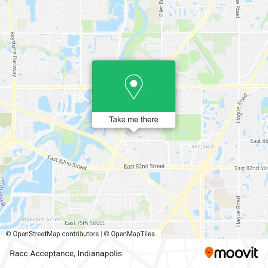
See Racc Acceptance, Indianapolis City (Balance), on the map
Public Transit to Racc Acceptance in Indianapolis City (Balance)
Wondering how to get to Racc Acceptance in Indianapolis City (Balance)? Moovit helps you find the best way to get to Racc Acceptance with step-by-step directions from the nearest public transit station.
Moovit provides free maps and live directions to help you navigate through your city. View schedules, routes, timetables, and find out how long does it take to get to Racc Acceptance in real time.
Looking for the nearest stop or station to Racc Acceptance? Check out this list of stops closest to your destination: 86th St & Allisonville Rd.
Bus: 82.
Want to see if there’s another route that gets you there at an earlier time? Moovit helps you find alternative routes or times. Get directions from and directions to Racc Acceptance easily from the Moovit App or Website.
We make riding to Racc Acceptance easy, which is why over 1.5 million users, including users in Indianapolis City (Balance), trust Moovit as the best app for public transit. You don’t need to download an individual bus app or train app, Moovit is your all-in-one transit app that helps you find the best bus time or train time available.
For information on prices of bus, costs and ride fares to Racc Acceptance, please check the Moovit app.
Use the app to navigate to popular places including to the airport, hospital, stadium, grocery store, mall, coffee shop, school, college, and university.
Racc Acceptance Address: 8708 Castle Creek Parkway East Dr street in Indianapolis City (Balance)
- Ashley Furniture Homestore,
- Ashley Store,
- Hagerman & Company, Inc.,
- Haymaker Insurance Solutions,
- Michael Hall,
- Caregiver Homes,
- The North Face Outlet,
- Sunday Group Management,
- Trustworthy Financial,
- Drew Keller, Broker at Keller Williams,
- Gander Mountain,
- Phillip Lande,
- Sue Kappen Real Estate Group,
- Delaware Trails North,
- For Sale by Owner,
- Bravo Cucina Italiana Castleton,
- Jennifer Funkhouser - Realtor, Broker, Agent, Abr - Real Broker Llc,
- Randy Worrell,
- Marc Jess,
- Menser Real Estate Group - Mrg
Places Near Racc Acceptance (Indianapolis City (Balance))
- Indianapolis Motor Speedway, Speedway,
- Lucas Oil Stadium, Indianapolis City (Balance),
- I U Health Methodist Hospital, Indianapolis City (Balance),
- St. Vincent Hospital - Indianapolis, Indianapolis City (Balance),
- Train Ride At Castleton Mall, Indianapolis City (Balance),
- Indiana Convention Center, Indianapolis City (Balance),
- Indianapolis Airport Zone 2, Indianapolis City (Balance),
- Methodist Hospital of Indianapolis, Indianapolis City (Balance),
- I-465 / I-65 Interchange, Indianapolis City (Balance),
- Gainbridge Fieldhouse, Indianapolis City (Balance),
- Cotter's Massage Parlor With Happy Endings, Indianapolis City (Balance),
- 119 W 19th St Parking, Indianapolis City (Balance),
- St. Vincent entrance #1, Indianapolis City (Balance),
- Lilly Corporate Center (Eli Lilly & Co), Indianapolis City (Balance),
- Eskenazi Hospital, Indianapolis City (Balance),
- Jersey Barn, Indianapolis City (Balance),
- Castleton Square Mall, Indianapolis,
- Plainfield, IN, Plainfield,
- THE BALT, Indianapolis City (Balance),
- Indiana, Indianapolis City (Balance)
How to get to popular places in Indianapolis with public transit
Get around Indianapolis City (Balance) by public transit!
Traveling around Indianapolis City (Balance) has never been so easy. See step by step directions as you travel to any attraction, street or major public transit station. View bus and train schedules, arrival times, service alerts and detailed routes on a map, so you know exactly how to get to anywhere in Indianapolis City (Balance).
When traveling to any destination around Indianapolis City (Balance) use Moovit's Live Directions with Get Off Notifications to know exactly where and how far to walk, how long to wait for your line, and how many stops are left. Moovit will alert you when it's time to get off — no need to constantly re-check whether yours is the next stop.
Wondering how to use public transit in Indianapolis City (Balance) or how to pay for public transit in Indianapolis City (Balance)? Moovit public transit app can help you navigate your way with public transit easily, and at minimum cost. It includes public transit fees, ticket prices, and costs. Looking for a map of Indianapolis City (Balance) public transit lines? Moovit public transit app shows all public transit maps in Indianapolis City (Balance) with all bus routes and stops on an interactive map.
Indianapolis has 1 transit type(s), including: bus, operated by several transit agencies, including IndyGo, FlixBus-us and Greyhound-us