Directions to Rachael Patelunas NP (Ballenger Creek) with public transportation
The following transit lines have routes that pass near Rachael Patelunas NP
 Bus: 10, 20, ROUTE 85 SHUTTLE.
- Train: MARC.
How to get to Rachael Patelunas NP by bus?
Click on the bus route to see step by step directions with maps, line arrival times and updated time schedules.
From I-270 Exit 10 (Clopper Rd. / West Diamond Ave.), Montgomery County
91 minFrom Walmart Supercenter, Montgomery County
148 minFrom Kaiser Permanente - Gaithersburg Medical Center, Montgomery County
125 minFrom Montgomery County Fairgrounds, Montgomery County
124 minFrom Germantown, Maryland, Montgomery County
141 minFrom Leesburg Corner Premium Outlet, Loudoun County
134 minFrom Clarksburg Premium Outlets, Montgomery County
277 minFrom Clarksburg Premium Outlets, Montgomery County
320 minFrom Montgomery Village, Maryland, Montgomery County
106 minFrom Kentlands, Montgomery County
98 min
Bus stops near Rachael Patelunas NP in Ballenger Creek
Train station near Rachael Patelunas NP in Ballenger Creek
- Frederick Marc Eb, 27 min walk,VIEW
Bus lines to Rachael Patelunas NP in Ballenger Creek
What are the closest stations to Rachael Patelunas NP?
The closest stations to Rachael Patelunas NP are:
- Crestwood Boulevard at Bank Court is 330 yards away, 5 min walk.
- Westview Drive at Crestwood Boulevard is 866 yards away, 11 min walk.
- Frederick Marc Eb is 2251 yards away, 27 min walk.
- Spectrum Drive at Route 85 (Sheetz) is 3120 yards away, 37 min walk.
Which bus lines stop near Rachael Patelunas NP?
These bus lines stop near Rachael Patelunas NP: 10, 20.
What’s the nearest train station to Rachael Patelunas NP in Ballenger Creek?
The nearest train station to Rachael Patelunas NP in Ballenger Creek is Frederick Marc Eb. It’s a 27 min walk away.
What’s the nearest bus station to Rachael Patelunas NP in Ballenger Creek?
The nearest bus station to Rachael Patelunas NP in Ballenger Creek is Crestwood Boulevard at Bank Court. It’s a 5 min walk away.
What time is the first train to Rachael Patelunas NP in Ballenger Creek?
The MARC is the first train that goes to Rachael Patelunas NP in Ballenger Creek. It stops nearby at 5:00 AM.
What time is the last train to Rachael Patelunas NP in Ballenger Creek?
The MARC is the last train that goes to Rachael Patelunas NP in Ballenger Creek. It stops nearby at 8:21 PM.
What time is the first bus to Rachael Patelunas NP in Ballenger Creek?
The 10 is the first bus that goes to Rachael Patelunas NP in Ballenger Creek. It stops nearby at 6:01 AM.
What time is the last bus to Rachael Patelunas NP in Ballenger Creek?
The 10 is the last bus that goes to Rachael Patelunas NP in Ballenger Creek. It stops nearby at 9:51 PM.
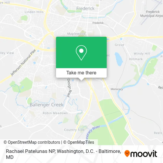
See Rachael Patelunas NP, Ballenger Creek, on the map
Public Transit to Rachael Patelunas NP in Ballenger Creek
Wondering how to get to Rachael Patelunas NP in Ballenger Creek? Moovit helps you find the best way to get to Rachael Patelunas NP with step-by-step directions from the nearest public transit station.
Moovit provides free maps and live directions to help you navigate through your city. View schedules, routes, timetables, and find out how long does it take to get to Rachael Patelunas NP in real time.
Looking for the nearest stop or station to Rachael Patelunas NP? Check out this list of stops closest to your destination: Crestwood Boulevard at Bank Court; Westview Drive at Crestwood Boulevard; Frederick Marc Eb; Spectrum Drive at Route 85 (Sheetz).
Bus: 10, 20, ROUTE 85 SHUTTLE.Train: MARC.
Want to see if there’s another route that gets you there at an earlier time? Moovit helps you find alternative routes or times. Get directions from and directions to Rachael Patelunas NP easily from the Moovit App or Website.
We make riding to Rachael Patelunas NP easy, which is why over 1.5 million users, including users in Ballenger Creek, trust Moovit as the best app for public transit. You don’t need to download an individual bus app or train app, Moovit is your all-in-one transit app that helps you find the best bus time or train time available.
For information on prices of bus, costs and ride fares to Rachael Patelunas NP, please check the Moovit app.
Get to Rachael Patelunas NP with public transit and pay for the ride in the Moovit app. In addition to all info you may need for your trip to Rachael Patelunas NP, including live directions, real-time arrivals and fare prices, you can also buy public transit passes for your rides. No need for cash or paper tickets to get to Rachael Patelunas NP - everything you need is accessible in the app with a click of the button.
Use the app to navigate to popular places including to the airport, hospital, stadium, grocery store, mall, coffee shop, school, college, and university.
Rachael Patelunas NP Address: 7211 Bank Ct Frederick, MD 21703 street in Ballenger Creek
- Christine Harris M.D.,
- Melissa Asuncion MD,
- Lev Agarunov M.D.,
- Linda Muehl CRNP,
- Frederick Health Medical Group - Sleep Medicine,
- Kellen Mulhern D.O.,
- Syed Mahmood M.D.,
- Lucas Couch D.O.,
- Olivia Poholchuk Pa-C,
- CJL Engineering,
- Nassco, Inc.,
- NVR,
- Clagett Residential Management LLC,
- Roosterbio,
- 5604 Buckeystown Pike Parking,
- Acorn Health,
- SB Remodeling,
- Potomac Classic PONTIAC,
- Bower House,
- Lumber Liquidators
Places Near Rachael Patelunas NP (Ballenger Creek)
- National Mall, Washington,
- National Museum of African American History and Culture, Washington,
- Pennsylvania Ave NW (3rd st and pennsylvania), Washington,
- Sibley Memorial Hospital, Washington,
- Warner Theatre, Washington,
- Amazon Hq2, Arlington County,
- PG Mall, Prince George's County,
- Capital One Arena, Washington,
- Washington DC VA Medical Center, Washington,
- Rock Creek Tennis Center, Washington,
- Marriott Marquis Washington, DC, Washington,
- Museum Of The Bible, Washington,
- Georgetown, Washington,
- The Anthem, Washington,
- Basilica of the National Shrine, Washington,
- M&T Bank Stadium, Baltimore,
- National Zoo, Washington,
- Washington National Cathedral, Washington,
- Westfield Montgomery Mall, Montgomery County,
- Camden Yards, Baltimore
How to get to popular places in Washington, D.C. - Baltimore, MD with public transit
Get around Ballenger Creek by public transit!
Traveling around Ballenger Creek has never been so easy. See step by step directions as you travel to any attraction, street or major public transit station. View bus and train schedules, arrival times, service alerts and detailed routes on a map, so you know exactly how to get to anywhere in Ballenger Creek.
When traveling to any destination around Ballenger Creek use Moovit's Live Directions with Get Off Notifications to know exactly where and how far to walk, how long to wait for your line, and how many stops are left. Moovit will alert you when it's time to get off — no need to constantly re-check whether yours is the next stop.
Wondering how to use public transit in Ballenger Creek or how to pay for public transit in Ballenger Creek? Moovit public transit app can help you navigate your way with public transit easily, and at minimum cost. It includes public transit fees, ticket prices, and costs. Looking for a map of Ballenger Creek public transit lines? Moovit public transit app shows all public transit maps in Ballenger Creek with all Bus, Train, Metro, Light Rail and Ferry routes and stops on an interactive map.
Washington, D.C. - Baltimore, MD has 5 transit type(s), including: Bus, Train, Metro, Light Rail and Ferry, operated by several transit agencies, including WMATA, Montgomery County Ride On, Fairfax Connector, TheBus, PRTC, DASH - Alexandria, Arlington Transit (ART), RTA of Central Maryland, MDOT MTA, MDOT MTA Light RailLink, MDOT MTA Commuter Bus, MDOT MTA Local Bus, FXBGO!, Virginia Railway Express (VRE) and MARC