How to get to Racing Club by Colectivo?
Click on the Colectivo route to see step by step directions with maps, line arrival times and updated time schedules.
From Avenida del Libertador, Distrito Federal
43 minFrom Colonia Express (Turismo-Agencias-Colonia Express), Distrito Federal
40 minFrom Av. Rivadavia y Av. Nazca, Distrito Federal
35 minFrom San Juan y Entre Rios, Distrito Federal
27 minFrom Plaza Irlanda, Distrito Federal
70 minFrom Avenida Gaona, Distrito Federal
70 minFrom Hospital Alemán | Deutsches Hospital, Distrito Federal
38 minFrom Sanatorio San Jose, Distrito Federal
50 minFrom Av. Santa Fe y Av. Raúl Scalabrini Ortiz, Distrito Federal
48 minFrom Hospital de Clinicas Capital Federal, Distrito Federal
36 min
How to get to Racing Club by train?
Click on the train route to see step by step directions with maps, line arrival times and updated time schedules.
From Av. Rivadavia y Av. Nazca, Distrito Federal
169 minFrom San Juan y Entre Rios, Distrito Federal
47 minFrom Plaza Irlanda, Distrito Federal
191 minFrom Avenida Gaona, Distrito Federal
191 minFrom Hospital Alemán | Deutsches Hospital, Distrito Federal
202 minFrom Hospital de Clinicas Capital Federal, Distrito Federal
199 min
Colectivo stops near Racing Club in Avellaneda
- Estadio Racing Club (Alsina Y Colón), 2 min walk,VIEW
- Estadio Racing Club (Colón Y Alsina), 3 min walk,VIEW
- Avenida Belgrano Y Adolfo Alsina (98 - 197), 7 min walk,VIEW
- Avenida Belgrano Y Piaggio (10 - 17 - 22 - 24 - 33 - 148 - 154 - 178 - 247 - 271 - 293), 8 min walk,VIEW
- Hospital Fiorito (24 - 74 - 100 - 154), 8 min walk,VIEW
Train station near Racing Club in Avellaneda
- Gerli, 16 min walk,VIEW
Colectivo lines to Racing Club in Avellaneda
- 95, R1: Avellaneda x Htal. Garrahan,VIEW
- 295, R5 - Est. Lanús - Pte. Pueyrredón (X Córdoba),VIEW
- 33, F: M | Monte Chingolo x Barracas,VIEW
- 98, 116 (Rojo): Barrio Gráfico x Barrio Nuñez,VIEW
- 197, B: B. Marítimo (R. 10),VIEW
- 10, Wilde,VIEW
- 17, Recoleta - Sarandí,VIEW
- 22, Quilmes,VIEW
- 24, R2 - Villa Del Parque - Wilde (X Lynch),VIEW
- 148, G: Solano x 844,VIEW
- 154, Est. Lanús,VIEW
- 178, RD: G - Zeballos x Larralde,VIEW
- 247, R5: San Francisco Solano x Cangallo,VIEW
- 271, Rp - Avellaneda - Est. Burzaco (X Camino x 570),VIEW
- 293, S: Don Orione,VIEW
- 74, Correo Central - Longchamps,VIEW
- 100, C: Roma y Lynch (Ramal 3),VIEW
What are the closest stations to Racing Club?
The closest stations to Racing Club are:
- Estadio Racing Club (Alsina Y Colón) is 125 meters away, 2 min walk.
- Estadio Racing Club (Colón Y Alsina) is 176 meters away, 3 min walk.
- Avenida Belgrano Y Adolfo Alsina (98 - 197) is 460 meters away, 7 min walk.
- Avenida Belgrano Y Piaggio (10 - 17 - 22 - 24 - 33 - 148 - 154 - 178 - 247 - 271 - 293) is 524 meters away, 8 min walk.
- Hospital Fiorito (24 - 74 - 100 - 154) is 596 meters away, 8 min walk.
- Gerli is 1221 meters away, 16 min walk.
Which Colectivo lines stop near Racing Club?
These Colectivo lines stop near Racing Club: 197, 95, 98.
Which train line stops near Racing Club?
ROCA (Ezeiza→Constitución)
What’s the nearest train station to Racing Club in Avellaneda?
The nearest train station to Racing Club in Avellaneda is Gerli. It’s a 16 min walk away.
What’s the nearest Colectivo station to Racing Club in Avellaneda?
The nearest Colectivo station to Racing Club in Avellaneda is Estadio Racing Club (Alsina Y Colón). It’s a 2 min walk away.
What time is the first train to Racing Club in Avellaneda?
The ROCA is the first train that goes to Racing Club in Avellaneda. It stops nearby at 4:16 AM.
What time is the last train to Racing Club in Avellaneda?
The ROCA is the last train that goes to Racing Club in Avellaneda. It stops nearby at 7:36 AM.
What time is the first Colectivo to Racing Club in Avellaneda?
The 295 is the first Colectivo that goes to Racing Club in Avellaneda. It stops nearby at 3:03 AM.
What time is the last Colectivo to Racing Club in Avellaneda?
The 24 is the last Colectivo that goes to Racing Club in Avellaneda. It stops nearby at 3:47 AM.
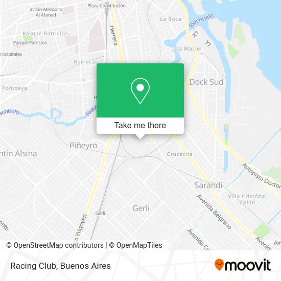
See Racing Club, Avellaneda, on the map
Public Transit to Racing Club in Avellaneda
Wondering how to get to Racing Club in Avellaneda? Moovit helps you find the best way to get to Racing Club with step-by-step directions from the nearest public transit station.
Moovit provides free maps and live directions to help you navigate through your city. View schedules, routes, timetables, and find out how long does it take to get to Racing Club in real time.
Looking for the nearest stop or station to Racing Club? Check out this list of stops closest to your destination: Estadio Racing Club (Alsina Y Colón); Estadio Racing Club (Colón Y Alsina); Avenida Belgrano Y Adolfo Alsina (98 - 197); Avenida Belgrano Y Piaggio (10 - 17 - 22 - 24 - 33 - 148 - 154 - 178 - 247 - 271 - 293); Hospital Fiorito (24 - 74 - 100 - 154); Gerli.
Colectivo: 197, 95, 98, 295, 33, 10, 17, 22, 24, 148, 74, 100.Train: ROCA.
Want to see if there’s another route that gets you there at an earlier time? Moovit helps you find alternative routes or times. Get directions from and directions to Racing Club easily from the Moovit App or Website.
We make riding to Racing Club easy, which is why over 1.5 million users, including users in Avellaneda, trust Moovit as the best app for public transit. You don’t need to download an individual bus app or train app, Moovit is your all-in-one transit app that helps you find the best bus time or train time available.
For information on prices of Colectivo, train and Subte, costs and ride fares to Racing Club, please check the Moovit app.
Use the app to navigate to popular places including to the airport, hospital, stadium, grocery store, mall, coffee shop, school, college, and university.
Racing Club Address: Pasaje Oreste O. Corbatta street in Avellaneda
- Pasaje Oreste O. Corbatta,
- Microestadio Polideportivo Jorge Camba,
- Tu Ropa Mi Ropa,
- Pasaje Mozart y Corbatta S/N,
- Avenida Adolfo Alsina / Constitución,
- Alsina 424,
- Estadio Juan Domingo Perón (Racing Club),
- Colon 800,
- Adolfo Alsina 400,
- Colón / Avenida Adolfo Alsina,
- Alsina 300,
- Casa Del Bicentenario Avellaneda,
- Pedro de Mendoza 330,
- Cattmell Scpa,
- Casa Tita Mattiussi,
- Pedro de Mendoza y Colon,
- Escuela De Educación Secundaria Técnica Nro 5 Salvador Debenedetti,
- Constitución 627,
- Juan Bautista Palaá 747,
- Colón
Places Near Racing Club (Avellaneda)
- La Plata, La Plata,
- Facultad de Odontología (UBA), Distrito Federal,
- Tecnópolis, Vicente López,
- Abasto Shopping, Distrito Federal,
- Aeroparque Jorge Newbery,
- Flores, Distrito Federal,
- Movistar Arena, Distrito Federal,
- Once, Distrito Federal,
- CABA, Distrito Federal,
- Avellaneda, Avellaneda,
- Parque de la Ciudad, Distrito Federal,
- Barrio Chino, Distrito Federal,
- Dot Baires Shopping, Vicente López,
- Buenos Aires, Distrito Federal,
- La Plata, La Plata,
- Unicenter Shopping, San Isidro,
- Estadio Monumental (River Plate), Distrito Federal,
- Hospital Santa Lucia, Distrito Federal,
- Jardín Japonés, Distrito Federal,
- Aeropuerto Ezeiza, Distrito Federal
How to get to popular places in Buenos Aires with public transit
Get around Avellaneda by public transit!
Traveling around Avellaneda has never been so easy. See step by step directions as you travel to any attraction, street or major public transit station. View bus and train schedules, arrival times, service alerts and detailed routes on a map, so you know exactly how to get to anywhere in Avellaneda.
When traveling to any destination around Avellaneda use Moovit's Live Directions with Get Off Notifications to know exactly where and how far to walk, how long to wait for your line, and how many stops are left. Moovit will alert you when it's time to get off — no need to constantly re-check whether yours is the next stop.
Wondering how to use public transit in Avellaneda or how to pay for public transit in Avellaneda? Moovit public transit app can help you navigate your way with public transit easily, and at minimum cost. It includes public transit fees, ticket prices, and costs. Looking for a map of Avellaneda public transit lines? Moovit public transit app shows all public transit maps in Avellaneda with all Colectivo, Train, Subte, Light Rail and Ferry routes and stops on an interactive map.
Buenos Aires has 5 transit type(s), including: Colectivo, Train, Subte, Light Rail and Ferry, operated by several transit agencies, including Municipalidad Carmen de Areco, Trenes Argentinos, Ferrovías, Metrovías, Subte de Buenos Aires, Doscientos Ocho Transporte Automotor S.A., Empresa del Oeste, Empresa de Transportes Tratado del PIlar S.R.L., Transportes Veintidos de Septiembre, Sargento Cabral, Transportes Sesenta y Ocho, Transportes Quirno Costa, Transportes Santa Fe, Transportes Automotores Riachuelo and Transportes Atlantida