Directions to Racoes da Juju (Paulista) with public transportation
The following transit lines have routes that pass near Racoes da Juju
How to get to Racoes da Juju by bus?
Click on the bus route to see step by step directions with maps, line arrival times and updated time schedules.
From Splash Eco Park, Abreu E Lima
74 minFrom Praia de Mangue Seco, Igarassu
75 minFrom U P A - Jardim Paulista Baixo, Paulista
42 minFrom Rodovia BR-101 Norte, Km 48 s/n, Abreu E Lima
76 minFrom Rua Professor Manoel de Almeida Belo, Olinda
42 minFrom Avenida Pan Nordestina, Olinda
44 minFrom Avenida Getúlio Vargas, Olinda
38 minFrom COPE Olinda, Olinda
39 minFrom Maternidade brites De Albuquerque, Olinda
43 minFrom Artur Lundgren I, Paulista
53 min
Bus stops near Racoes da Juju in Paulista
Bus lines to Racoes da Juju in Paulista
- 1958 COSTA AZUL / TI PELÓPIDAS, Via Rua Walfrido Carneiro Da Silva,VIEW
- 1922 PAU AMARELO / TI PELÓPIDAS, Pau Amarelo / Ti Pelópidas,VIEW
- 1960 TI RIO DOCE / MARIA FARINHA (CASA CAIADA), Ti Rio Doce / Maria Farinha (Casa Caiada),VIEW
- 1992 PAU AMARELO, Pau Amarelo,VIEW
- 1995 PAU AMARELO (BACURAU), Pau Amarelo (Bacurau),VIEW
- 1982 CONJUNTO BEIRA MAR / DERBY, Saída Da Costa Azul,VIEW
What are the closest stations to Racoes da Juju?
The closest stations to Racoes da Juju are:
- Rua Manoel De Araújo, 405 is 166 meters away, 3 min walk.
- Av. Dr. Cláudio José Gueiros Leite, 522 | Forte De Pau Amarelo is 244 meters away, 4 min walk.
- Av. Costa Azul, 400 is 273 meters away, 4 min walk.
Which bus lines stop near Racoes da Juju?
These bus lines stop near Racoes da Juju: 1958 COSTA AZUL / TI PELÓPIDAS, 1992 PAU AMARELO.
What’s the nearest bus station to Racoes da Juju in Paulista?
The nearest bus station to Racoes da Juju in Paulista is Rua Manoel De Araújo, 405. It’s a 3 min walk away.
What time is the first bus to Racoes da Juju in Paulista?
The 1995 PAU AMARELO (BACURAU) is the first bus that goes to Racoes da Juju in Paulista. It stops nearby at 3:20 AM.
What time is the last bus to Racoes da Juju in Paulista?
The 1995 PAU AMARELO (BACURAU) is the last bus that goes to Racoes da Juju in Paulista. It stops nearby at 3:23 AM.
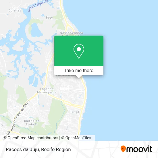
See Racoes da Juju, Paulista, on the map
Public Transit to Racoes da Juju in Paulista
Wondering how to get to Racoes da Juju in Paulista? Moovit helps you find the best way to get to Racoes da Juju with step-by-step directions from the nearest public transit station.
Moovit provides free maps and live directions to help you navigate through your city. View schedules, routes, timetables, and find out how long does it take to get to Racoes da Juju in real time.
Looking for the nearest stop or station to Racoes da Juju? Check out this list of stops closest to your destination: Rua Manoel De Araújo; Av. Dr. Cláudio José Gueiros Leite; Av. Costa Azul.
Bus: 1958 COSTA AZUL / TI PELÓPIDAS, 1992 PAU AMARELO, 1922 PAU AMARELO / TI PELÓPIDAS, 1960 TI RIO DOCE / MARIA FARINHA (CASA CAIADA), 1995 PAU AMARELO (BACURAU), 1982 CONJUNTO BEIRA MAR / DERBY.
Want to see if there’s another route that gets you there at an earlier time? Moovit helps you find alternative routes or times. Get directions from and directions to Racoes da Juju easily from the Moovit App or Website.
We make riding to Racoes da Juju easy, which is why over 1.5 million users, including users in Paulista, trust Moovit as the best app for public transit. You don’t need to download an individual bus app or train app, Moovit is your all-in-one transit app that helps you find the best bus time or train time available.
For information on prices of bus, costs and ride fares to Racoes da Juju, please check the Moovit app.
Use the app to navigate to popular places including to the airport, hospital, stadium, grocery store, mall, coffee shop, school, college, and university.
Racoes da Juju Address: Rua Doutor Sebastião Amaral, 178 Pau Amarelo Paulista-PE 53433-010 street in Paulista
- Tudo Pra Você Aves e Frios,
- Ana Lianda,
- Fernando Carvalho Arquitetura,
- Dois Pra Cima Studio,
- Supermercado Todo Dia,
- Edifício Caio Marcio,
- Lima Distribuidora,
- Rua Dom Diamantino Costa 388,
- Serralheria do Matuto,
- N'Ativa Tecnologia, Comunicação e Cultura,
- Edifício Ferreira Neto,
- Rua Presidente Costa e Silva,
- Illuminare Iluminação e Decoracao,
- Mf Locacoes,
- Aldenize,
- Carlinhos Bar e Restaurante,
- Rua Brecho Fernandes Paes 154,
- SOS Mecanica e Gnv,
- Indo Buscar a Gordinha *0*,
- Assembleia De Deus - Pau Amarelo Forte
Places Near Racoes da Juju (Paulista)
- Shopping RioMar Recife, Pina,
- Hospital Altino Ventura, Iputinga,
- Shopping Recife, Boa Viagem,
- Shopping Patteo Olinda, Olinda,
- Centro de Convenções de Pernambuco, Olinda,
- Marco Zero, Bairro Do Recife,
- Hospital Agamenon Magalhães, Tamarineira,
- llll, Fundão,
- Imip (Instituto Materno-Infantil De Pernambuco), Coelhos,
- SHOPPING TACARUNA, Santo Amaro,
- SHOPPING GUARARAPES, Jaboatão Dos Guararapes,
- Parque da Jaqueira, Jaqueira,
- tuuuuu, Olinda,
- Arena de Pernambuco, São Lourenço Da Mata,
- Hospital Geral De Areias, Areias,
- Hospital Universitário Oswaldo Cruz, Santo Amaro,
- hospital otavio de freitas - UTI, Tejipió,
- Hospital Eduardo Campus Da Pessoa Idosa, Areias,
- Hospital Maria Lucinda, Parnamirim,
- Imbiribeira, Imbiribeira
How to get to popular places in Recife Region with public transit
Get around Paulista by public transit!
Traveling around Paulista has never been so easy. See step by step directions as you travel to any attraction, street or major public transit station. View bus and train schedules, arrival times, service alerts and detailed routes on a map, so you know exactly how to get to anywhere in Paulista.
When traveling to any destination around Paulista use Moovit's Live Directions with Get Off Notifications to know exactly where and how far to walk, how long to wait for your line, and how many stops are left. Moovit will alert you when it's time to get off — no need to constantly re-check whether yours is the next stop.
Wondering how to use public transit in Paulista or how to pay for public transit in Paulista? Moovit public transit app can help you navigate your way with public transit easily, and at minimum cost. It includes public transit fees, ticket prices, and costs. Looking for a map of Paulista public transit lines? Moovit public transit app shows all public transit maps in Paulista with all Bus, Train and Subway routes and stops on an interactive map.
Recife Region has 3 transit type(s), including: Bus, Train and Subway, operated by several transit agencies, including CBTU (Metrorec), BRT (Via Livre), Grande Recife, BORBOREMA IMPERIAL (TIP), BORBOREMA IMPERIAL (B.V), RODOVIÁRIA POTENGY, EMPRESA METROPOLITANA, CONSÓRCIO RECIFE, SÃO JUDAS TADEU, Expresso 1002, Rodotur Turismo, Complementar Recife, Sistema Municipal - Jaboatão, Sistema Municipal - Cabo and Sistema Municipal - Ipojuca