How to get to Radar X Rastreamento Belem by bus?
Click on the bus route to see step by step directions with maps, line arrival times and updated time schedules.
From Uepa-Universidade do Estado do Pará, Belém
55 minFrom CESEP, Sacramenta
46 minFrom Av.Senador Lemos, Belém
54 minFrom Dom Pedro I, Belém
53 minFrom Tv. Dom Romualdo de Seixas, Belém
54 minFrom Rua Cláudio Barbosa da Silva, Marituba
51 minFrom Final da Linha do Curuçambá, Ananindeua
40 minFrom Shopping Bosque Grão Pará, Entroncamento
54 minFrom Hospital Universitário João de Barros Barreto (HUJBB), Guama
37 minFrom Travessa Magno De Araujo 474, Sacramenta
42 min
Bus stops near Radar X Rastreamento Belem in Ananindeua
Bus lines to Radar X Rastreamento Belem in Ananindeua
- 015, 40 Horas - Castanheira,VIEW
- 754, Jardim Sideral - Ver-O-Peso,VIEW
- 901, Cidade Nova 5 - Ver-O-Peso,VIEW
- 902, Cidade Nova 6 - Pres. Vargas,VIEW
- 903, Paar - São Brás,VIEW
- 908, Paar - Ceasa,VIEW
- 932, UNAMA,VIEW
- 964, Jaderlândia - Ver-O-Peso,VIEW
- 985, 40 Horas - Ver-O-Peso,VIEW
- 986, Jiboia Branca - Ver-O-Peso,VIEW
- 999, Curuçambá - UFPA,VIEW
- 930, Icuí - Pres. Vargas,VIEW
- 321, UFPA - Cidade Nova,VIEW
- 878, Forte - Cidade Nova - Icoaraci via Satélite,VIEW
- 878 S, Vialoc - Cidade Nova - Icoaraci via Satélite,VIEW
- 904, Presidente Vargas,VIEW
What are the closest stations to Radar X Rastreamento Belem?
The closest stations to Radar X Rastreamento Belem are:
- Supermercado Cidade | Sentido Sul is 79 meters away, 2 min walk.
- Supermercado Cidade | Sentido Norte is 124 meters away, 2 min walk.
- Cj. Abelardo Condurú | Três Corações Com Quadra 18 is 200 meters away, 3 min walk.
- Metrópole Ananindeua | Providência Com Br-316 is 218 meters away, 4 min walk.
Which bus lines stop near Radar X Rastreamento Belem?
These bus lines stop near Radar X Rastreamento Belem: 901, 908, 930, 932.
What’s the nearest bus station to Radar X Rastreamento Belem in Ananindeua?
The nearest bus stations to Radar X Rastreamento Belem in Ananindeua are Supermercado Cidade | Sentido Sul and Supermercado Cidade | Sentido Norte. The closest one is a 2 min walk away.
What time is the first bus to Radar X Rastreamento Belem in Ananindeua?
The 908 is the first bus that goes to Radar X Rastreamento Belem in Ananindeua. It stops nearby at 3:35 AM.
What time is the last bus to Radar X Rastreamento Belem in Ananindeua?
The 908 is the last bus that goes to Radar X Rastreamento Belem in Ananindeua. It stops nearby at 3:37 AM.
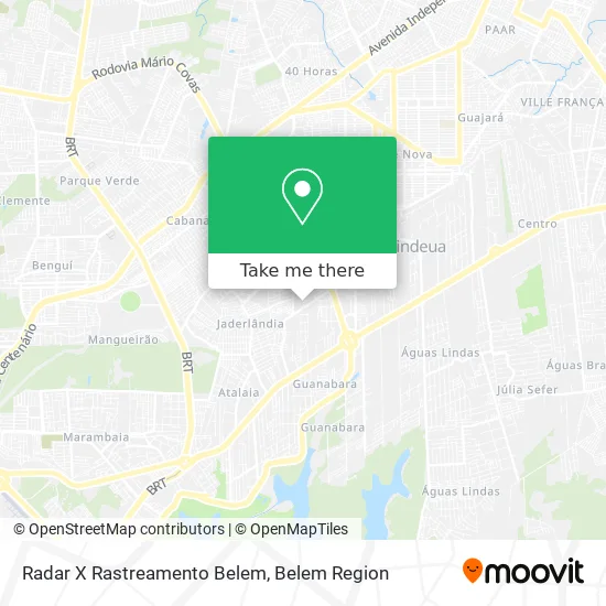
See Radar X Rastreamento Belem, Ananindeua, on the map
Public Transit to Radar X Rastreamento Belem in Ananindeua
Wondering how to get to Radar X Rastreamento Belem in Ananindeua? Moovit helps you find the best way to get to Radar X Rastreamento Belem with step-by-step directions from the nearest public transit station.
Moovit provides free maps and live directions to help you navigate through your city. View schedules, routes, timetables, and find out how long does it take to get to Radar X Rastreamento Belem in real time.
Looking for the nearest stop or station to Radar X Rastreamento Belem? Check out this list of stops closest to your destination: Supermercado Cidade | Sentido Sul; Supermercado Cidade | Sentido Norte; Cj. Abelardo Condurú | Três Corações Com Quadra 18; Metrópole Ananindeua | Providência Com Br-316.
Bus: 901, 908, 930, 932, 015, 754, 902, 903, 321, 878, 878 S, 904.
Want to see if there’s another route that gets you there at an earlier time? Moovit helps you find alternative routes or times. Get directions from and directions to Radar X Rastreamento Belem easily from the Moovit App or Website.
We make riding to Radar X Rastreamento Belem easy, which is why over 1.5 million users, including users in Ananindeua, trust Moovit as the best app for public transit. You don’t need to download an individual bus app or train app, Moovit is your all-in-one transit app that helps you find the best bus time or train time available.
For information on prices of bus, costs and ride fares to Radar X Rastreamento Belem, please check the Moovit app.
Use the app to navigate to popular places including to the airport, hospital, stadium, grocery store, mall, coffee shop, school, college, and university.
Radar X Rastreamento Belem Address: Passagem Santa Marta, 43 Ananindeua-PA 66650-370 street in Ananindeua
- Igreja Adventista do 7º Dia Machado de Assis,
- Alameda São Pedro 63,
- Rua Santa Terezinha,
- Residencial Bosque Metropole,
- Restaurante e Conveniencia Ki Delicia,
- Varejo Guerreiro,
- Jackson Informatica,
- Jrafah Bolsas,
- Royalnorte Distribuidora Royalcanin,
- Datrion Logistica,
- Conselho Tutelar IV,
- Tec Bombas,
- Olé Arena,
- Petlegal,
- Brasloc Servicos Combinados de Escritorios e Administracao,
- Manutenção de Split e Ar-Condicionado.,
- Ar Frio Refrigeração,
- Residencial Bosque Solare,
- Viatran - Viana Transporte e Comercio,
- Paróquia De Santo André Apóstolo
Places Near Radar X Rastreamento Belem (Ananindeua)
- Avenida Augusto Montenegro, Belém,
- Shopping Pátio Belém, Belém,
- Av.Senador Lemos, Belém,
- Bancrevea, Bengui,
- Praça Brasil, Belém,
- Parque Shopping Belém, Bengui,
- hospital Barros Barreto, Belém,
- Shopping Metrópole Ananindeua, Ananindeua,
- Linha 872: Icoaraci - Almirante Barroso (Presidente Vargas), Icoaraci,
- Doca, Belém,
- Santa Casa De Misericórdia, Belém,
- Hangar PA, Belém,
- Boulevard Shopping, Belém,
- Grão Pará, Belém,
- Mangal Das Garças, Belém,
- Avenida Júlio Cesar, Belém,
- Aeroporto Internacional de Belém (BEL), Entroncamento,
- Shopping Bosque Grão Pará, Entroncamento,
- Shopping Center Bosque Grão Pará, Entroncamento,
- Centro Integrado de Inclusão e Reabilitação - CIIR, Entroncamento
How to get to popular places in Belem Region with public transit
Get around Ananindeua by public transit!
Traveling around Ananindeua has never been so easy. See step by step directions as you travel to any attraction, street or major public transit station. View bus and train schedules, arrival times, service alerts and detailed routes on a map, so you know exactly how to get to anywhere in Ananindeua.
When traveling to any destination around Ananindeua use Moovit's Live Directions with Get Off Notifications to know exactly where and how far to walk, how long to wait for your line, and how many stops are left. Moovit will alert you when it's time to get off — no need to constantly re-check whether yours is the next stop.
Wondering how to use public transit in Ananindeua or how to pay for public transit in Ananindeua? Moovit public transit app can help you navigate your way with public transit easily, and at minimum cost. It includes public transit fees, ticket prices, and costs. Looking for a map of Ananindeua public transit lines? Moovit public transit app shows all public transit maps in Ananindeua with all Bus and Ferry routes and stops on an interactive map.
Belem Region has 2 transit type(s), including: Bus and Ferry, operated by several transit agencies, including BRT Metropolitano, BRT Belém, SETRANSBEL, Coopcaban, Expresso Modelo, Voyage Transportes, Amazonat, Coopersati, Luane Transportes, Cooptarvc, Ruth Transportes, Mayara Transportes, Cooptauá, Expresso São José and Castanhal (Clara, Rosa's, Salve Maria)