How to get to Radio Poder 1030 by bus?
Click on the bus route to see step by step directions with maps, line arrival times and updated time schedules.
From Headquarters - U.S. Coast Guard, Washington
57 minFrom Nationals Park, Washington
50 minFrom DoubleTree by Hilton Hotel Washington DC-Crystal City, Arlington County
89 minFrom Tidal Basin, Washington
78 minFrom Saint Marks Episcopal Church, Washington
60 minFrom D.C. Jail, Washington
65 minFrom Joint Base Andrews, Prince George's County
37 minFrom Holiday Inn National Airport/Crystal City, Arlington County
69 minFrom Federal Aviation Administration (FAA) Headquarters, Washington
66 minFrom Botanical Gardens, Washington
64 min
Bus stops near Radio Poder 1030 in Prince George's County
Bus lines to Radio Poder 1030 in Prince George's County
- C11, South To National Harbor,VIEW
- P90, West To Oxon Hill P+R,VIEW
- P94, West To National Harbor,VIEW
- P96, South To Oxon Hill P+R,VIEW
- P97, North To Southern Av,VIEW
- P95, Southern Avenue Station,VIEW
- 610, 610/22 Us 301 Park & Ride,VIEW
- 620, 620/12 Waldorf,VIEW
- 640, 640/5 Washington Dc,VIEW
- 650, 650/8 La Plata,VIEW
- P87, West To Oxon Hill P+R,VIEW
What are the closest stations to Radio Poder 1030?
The closest stations to Radio Poder 1030 are:
- Oxon Hill Rd & Harborview Ave is 138 yards away, 2 min walk.
- Oxon Hill Rd + Tanger Blvd is 138 yards away, 2 min walk.
- Oxon Hill Park & Ride is 436 yards away, 6 min walk.
- Oxon Hill P+R+Bay A is 514 yards away, 7 min walk.
Which bus lines stop near Radio Poder 1030?
These bus lines stop near Radio Poder 1030: C11, P87, P90, P95.
What’s the nearest bus station to Radio Poder 1030 in Prince George's County?
The nearest bus stations to Radio Poder 1030 in Prince George's County are Oxon Hill Rd & Harborview Ave and Oxon Hill Rd + Tanger Blvd. The closest one is a 2 min walk away.
What time is the first bus to Radio Poder 1030 in Prince George's County?
The C11 is the first bus that goes to Radio Poder 1030 in Prince George's County. It stops nearby at 4:03 AM.
What time is the last bus to Radio Poder 1030 in Prince George's County?
The P94 is the last bus that goes to Radio Poder 1030 in Prince George's County. It stops nearby at 2:49 AM.
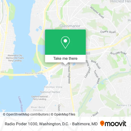
See Radio Poder 1030, Prince George's County, on the map
Public Transit to Radio Poder 1030 in Prince George's County
Wondering how to get to Radio Poder 1030 in Prince George's County? Moovit helps you find the best way to get to Radio Poder 1030 with step-by-step directions from the nearest public transit station.
Moovit provides free maps and live directions to help you navigate through your city. View schedules, routes, timetables, and find out how long does it take to get to Radio Poder 1030 in real time.
Looking for the nearest stop or station to Radio Poder 1030? Check out this list of stops closest to your destination: Oxon Hill Rd & Harborview Ave; Oxon Hill Rd + Tanger Blvd; Oxon Hill Park & Ride; Oxon Hill P+R+Bay A.
Bus: C11, P87, P90, P95, P94, P96, P97, 610, 620, 640, 650.
Want to see if there’s another route that gets you there at an earlier time? Moovit helps you find alternative routes or times. Get directions from and directions to Radio Poder 1030 easily from the Moovit App or Website.
We make riding to Radio Poder 1030 easy, which is why over 1.5 million users, including users in Prince George's County, trust Moovit as the best app for public transit. You don’t need to download an individual bus app or train app, Moovit is your all-in-one transit app that helps you find the best bus time or train time available.
For information on prices of bus and metro, costs and ride fares to Radio Poder 1030, please check the Moovit app.
Use the app to navigate to popular places including to the airport, hospital, stadium, grocery store, mall, coffee shop, school, college, and university.
Radio Poder 1030 Address: 6710 Oxon Hill Rd Oxon Hill, MD 20745 street in Prince George's County
- Ultegra Solutions,
- Kealee Construction,
- Forthright Autocare,
- Ricardo Cooper,
- TNT Event Foto,
- Body Matrix LLC,
- Pro-Perform Spinal Health & Rehab,
- Amurphylegal,
- The Frugal Socialite,
- Executive Suite Professionals,
- Tammarra Peacock Realtor,
- Shawnese Ware,
- Mya Grossman,
- The Viya Group,
- Cheryl the Realtor,
- Bowie, MD Homes,
- World Power Gospel Radio,
- Crawford Alesia, DDS,
- Touch Beauty Bar,
- Sutton's Seasoning
Places Near Radio Poder 1030 (Prince George's County)
- M&T Bank Stadium, Baltimore,
- Amazon Hq2, Arlington County,
- Sibley Memorial Hospital, Washington,
- Rock Creek Tennis Center, Washington,
- National Mall, Washington,
- Washington National Cathedral, Washington,
- Pennsylvania Ave NW (3rd st and pennsylvania), Washington,
- Basilica of the National Shrine, Washington,
- Museum Of The Bible, Washington,
- Capital One Arena, Washington,
- National Museum of African American History and Culture, Washington,
- The Anthem, Washington,
- Camden Yards, Baltimore,
- Westfield Montgomery Mall, Montgomery County,
- PG Mall, Prince George's County,
- National Zoo, Washington,
- Marriott Marquis Washington, DC, Washington,
- Georgetown, Washington,
- Washington DC VA Medical Center, Washington,
- Warner Theatre, Washington
How to get to popular places in Washington, D.C. - Baltimore, MD with public transit
Get around Prince George's County by public transit!
Traveling around Prince George's County has never been so easy. See step by step directions as you travel to any attraction, street or major public transit station. View bus and train schedules, arrival times, service alerts and detailed routes on a map, so you know exactly how to get to anywhere in Prince George's County.
When traveling to any destination around Prince George's County use Moovit's Live Directions with Get Off Notifications to know exactly where and how far to walk, how long to wait for your line, and how many stops are left. Moovit will alert you when it's time to get off — no need to constantly re-check whether yours is the next stop.
Wondering how to use public transit in Prince George's County or how to pay for public transit in Prince George's County? Moovit public transit app can help you navigate your way with public transit easily, and at minimum cost. It includes public transit fees, ticket prices, and costs. Looking for a map of Prince George's County public transit lines? Moovit public transit app shows all public transit maps in Prince George's County with all Bus, Train, Metro, Light Rail and Ferry routes and stops on an interactive map.
Washington, D.C. - Baltimore, MD has 5 transit type(s), including: Bus, Train, Metro, Light Rail and Ferry, operated by several transit agencies, including WMATA, Montgomery County Ride On, Fairfax Connector, TheBus, PRTC, DASH - Alexandria, Arlington Transit (ART), RTA of Central Maryland, MDOT MTA, MDOT MTA Light RailLink, MDOT MTA Commuter Bus, MDOT MTA Local Bus, FXBGO!, Virginia Railway Express (VRE) and MARC