How to get to Radioshack by bus?
Click on the bus route to see step by step directions with maps, line arrival times and updated time schedules.
From Hospital Augusto B. Leguía - PNP, Rimac
40 minFrom Av Argentina, Lima
32 minFrom AV IQUITOS LA VICTORIA, La Victori
28 minFrom Surco, Santiago D
43 minFrom LA PUNTA CALLAO, Ventanilla
53 minFrom cerca a MAKRO SURCO, Santiago D
42 minFrom AV VELASCO ASTETE SURCO, Santiago D
46 minFrom Centro de Exposiciones Jockey Club, Santiago D
45 minFrom Coliseo Mariscal Caceres, Chorrillos
47 minFrom Av. Nicolas Ayllon, Ate
47 min
Bus stops near Radioshack in Magdalena
Bus lines to Radioshack in Magdalena
- 1008, Sucre (Magdalena Del Mar) - Villa Club (Carabayllo),VIEW
- 1012, Magdalena - Torreblanca (Carabayllo),VIEW
- 1021, Mercado (Magdalena Del Mar) - Torre Blanca (Carabayllo),VIEW
- 1030, Canta Callao (San Martin De Porres) - San Diego (San Martin De Porres),VIEW
- 1045, Huáscar (San Juan De Lurigancho) - Mercado (Magdalena Del Mar),VIEW
- 1182, San Juan de Miraflores - Carabayllo,VIEW
- 1205, El Agustino - San Miguel,VIEW
- 1207, Santa María (San Juan De Lurigancho) - La Paz (San Miguel),VIEW
- 1219, San Miguel - Ate,VIEW
- 1252, V.M.T. - San Miguel,VIEW
- 1269, Santa Rosa (Callao) - Las Gaviotas (Ate),VIEW
- 1272, Minka (Callao) - Santa Marta (Santa Anita),VIEW
- 1275, Upc (Santiago De Surco) - Oquendo (San Martín De Porres),VIEW
- 1293, José Gálvez (Pachacamac) - Mi Perú (Ventanilla),VIEW
- 1462, Carabayllo - Universitaria - Brasil - Carabayllo,VIEW
- 1475, Campoy (San Juan De Lurigancho) - La Paz (Callao),VIEW
- IM18, Upc (Santiago De Surco) - Chuquitanta (San Martín De Porres),VIEW
- 1219 SX, Aeropuerto (Callao) - Galerías Brasil (Pueblo Libre),VIEW
- 1010, Pte. Piedra - Magdalena - Pte. Piedra,VIEW
- 1024, Los Sauces - Cerro Candela,VIEW
What are the closest stations to Radioshack?
The closest stations to Radioshack are:
- Sucre is 157 meters away, 3 min walk.
- Mercado Bolognesi is 198 meters away, 3 min walk.
- Bolognesi is 205 meters away, 3 min walk.
- Leoncio Prado is 313 meters away, 5 min walk.
- Avenida Antonio José De Sucre, 574 is 339 meters away, 5 min walk.
- Jirón Salaverry, 236 is 439 meters away, 6 min walk.
Which bus lines stop near Radioshack?
These bus lines stop near Radioshack: 1021, 1024, 1111, 1269, 1272, 1275, 1475, IM18.
What’s the nearest bus station to Radioshack in Magdalena?
The nearest bus stations to Radioshack in Magdalena are Sucre, Mercado Bolognesi and Bolognesi. The closest one is a 3 min walk away.
What time is the first bus to Radioshack in Magdalena?
The 1302 is the first bus that goes to Radioshack in Magdalena. It stops nearby at 4:22 AM.
What time is the last bus to Radioshack in Magdalena?
The 1021 is the last bus that goes to Radioshack in Magdalena. It stops nearby at 1:12 AM.
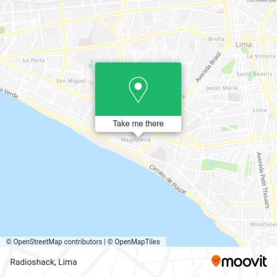
See Radioshack, Magdalena, on the map
Public Transit to Radioshack in Magdalena
Wondering how to get to Radioshack in Magdalena? Moovit helps you find the best way to get to Radioshack with step-by-step directions from the nearest public transit station.
Moovit provides free maps and live directions to help you navigate through your city. View schedules, routes, timetables, and find out how long does it take to get to Radioshack in real time.
Looking for the nearest stop or station to Radioshack? Check out this list of stops closest to your destination: Sucre; Mercado Bolognesi; Bolognesi; Leoncio Prado; Avenida Antonio José De Sucre; Jirón Salaverry.
Bus: 1021, 1024, 1111, 1269, 1272, 1275, 1475, IM18, 1008, 1012, 1030, 1045, 1219 SX, 1010, 1302, 1482, 1163, CR43, 1276, 1491.
Want to see if there’s another route that gets you there at an earlier time? Moovit helps you find alternative routes or times. Get directions from and directions to Radioshack easily from the Moovit App or Website.
We make riding to Radioshack easy, which is why over 1.5 million users, including users in Magdalena, trust Moovit as the best app for public transit. You don’t need to download an individual bus app or train app, Moovit is your all-in-one transit app that helps you find the best bus time or train time available.
For information on prices of bus, costs and ride fares to Radioshack, please check the Moovit app.
Use the app to navigate to popular places including to the airport, hospital, stadium, grocery store, mall, coffee shop, school, college, and university.
Radioshack Address: Jirón Bolognesi Orbea, 15086 Magdalena del Mar street in Magdalena
- globalnet,
- Enrique LLosa (ex Bolognesi) 436 dpto 204,
- Galeria Nueva Magdalena,
- Ferretería La Popular,
- Plaza Vea Express,
- Coolbox,
- Montalvo Bolognesi,
- Lulala Organizadores Utilidades de Hogar,
- CALLE BOLOGNESI 389 ALTURA DE LA CUADRA 5 DE BERTOLOTTO,
- La Patasquita Pe,
- La Rosa de Saron,
- Óptica Latina,
- CC Bolognesi,
- El Cholo,
- El Nazareno,
- Pepitos Oskar,
- La Ganadería de Huachumay Huánuco,
- Trapos & Detalles,
- Best Color S. R. L.,
- Florería-Emotions
Places Near Radioshack (Magdalena)
- Larcomar, Miraflores,
- Centro Comercial Plaza Norte, Independen,
- Circuito Mágico Del Agua, Lima,
- Plaza San Miguel, San Miguel,
- Av. Abancay, Lima,
- Barranco, Barranco,
- Mall Del Sur,
- Pontificia Universidad Católica del Perú - PUCP, San Miguel,
- Av. Salaverry, Jesus Mari,
- Parque de las Leyendas, San Miguel,
- Aeropuerto Internacional Jorge Chávez, Ventanilla,
- Real Plaza Puruchuco, Ate,
- Hospital Edgardo Rebagliati Martins, Jesus Mari,
- Miraflores, Miraflores,
- Jockey Plaza, Santiago D,
- Gamarra,
- av arequipa, Lima,
- Paradero Av.Brasil,
- Parque Kennedy, Miraflores,
- Av. La Marina, San Miguel
How to get to popular places in Lima with public transit
Get around Magdalena by public transit!
Traveling around Magdalena has never been so easy. See step by step directions as you travel to any attraction, street or major public transit station. View bus and train schedules, arrival times, service alerts and detailed routes on a map, so you know exactly how to get to anywhere in Magdalena.
When traveling to any destination around Magdalena use Moovit's Live Directions with Get Off Notifications to know exactly where and how far to walk, how long to wait for your line, and how many stops are left. Moovit will alert you when it's time to get off — no need to constantly re-check whether yours is the next stop.
Wondering how to use public transit in Magdalena or how to pay for public transit in Magdalena? Moovit public transit app can help you navigate your way with public transit easily, and at minimum cost. It includes public transit fees, ticket prices, and costs. Looking for a map of Magdalena public transit lines? Moovit public transit app shows all public transit maps in Magdalena with all Bus, Metro and Ferry routes and stops on an interactive map.
Lima has 3 transit type(s), including: Bus, Metro and Ferry, operated by several transit agencies, including Metro de Lima Línea 2 , Metro de Lima, Corredor Rojo, Metropolitano, Metropolitano - Alimentadores, Corredor Morado, Corredor Azul, Rutas Tradicionales, Transportes y Servicios La Esperanza S.A., Las Flores S.A., Virgen de la Asunción S.A., Consorcio HAM, Transportes y Service Canadá S.A., ETUL4SA and ETUCHISA