How to get to Rado by bus?
Click on the bus route to see step by step directions with maps, line arrival times and updated time schedules.
From 22-24 Boulevard Pershing, Paris
55 minFrom Hôpital Necker, Paris
90 minFrom 26 Rue d'Ulm, Paris
65 minFrom Rue d'Ulm, Paris
65 minFrom 15 Rue Blanche, Paris
57 minFrom La Bellevilloise, Paris
83 minFrom Clinique Geoffroy Saint-Hilaire, Paris
58 minFrom 16ème, Paris
71 minFrom 5e Arrondissement, Paris
73 minFrom Carette, Paris
71 min
How to get to Rado by train?
Click on the train route to see step by step directions with maps, line arrival times and updated time schedules.
How to get to Rado by metro?
Click on the metro route to see step by step directions with maps, line arrival times and updated time schedules.
From 22-24 Boulevard Pershing, Paris
74 minFrom Hôpital Necker, Paris
71 minFrom 26 Rue d'Ulm, Paris
74 minFrom Rue d'Ulm, Paris
74 minFrom 15 Rue Blanche, Paris
59 minFrom La Bellevilloise, Paris
77 minFrom Clinique Geoffroy Saint-Hilaire, Paris
67 minFrom 16ème, Paris
79 minFrom 5e Arrondissement, Paris
66 minFrom Carette, Paris
90 min
Bus stops near Rado in L'Ile-Saint-Denis
Bus lines to Rado in L'Ile-Saint-Denis
What are the closest stations to Rado?
The closest stations to Rado are:
- Mairie de L'Île Saint-Denis is 163 meters away, 3 min walk.
- Rue du Port is 411 meters away, 6 min walk.
- Gare de Saint-Denis RER is 557 meters away, 8 min walk.
- Mairie de Villeneuve-La-Garenne is 636 meters away, 9 min walk.
- Saint-Denis is 770 meters away, 11 min walk.
Which train line stops near Rado?
H (Creil/ Pontoise/ Persan - Beaumont/ Luzarches)
Which RER line stops near Rado?
D (Creil)
Which metro line stops near Rado?
13 (Saint-Denis - Université)
Which bus lines stop near Rado?
These bus lines stop near Rado: 170, 237, 274.
What’s the nearest bus station to Rado in L'Ile-Saint-Denis?
The nearest bus station to Rado in L'Ile-Saint-Denis is Mairie de L'Île Saint-Denis. It’s a 3 min walk away.
What time is the first light rail to Rado in L'Ile-Saint-Denis?
The T8 is the first light rail that goes to Rado in L'Ile-Saint-Denis. It stops nearby at 6:22 AM.
What time is the last light rail to Rado in L'Ile-Saint-Denis?
The T1 is the last light rail that goes to Rado in L'Ile-Saint-Denis. It stops nearby at 12:59 AM.
What time is the first train to Rado in L'Ile-Saint-Denis?
The H is the first train that goes to Rado in L'Ile-Saint-Denis. It stops nearby at 5:10 AM.
What time is the last train to Rado in L'Ile-Saint-Denis?
The H is the last train that goes to Rado in L'Ile-Saint-Denis. It stops nearby at 12:55 AM.
What time is the first bus to Rado in L'Ile-Saint-Denis?
The N51 is the first bus that goes to Rado in L'Ile-Saint-Denis. It stops nearby at 3:02 AM.
What time is the last bus to Rado in L'Ile-Saint-Denis?
The N51 is the last bus that goes to Rado in L'Ile-Saint-Denis. It stops nearby at 3:35 AM.
What time is the first RER to Rado in L'Ile-Saint-Denis?
The D is the first RER that goes to Rado in L'Ile-Saint-Denis. It stops nearby at 5:01 AM.
What time is the last RER to Rado in L'Ile-Saint-Denis?
The D is the last RER that goes to Rado in L'Ile-Saint-Denis. It stops nearby at 1:01 AM.
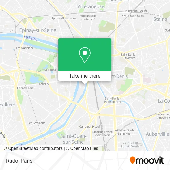
See Rado, L'Ile-Saint-Denis, on the map
Public Transit to Rado in L'Ile-Saint-Denis
Wondering how to get to Rado in L'Ile-Saint-Denis? Moovit helps you find the best way to get to Rado with step-by-step directions from the nearest public transit station.
Moovit provides free maps and live directions to help you navigate through your city. View schedules, routes, timetables, and find out how long does it take to get to Rado in real time.
Looking for the nearest stop or station to Rado? Check out this list of stops closest to your destination: Mairie de L'Île Saint-Denis; Rue du Port; Gare de Saint-Denis RER; Mairie de Villeneuve-La-Garenne; Saint-Denis.
Train: H.RER: D.Metro: 13.Bus: 170, 237, 274, 254, N51, T1, D, H.
Want to see if there’s another route that gets you there at an earlier time? Moovit helps you find alternative routes or times. Get directions from and directions to Rado easily from the Moovit App or Website.
We make riding to Rado easy, which is why over 1.5 million users, including users in L'Ile-Saint-Denis, trust Moovit as the best app for public transit. You don’t need to download an individual bus app or train app, Moovit is your all-in-one transit app that helps you find the best bus time or train time available.
For information on prices of metro, bus, RER and train, costs and ride fares to Rado, please check the Moovit app.
Use the app to navigate to popular places including to the airport, hospital, stadium, grocery store, mall, coffee shop, school, college, and university.
Rado Address: 15 Quai de Seine 93450 L'Île-Saint-Denis street in L'Ile-Saint-Denis
- Résidence Autonomie Ambroise Croizat,
- R.S.J.A.M. - A. Croizat,
- Rue du Bocage,
- Fresque Injustice,
- Fresque Trop de Murs,
- Salon de la Libération,
- Hôtel,
- Eglise la Puissance & Pasteur Daclau,
- Tidghi Négoce,
- Lcfr,
- Europe Top dem,
- GALERIES Lafayette,
- Stych,
- 22 Rue Charles Michels,
- 9 Boulevard de la Libération,
- Aide Sociale à l'Enfance,
- Accueil Banlieues,
- Hôtel de Ville de l'Ile Saint Denis,
- Aide Ménagères Ere A Domicile,
- 1 Rue Mechin
Places Near Rado (L'Ile-Saint-Denis)
- Théâtre Mogador, Paris,
- Galeries Lafayette, Paris,
- Beaugrenelle, Paris,
- Hôpital Cochin, Paris,
- Hôpital Beaujon, Clichy,
- Gare Routière Flixbus, Paris,
- Hopital Lariboisière, Paris,
- Fondation Louis Vuitton, Paris,
- Hôpital Pitié Salpêtrière, Paris,
- Marché Saint-Pierre, Paris,
- Hôpital Necker, Paris,
- Créteil Soleil, Creteil,
- Galeries Lafayette Haussmann, Paris,
- Hôpital Henri Mondor, Creteil,
- 29 Rue Manin, Paris,
- Hopital Foch, Suresnes,
- Hôpital de la Pitié-Salpêtrière, Paris,
- Hôpital Saint-Joseph, Paris,
- Atelier Des Lumieres, Paris,
- Centre Hospitalier des 15/20, Paris
How to get to popular places in Paris with public transit
Get around L'Ile-Saint-Denis by public transit!
Traveling around L'Ile-Saint-Denis has never been so easy. See step by step directions as you travel to any attraction, street or major public transit station. View bus and train schedules, arrival times, service alerts and detailed routes on a map, so you know exactly how to get to anywhere in L'Ile-Saint-Denis.
When traveling to any destination around L'Ile-Saint-Denis use Moovit's Live Directions with Get Off Notifications to know exactly where and how far to walk, how long to wait for your line, and how many stops are left. Moovit will alert you when it's time to get off — no need to constantly re-check whether yours is the next stop.
Wondering how to use public transit in L'Ile-Saint-Denis or how to pay for public transit in L'Ile-Saint-Denis? Moovit public transit app can help you navigate your way with public transit easily, and at minimum cost. It includes public transit fees, ticket prices, and costs. Looking for a map of L'Ile-Saint-Denis public transit lines? Moovit public transit app shows all public transit maps in L'Ile-Saint-Denis with all Bus, Train, Metro, Light Rail, RER, Funicular and Gondola routes and stops on an interactive map.
Paris has 7 transit type(s), including: Bus, Train, Metro, Light Rail, RER, Funicular and Gondola, operated by several transit agencies, including RATP, RER, RER Bus de remplacement, Train, Train Bus de remplacement, Tramway Bus de remplacement, TER, ADP, Magical Shuttle, Argenteuil - Boucles de Seine, Autocars Dominique, Bièvre, Brie et 2 Morin, Le Bus - C.C. du Clermontois and Cœur d’Essonne