How to get to Radsport Haritz by bus?
Click on the bus route to see step by step directions with maps, line arrival times and updated time schedules.
From SAP Campus, Walldorf
29 minFrom Möbel Höffner, Schwetzingen
68 minFrom Thoraxklinik Heidelberg, Neuenheim
68 minFrom Neuenheimer Feld, Neuenheim
59 minFrom Thermen & Badewelt Sinsheim, Sinsheim
156 minFrom Thingstätte, Handschuhsheim
84 minFrom Hauptfeuerwache, Berufsfeuerwehr Mannheim, Neckarau
130 minFrom SAP Headquarters, Walldorf
34 min
How to get to Radsport Haritz by train?
Click on the train route to see step by step directions with maps, line arrival times and updated time schedules.
Bus stops near Radsport Haritz in Stuttgart
Light Rail stations near Radsport Haritz in Stuttgart
- Georgi-Marktplatz, 6 min walk,VIEW
Bus lines to Radsport Haritz in Stuttgart
- 726, St. Ilgen, Weberstraße,VIEW
- 751, Leimen, Kurpfalz-Centrum,VIEW
- 758, Leimen, Steige,VIEW
- 7903, Leimen, Kurpfalz-Centrum,VIEW
- 723, Rohrbach, Süd,VIEW
- RNV 23, Heidelberg, Bismarckplatz,VIEW
- 7902, St. Ilgen, Heidelberger Weg,VIEW
- 749, Wiesloch-Walldorf, Bf,VIEW
- 757, Schatthausen, Kirche,VIEW
- 7900, Ochsenbach,VIEW
- 7901, Leimen, Kurpfalz-Centrum,VIEW
- 7904, Leimen, Kurpfalz-Centrum,VIEW
What are the closest stations to Radsport Haritz?
The closest stations to Radsport Haritz are:
- Leimen, Tuchbleiche is 194 meters away, 3 min walk.
- Georgi-Marktplatz is 440 meters away, 6 min walk.
- Leimen, Wilhelm-Haug-Straße is 447 meters away, 6 min walk.
- Leimen, Georgi-Marktplatz is 460 meters away, 7 min walk.
- Leimen, Gutenbergstraße is 471 meters away, 7 min walk.
- Leimen, Kurpfalz-Centrum is 500 meters away, 7 min walk.
Which bus lines stop near Radsport Haritz?
These bus lines stop near Radsport Haritz: 749, 751, 757, 758.
Which train lines stop near Radsport Haritz?
These train lines stop near Radsport Haritz: RB68, S3.
Which light rail lines stop near Radsport Haritz?
These light rail lines stop near Radsport Haritz: 23, S3.
What’s the nearest light rail station to Radsport Haritz in Stuttgart?
The nearest light rail station to Radsport Haritz in Stuttgart is Georgi-Marktplatz. It’s a 6 min walk away.
What’s the nearest bus station to Radsport Haritz in Stuttgart?
The nearest bus station to Radsport Haritz in Stuttgart is Leimen, Tuchbleiche. It’s a 3 min walk away.
What time is the first light rail to Radsport Haritz in Stuttgart?
The 23 is the first light rail that goes to Radsport Haritz in Stuttgart. It stops nearby at 4:30 AM.
What time is the last light rail to Radsport Haritz in Stuttgart?
The RNV 23 is the last light rail that goes to Radsport Haritz in Stuttgart. It stops nearby at 12:39 AM.
What time is the first bus to Radsport Haritz in Stuttgart?
The 723 is the first bus that goes to Radsport Haritz in Stuttgart. It stops nearby at 5:04 AM.
What time is the last bus to Radsport Haritz in Stuttgart?
The 7902 is the last bus that goes to Radsport Haritz in Stuttgart. It stops nearby at 1:46 AM.
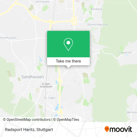
See Radsport Haritz, Stuttgart, on the map
Public Transit to Radsport Haritz in Stuttgart
Wondering how to get to Radsport Haritz in Stuttgart? Moovit helps you find the best way to get to Radsport Haritz with step-by-step directions from the nearest public transit station.
Moovit provides free maps and live directions to help you navigate through your city. View schedules, routes, timetables, and find out how long does it take to get to Radsport Haritz in real time.
Looking for the nearest stop or station to Radsport Haritz? Check out this list of stops closest to your destination: Leimen; Georgi-Marktplatz; Leimen; Leimen; Leimen; Leimen.
Bus: 749, 751, 757, 758, 726, 7903, 723, RNV 23, 7902, 7900, 7901, 7904.Train: RB68, S3.Light Rail: 23, S3.
Want to see if there’s another route that gets you there at an earlier time? Moovit helps you find alternative routes or times. Get directions from and directions to Radsport Haritz easily from the Moovit App or Website.
We make riding to Radsport Haritz easy, which is why over 1.5 million users, including users in Stuttgart, trust Moovit as the best app for public transit. You don’t need to download an individual bus app or train app, Moovit is your all-in-one transit app that helps you find the best bus time or train time available.
For information on prices of bus, train and light rail, costs and ride fares to Radsport Haritz, please check the Moovit app.
Use the app to navigate to popular places including to the airport, hospital, stadium, grocery store, mall, coffee shop, school, college, and university.
Radsport Haritz Address: Sankt Ilgener Straße street in Stuttgart
- Haritz Radsport,
- J. Tatarakis,
- Udo Proske,
- Anwaltskanzlei Guhl,
- Rechtsanwalt Gerhard Gößl,
- Haus und Grund Leimen,
- Thomas Kern,
- Kanzlei Kern,
- Stadtwerke Leimen / Technische Betriebe Leimen,
- Synergist,
- Deutsches Rotes Kreuz,
- Jugendfeuerwehr Leimen,
- Erik Ilmberger Sanitär,
- Uwe Quaty,
- Fellhauer,
- Trepches C.,
- Turnverein Germania St.Ilgen,
- Waldwelt,
- Hedu Natur,
- Katholischer Kindergarten St. Georg
Places Near Radsport Haritz (Stuttgart)
- Hanns-Martin-Schleyer-Halle, Bad Cannstatt,
- Geilhaus Haus 33a, Reutlingen-Betzingen,
- Mercedes-Benz Museum, Bad Cannstatt,
- Waldfriedhof, Degerloch,
- Porsche-Arena, Bad Cannstatt,
- Im Wizemann (Halle), Bad Cannstatt,
- Marmorsaal Im Weissenburgpark, Stuttgart-Süd,
- Hauptbahnhof Stuttgart, Stuttgart-Mitte,
- Gasometer Pforzheim, Pforzheim,
- Porsche Museum, Zuffenhausen,
- FlixBus Haltestelle, Stuttgart,
- Gleis 101/102 (tief), Stuttgart-Mitte,
- Wilhelma (U-Bahn Wilhelma), Bad Cannstatt,
- Klinikum Stuttgart - Katharinenhospital, Stuttgart-Mitte,
- Pariser Platz Stuttgart, Stuttgart-Mitte,
- Mercedes-Benz Museum (Mercedes Museum Stuttgart), Bad Cannstatt,
- SI-Centrum, Möhringen,
- Mettingen Eros-Center Puff Laufhaus, Esslingen Am Neckar,
- Schleyerhalle, Bad Cannstatt,
- Hanns-Martin-Schleyer-Halle (Stuttgart Hans-Martin-Schleyerhalle), Bad Cannstatt
How to get to popular places in Stuttgart with public transit
Get around Stuttgart by public transit!
Traveling around Stuttgart has never been so easy. See step by step directions as you travel to any attraction, street or major public transit station. View bus and train schedules, arrival times, service alerts and detailed routes on a map, so you know exactly how to get to anywhere in Stuttgart.
When traveling to any destination around Stuttgart use Moovit's Live Directions with Get Off Notifications to know exactly where and how far to walk, how long to wait for your line, and how many stops are left. Moovit will alert you when it's time to get off — no need to constantly re-check whether yours is the next stop.
Wondering how to use public transit in Stuttgart or how to pay for public transit in Stuttgart? Moovit public transit app can help you navigate your way with public transit easily, and at minimum cost. It includes public transit fees, ticket prices, and costs. Looking for a map of Stuttgart public transit lines? Moovit public transit app shows all public transit maps in Stuttgart with all Bus, Train, Subway, Light Rail, Ferry, S-Bahn and Funicular routes and stops on an interactive map.
Stuttgart has 7 transit type(s), including: Bus, Train, Subway, Light Rail, Ferry, S-Bahn and Funicular, operated by several transit agencies, including SSB - Stadtbahn, SSB, SSB - Seilbahn / Zacke, S-Bahn Stuttgart, Rhein-Neckar-Verkehr GmbH (rnv), Karlsruher Verkehrsverbund, DB AG, DB Regiobus BW, Arverio Baden-Württemberg GmbH, DB RegioNetz Verkehrs GmbH Westfrankenbahn, DB Regio AG Baden-Württemberg, Südwestdeutsche Verkehrs-AG, DB Regio AG Mitte Region Hessen, DB and Bodensee-Oberschwaben-Bahn