How to get to Raelyn Lawrence by bus?
Click on the bus route to see step by step directions with maps, line arrival times and updated time schedules.
Bus stops near Raelyn Lawrence in West Hartford
Bus lines to Raelyn Lawrence in West Hartford
What are the closest stations to Raelyn Lawrence?
The closest stations to Raelyn Lawrence are:
- S Main St @ Banknorth is 75 yards away, 1 min walk.
- Farmington Ave @ N Main St is 105 yards away, 2 min walk.
- Farmington Ave @ South Main St is 168 yards away, 3 min walk.
Which bus line stops near Raelyn Lawrence?
66 (66h - Farmington Av-Uconn Health Ctr)
What’s the nearest bus station to Raelyn Lawrence in West Hartford?
The nearest bus station to Raelyn Lawrence in West Hartford is S Main St @ Banknorth. It’s a 1 min walk away.
What time is the first bus to Raelyn Lawrence in West Hartford?
The 60 is the first bus that goes to Raelyn Lawrence in West Hartford. It stops nearby at 4:57 AM.
What time is the last bus to Raelyn Lawrence in West Hartford?
The 60 is the last bus that goes to Raelyn Lawrence in West Hartford. It stops nearby at 1:08 AM.
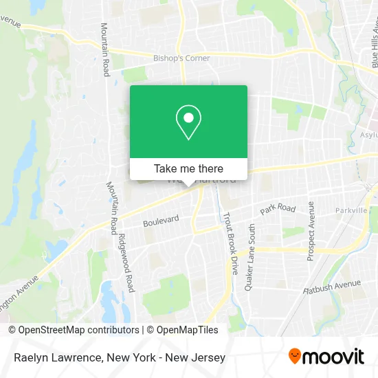
See Raelyn Lawrence, West Hartford, on the map
Public Transit to Raelyn Lawrence in West Hartford
Wondering how to get to Raelyn Lawrence in West Hartford? Moovit helps you find the best way to get to Raelyn Lawrence with step-by-step directions from the nearest public transit station.
Moovit provides free maps and live directions to help you navigate through your city. View schedules, routes, timetables, and find out how long does it take to get to Raelyn Lawrence in real time.
Looking for the nearest stop or station to Raelyn Lawrence? Check out this list of stops closest to your destination: S Main St @ Banknorth; Farmington Ave @ N Main St; Farmington Ave @ South Main St.
Bus: 66, 60, 64, 153, 62.
Want to see if there’s another route that gets you there at an earlier time? Moovit helps you find alternative routes or times. Get directions from and directions to Raelyn Lawrence easily from the Moovit App or Website.
We make riding to Raelyn Lawrence easy, which is why over 1.7 million users, including users in West Hartford, trust Moovit as the best app for public transit. You don’t need to download an individual bus app or train app, Moovit is your all-in-one transit app that helps you find the best bus time or train time available.
For information on prices of bus and train, costs and ride fares to Raelyn Lawrence, please check the Moovit app.
Use the app to navigate to popular places including to the airport, hospital, stadium, grocery store, mall, coffee shop, school, college, and university.
Raelyn Lawrence Address: 992 Farmington Ave street in West Hartford
- Lori Meyerson, Realtor / Coldwell Banker Realty,
- Isabelle Barere, Realtor® - Coldwell Banker Realty,
- Homes by Samantha With the Leah Muchie Team at Coldwell Banker,
- Berlin Pineda Realtor,
- Chris Scigulinsky- Coldwell Banker Residential Brokerage,
- Judy Bergman Sells Ct,
- Joyce Aparicio,
- Realtywithnicky,
- Mike Willin Real Estate,
- Ashley Buscema,
- Properties by Mela,
- Sylvie Fillion at Guaranteed Rate Affinity - Nmls #110720,
- Eyelash Extensions & More,
- Lindalopez.Realtor,
- Vaiva Baltonis, Real Estate,
- Josh Rutledge, Coldwell Banker Realty,
- Adam Cannon Real Estate,
- Eric Toth,
- Lisa Mccarthy, Coldwell Banker Realty,
- Tracey Hollerbach Real Estate
Places Near Raelyn Lawrence (West Hartford)
- Bellevue Hospital, Manhattan,
- Rockefeller Center, Manhattan,
- San Gennaro Feast, Manhattan,
- 1 Police Plaza, Manhattan,
- Queens Center Mall, Queens,
- Hudson Yards, Manhattan,
- Katz's Deli, Manhattan,
- Pier 83, Manhattan,
- Chinatown, Manhattan,
- qqqq, Manhattan,
- Wall Street, Manhattan,
- SoHo, Manhattan,
- 66 John Street, Manhattan,
- 911 Memorial, Manhattan,
- 3 Stone St, Manhattan,
- Mountainside Hospital, Glen Ridge,
- 111 Centre New York City Supreme Court, Manhattan,
- 26 Federal Plaza, Manhattan,
- 376 Hudson Street, Manhattan,
- Times Square, Manhattan
How to get to popular places in New York - New Jersey with public transit
Get around West Hartford by public transit!
Traveling around West Hartford has never been so easy. See step by step directions as you travel to any attraction, street or major public transit station. View bus and train schedules, arrival times, service alerts and detailed routes on a map, so you know exactly how to get to anywhere in West Hartford.
When traveling to any destination around West Hartford use Moovit's Live Directions with Get Off Notifications to know exactly where and how far to walk, how long to wait for your line, and how many stops are left. Moovit will alert you when it's time to get off — no need to constantly re-check whether yours is the next stop.
Wondering how to use public transit in West Hartford or how to pay for public transit in West Hartford? Moovit public transit app can help you navigate your way with public transit easily, and at minimum cost. It includes public transit fees, ticket prices, and costs. Looking for a map of West Hartford public transit lines? Moovit public transit app shows all public transit maps in West Hartford with all Bus, Train, Subway, Light Rail, Ferry and Cable Car routes and stops on an interactive map.
New York - New Jersey has 6 transit type(s), including: Bus, Train, Subway, Light Rail, Ferry and Cable Car, operated by several transit agencies, including MTA Subway, Metro-North Railroad, LIRR, PATH, MTA New York City Transit - Express routes, MTA Bus, NJ Transit, NYC Ferry, NICE bus, Bee-Line Bus, NJ Transit Rail, Norwalk Transit District, Hartford Line, River Valley Transit and HART