Directions to Rafa Transportes (Regiao Administrativa VII) with public transportation
The following transit lines have routes that pass near Rafa Transportes
 Bus: P711, P714, P750, TR493-01, VILA MARIA / BOA VISTA.
How to get to Rafa Transportes by bus?
Click on the bus route to see step by step directions with maps, line arrival times and updated time schedules.
From Colégio Estadual Guanabara, Volta Redonda
32 minFrom Centro Médico Santa Maria, Regiao Administrativa IV
30 minFrom Avenida Nossa Senhora do Amparo, Volta Redonda
55 minFrom Sesi Barra Mansa, Barra Mansa
56 minFrom Avenida Paulista, Volta Redonda
65 minFrom DETRAN - Sao Luiz, Volta Redonda
53 minFrom Rua Coroados 505, Volta Redonda
56 minFrom Rua Goiás, Volta Redonda
60 minFrom USF Vila Rica Três Poços, Volta Redonda
60 min
Bus stops near Rafa Transportes in Regiao Administrativa VII
Bus lines to Rafa Transportes in Regiao Administrativa VII
What are the closest stations to Rafa Transportes?
The closest stations to Rafa Transportes are:
- Rua Nossa Senhora Aparecida, 60 is 35 meters away, 1 min walk.
- Rua Raimundo Clemente De Freitas, 160 is 159 meters away, 3 min walk.
- Br-116 - B. Boa Vista I is 212 meters away, 4 min walk.
Which bus lines stop near Rafa Transportes?
These bus lines stop near Rafa Transportes: P711, P714, P750, TR493-01.
What’s the nearest bus station to Rafa Transportes in Regiao Administrativa VII?
The nearest bus station to Rafa Transportes in Regiao Administrativa VII is Rua Nossa Senhora Aparecida, 60. It’s a 1 min walk away.
What time is the first bus to Rafa Transportes in Regiao Administrativa VII?
The TR493-02 is the first bus that goes to Rafa Transportes in Regiao Administrativa VII. It stops nearby at 3:36 AM.
What time is the last bus to Rafa Transportes in Regiao Administrativa VII?
The P714 is the last bus that goes to Rafa Transportes in Regiao Administrativa VII. It stops nearby at 12:41 AM.
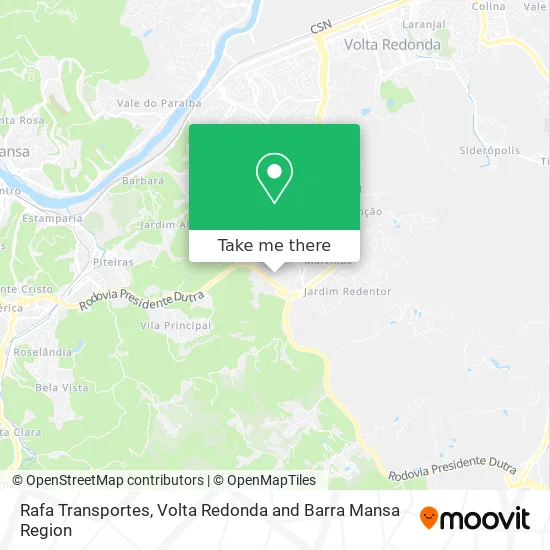
See Rafa Transportes, Regiao Administrativa VII, on the map
Public Transit to Rafa Transportes in Regiao Administrativa VII
Wondering how to get to Rafa Transportes in Regiao Administrativa VII? Moovit helps you find the best way to get to Rafa Transportes with step-by-step directions from the nearest public transit station.
Moovit provides free maps and live directions to help you navigate through your city. View schedules, routes, timetables, and find out how long does it take to get to Rafa Transportes in real time.
Looking for the nearest stop or station to Rafa Transportes? Check out this list of stops closest to your destination: Rua Nossa Senhora Aparecida; Rua Raimundo Clemente De Freitas; Br-116 - B. Boa Vista I.
Bus: P711, P714, P750, TR493-01, VILA MARIA / BOA VISTA, P740, REGIÃO LESTE, VILA PRINCIPAL.
Want to see if there’s another route that gets you there at an earlier time? Moovit helps you find alternative routes or times. Get directions from and directions to Rafa Transportes easily from the Moovit App or Website.
We make riding to Rafa Transportes easy, which is why over 1.5 million users, including users in Regiao Administrativa VII, trust Moovit as the best app for public transit. You don’t need to download an individual bus app or train app, Moovit is your all-in-one transit app that helps you find the best bus time or train time available.
For information on prices of bus, costs and ride fares to Rafa Transportes, please check the Moovit app.
Use the app to navigate to popular places including to the airport, hospital, stadium, grocery store, mall, coffee shop, school, college, and university.
Rafa Transportes Address: Rua Geraldo José de Freitas, 318 Boa Vista I Barra Mansa-RJ 27332-180 street in Regiao Administrativa VII
- Rua M / Rua Maria das Graças,
- A R Producoes e Eventos,
- Trevo Auto Pecas,
- Home Milosz,
- Lancheria Barra Mansa Sul,
- Cleidson Júnior da Sil,
- Majofer,
- Boa Vista I,
- Transsilvaentregas,
- Agro Boa Vista,
- Rancho da Dutra Restaurante e Pusada,
- Bar do Fernando,
- WLM Participações e Comércio de Máquinas e Veículos S.A.,
- Nuvii Tech,
- Borracharia do Chico,
- Injeções Barra Mansa - Diesel,
- Jultec Manutenção Automotiva,
- Transportadora Augusto,
- Rodolog Transportes e Servicos de Logistica,
- Lx Logística e Transporte
Places Near Rafa Transportes (Regiao Administrativa VII)
- Unimed Volta Redonda, Volta Redonda,
- Jardim Europa, Volta Redonda,
- Vila Santa Cecília, Volta Redonda,
- Parque Nacional de Itatiáia, Itatiaia,
- Jardim Vila Rica - Tiradentes, Volta Redonda,
- CSN - Escritório Central Novo, Volta Redonda,
- Parque Aquático Aldeia das Águas Resort, Volta Redonda,
- Jardim Primavera, Volta Redonda,
- Aero Clube, Volta Redonda,
- Rua Simão da Cunha Gago, Volta Redonda,
- Retiro, Volta Redonda,
- Vila Mury, Volta Redonda,
- Hospital Unimed Volta Redonda, Volta Redonda,
- Ilha São João, Volta Redonda,
- Shopping Park Sul, Volta Redonda,
- Bairro da Passagem - Cabo Frio RJ, Passa-Vinte,
- Moinho De Vento, Barra Mansa,
- Hospital Regional Doutora Zilda Arns-PS, Volta Redonda,
- Shopping Park Sul Volta Redonda, Volta Redonda,
- Aterrado, Volta Redonda
How to get to popular places in Volta Redonda and Barra Mansa Region with public transit
Get around Regiao Administrativa VII by public transit!
Traveling around Regiao Administrativa VII has never been so easy. See step by step directions as you travel to any attraction, street or major public transit station. View bus and train schedules, arrival times, service alerts and detailed routes on a map, so you know exactly how to get to anywhere in Regiao Administrativa VII.
When traveling to any destination around Regiao Administrativa VII use Moovit's Live Directions with Get Off Notifications to know exactly where and how far to walk, how long to wait for your line, and how many stops are left. Moovit will alert you when it's time to get off — no need to constantly re-check whether yours is the next stop.
Wondering how to use public transit in Regiao Administrativa VII or how to pay for public transit in Regiao Administrativa VII? Moovit public transit app can help you navigate your way with public transit easily, and at minimum cost. It includes public transit fees, ticket prices, and costs. Looking for a map of Regiao Administrativa VII public transit lines? Moovit public transit app shows all public transit maps in Regiao Administrativa VII with all Bus and Train routes and stops on an interactive map.
Volta Redonda and Barra Mansa Region has 2 transit type(s), including: Bus and Train, operated by several transit agencies, including Cidade do Aço, Viação Elite, Princesinha do Vale, Colitur Transportes Rodoviários, Viação Pinheiral, Resendense, BusUFF, Bem-Te-Vi Transportes, Transa Transporte Coletivo, JMS-Tur, Viação Falcão, UTIL - União Transporte Interestadual de Luxo, Viação Penedo, Empresa de Ônibus Pedro Antônio and Porto Real Transportes Coletivos