Directions to Rafael Castro (Almirante Tamandaré) with public transportation
The following transit lines have routes that pass near Rafael Castro
How to get to Rafael Castro by bus?
Click on the bus route to see step by step directions with maps, line arrival times and updated time schedules.
From Hospital de Olhos do Paraná, Centro
39 minFrom Hospital Universitário Cajuru, Cristo Rei
57 minFrom Atuba, Atuba
59 minFrom Hospital Marcelino Champagnat, Jardim Botânico
56 minFrom Teatro Positivo, Cic
85 minFrom Linha 702 Ligeirinho Fazendinha/Tamandaré, Rebouças
54 minFrom Rua Tamoios, Vila Izabel
69 minFrom Rua México, Bacacheri
79 minFrom Praça das Nações, Alto Da Rua XV
46 minFrom Rebouças, Rebouças
49 min
Bus stops near Rafael Castro in Almirante Tamandaré
Bus lines to Rafael Castro in Almirante Tamandaré
What are the closest stations to Rafael Castro?
The closest stations to Rafael Castro are:
- R. José Kleina, 505 is 375 meters away, 5 min walk.
- Rua Rio Grande Do Sul, 65 (Vila Tanguá) is 709 meters away, 10 min walk.
Which bus line stops near Rafael Castro?
A77 TANGUÁ / GUADALUPE (Terminal Guadalupe → Tanguá)
What’s the nearest bus station to Rafael Castro in Almirante Tamandaré?
The nearest bus station to Rafael Castro in Almirante Tamandaré is R. José Kleina, 505. It’s a 5 min walk away.
What time is the first bus to Rafael Castro in Almirante Tamandaré?
The A77 TANGUÁ / GUADALUPE is the first bus that goes to Rafael Castro in Almirante Tamandaré. It stops nearby at 5:15 AM.
What time is the last bus to Rafael Castro in Almirante Tamandaré?
The A80 TANGUÁ (VILA MARTA) / GUADALUPE is the last bus that goes to Rafael Castro in Almirante Tamandaré. It stops nearby at 12:50 AM.
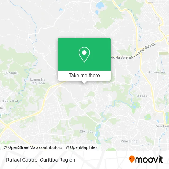
See Rafael Castro, Almirante Tamandaré, on the map
Public Transit to Rafael Castro in Almirante Tamandaré
Wondering how to get to Rafael Castro in Almirante Tamandaré? Moovit helps you find the best way to get to Rafael Castro with step-by-step directions from the nearest public transit station.
Moovit provides free maps and live directions to help you navigate through your city. View schedules, routes, timetables, and find out how long does it take to get to Rafael Castro in real time.
Looking for the nearest stop or station to Rafael Castro? Check out this list of stops closest to your destination: R. José Kleina; Rua Rio Grande Do Sul.
Bus: A77 TANGUÁ / GUADALUPE, A80 TANGUÁ (VILA MARTA) / GUADALUPE, A22 TANGUÁ / TAMANDARÉ.
Want to see if there’s another route that gets you there at an earlier time? Moovit helps you find alternative routes or times. Get directions from and directions to Rafael Castro easily from the Moovit App or Website.
We make riding to Rafael Castro easy, which is why over 1.5 million users, including users in Almirante Tamandaré, trust Moovit as the best app for public transit. You don’t need to download an individual bus app or train app, Moovit is your all-in-one transit app that helps you find the best bus time or train time available.
For information on prices of bus, costs and ride fares to Rafael Castro, please check the Moovit app.
Use the app to navigate to popular places including to the airport, hospital, stadium, grocery store, mall, coffee shop, school, college, and university.
Rafael Castro Address: Rua Manoel Alves de Almeida, 46 Tanguá Almirante Tamandaré-PR 83508-415 street in Almirante Tamandaré
- Rua Manoel Alves de Almeida,
- Velifera Centro de Servicos Compartilhados,
- F Schreiber Representacoes Comerciais,
- Condominio Colinas do Tanguá,
- Canguru Motos,
- Rua Marta Kleina 167,
- Incorporação X20 Key West Spe,
- Clinica de Estética Nogueira,
- Paola Leticia Pessin,
- Notável Estruturas Para Eventos,
- Rua Paraná 48,
- Lima Estofados,
- Imperio Tires,
- Loteamento Marinoni,
- Somos Administradora de Bens,
- Morro da Formiga #Tangua Loko,
- Travessa José Kleina 501,
- By Jordan - Reparação Automotiva,
- Campo Largo Ensino de Idiomas,
- Panificadora Padares
Places Near Rafael Castro (Almirante Tamandaré)
- Hospital Universitário Evangélico de Curitiba, Bigorrilho,
- Rua Martim Afonso 558, Mercês,
- Park Shopping Barigüi, Mossunguê,
- Hhhhh, Fazendinha,
- Jockey Plaza Shopping Center, Tarumã,
- Jardim Botânico de Curitiba PR, Centro,
- Rua General Mário Tourinho, Campina Do Siqueira,
- Hospital Erasto Gaertner, Jardim Das Américas,
- Hospital Angelina Caron, Campina Grande Do Sul,
- Parque Barigui, Mercês,
- Hospital do Rocio, Campo,
- Hospital Madalena Sofia, Bairro Alto,
- Arena Da Baixada - Curitiba,
- Pontifícia Universidade Católica do Paraná (PUCPR), Prado Velho,
- Campo Largo, Campo,
- Shopping Palladium, Portão,
- Hospital Nossa Senhora Das Graças, Mercês,
- Hospital de Clínicas (HC - UFPR), Centro,
- Shopping Estação, Rebouças,
- Hospital Da Cruz Vermelha, Batel
How to get to popular places in Curitiba Region with public transit
Get around Almirante Tamandaré by public transit!
Traveling around Almirante Tamandaré has never been so easy. See step by step directions as you travel to any attraction, street or major public transit station. View bus and train schedules, arrival times, service alerts and detailed routes on a map, so you know exactly how to get to anywhere in Almirante Tamandaré.
When traveling to any destination around Almirante Tamandaré use Moovit's Live Directions with Get Off Notifications to know exactly where and how far to walk, how long to wait for your line, and how many stops are left. Moovit will alert you when it's time to get off — no need to constantly re-check whether yours is the next stop.
Wondering how to use public transit in Almirante Tamandaré or how to pay for public transit in Almirante Tamandaré? Moovit public transit app can help you navigate your way with public transit easily, and at minimum cost. It includes public transit fees, ticket prices, and costs. Looking for a map of Almirante Tamandaré public transit lines? Moovit public transit app shows all public transit maps in Almirante Tamandaré with all Bus and Cable Car routes and stops on an interactive map.
Curitiba Region has 2 transit type(s), including: Bus and Cable Car, operated by several transit agencies, including Sistema Integrado de Mobilidade (URBS), Sistema Integrado de Mobilidade (AMEP), URBS (Cartões bancários e Dinheiro), URBS (Cartões bancários / Cartão URBS), AMEP (Cartões bancários / Cartão MetroCard), AMEP (Cartões bancários / Cartão MetroCard / Dinheiro), Viação Colombo (Dinheiro), TRIAR (Cartão TRIAR / Dinheiro), Empresa Curitiba Cerro Azul (Dinheiro), Expresso Nossa Senhora da Penha (Dinheiro), Empresa Campo Alto Tijucas (Dinheiro), Auto Viação São José (Cartão VEM / Dinheiro), BRT S/A (Cartão VEM / Dinheiro), TransPiedade (Cartão Cidadão / Dinheiro) and Oceânica Sul (Cartão Transporte / Dinheiro)