How to get to Rafael Romero Tabuenca by bus?
Click on the bus route to see step by step directions with maps, line arrival times and updated time schedules.
From Calle de los Angeles 9, Fuenlabrada
44 minFrom Cuatro Vientos, Madrid
77 minFrom Hospital Universitario de Getafe, Getafe
80 minFrom Zarzaquemada, Área Metropolitana De Madrid Y Corredor Del Henares
67 minFrom Calle del Trueno 32, Leganés
68 minFrom Avenida de las Arcas del Agua, Getafe
83 minFrom Kinepolis Madrid Ciudad de la Imagen, Pozuelo De Alarcón
71 minFrom rio alberche, Madrid
44 minFrom Tres Aguas, Alcorcón
44 minFrom Loranca, Área Metropolitana De Madrid Y Corredor Del Henares
90 min
How to get to Rafael Romero Tabuenca by train?
Click on the train route to see step by step directions with maps, line arrival times and updated time schedules.
How to get to Rafael Romero Tabuenca by metro?
Click on the metro route to see step by step directions with maps, line arrival times and updated time schedules.
From Calle de los Angeles 9, Fuenlabrada
30 minFrom Hospital Universitario de Getafe, Getafe
46 minFrom Zarzaquemada, Área Metropolitana De Madrid Y Corredor Del Henares
42 minFrom Calle del Trueno 32, Leganés
49 minFrom Avenida de las Arcas del Agua, Getafe
32 minFrom rio alberche, Madrid
59 minFrom Tres Aguas, Alcorcón
44 min
Bus stops near Rafael Romero Tabuenca in Móstoles
Metro station near Rafael Romero Tabuenca in Móstoles
- Manuela Malasaña, 10 min walk,VIEW
Train station near Rafael Romero Tabuenca in Móstoles
- Móstoles, 28 min walk,VIEW
Bus lines to Rafael Romero Tabuenca in Móstoles
What are the closest stations to Rafael Romero Tabuenca?
The closest stations to Rafael Romero Tabuenca are:
- Av. Carlos V - Hospital is 273 meters away, 4 min walk.
- Alfonso XII - Nápoles is 278 meters away, 4 min walk.
- Av. Osa Menor - Est. Manuela Malasaña is 285 meters away, 5 min walk.
- Av. Carlos V - Camino De Humanes is 473 meters away, 7 min walk.
- Manuela Malasaña is 736 meters away, 10 min walk.
- Móstoles is 2148 meters away, 28 min walk.
Which bus lines stop near Rafael Romero Tabuenca?
These bus lines stop near Rafael Romero Tabuenca: 4, 520, 523, 524.
Which train line stops near Rafael Romero Tabuenca?
C5 (Móstoles - El Soto)
Which metro line stops near Rafael Romero Tabuenca?
M-12 (MetroSur Andén 2)
What’s the nearest metro station to Rafael Romero Tabuenca in Móstoles?
The nearest metro station to Rafael Romero Tabuenca in Móstoles is Manuela Malasaña. It’s a 10 min walk away.
What’s the nearest train station to Rafael Romero Tabuenca in Móstoles?
The nearest train station to Rafael Romero Tabuenca in Móstoles is Móstoles. It’s a 28 min walk away.
What’s the nearest bus station to Rafael Romero Tabuenca in Móstoles?
The nearest bus stations to Rafael Romero Tabuenca in Móstoles are Av. Carlos V - Hospital and Alfonso XII - Nápoles. The closest one is a 4 min walk away.
What time is the first metro to Rafael Romero Tabuenca in Móstoles?
The M-12 is the first metro that goes to Rafael Romero Tabuenca in Móstoles. It stops nearby at 6:05 AM.
What time is the last metro to Rafael Romero Tabuenca in Móstoles?
The M-12 is the last metro that goes to Rafael Romero Tabuenca in Móstoles. It stops nearby at 2:15 AM.
What time is the first train to Rafael Romero Tabuenca in Móstoles?
The C5 is the first train that goes to Rafael Romero Tabuenca in Móstoles. It stops nearby at 5:18 AM.
What time is the last train to Rafael Romero Tabuenca in Móstoles?
The C5 is the last train that goes to Rafael Romero Tabuenca in Móstoles. It stops nearby at 12:36 AM.
What time is the first bus to Rafael Romero Tabuenca in Móstoles?
The N503 is the first bus that goes to Rafael Romero Tabuenca in Móstoles. It stops nearby at 3:02 AM.
What time is the last bus to Rafael Romero Tabuenca in Móstoles?
The N503 is the last bus that goes to Rafael Romero Tabuenca in Móstoles. It stops nearby at 2:33 AM.
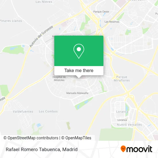
See Rafael Romero Tabuenca, Móstoles, on the map
Public Transit to Rafael Romero Tabuenca in Móstoles
Wondering how to get to Rafael Romero Tabuenca in Móstoles? Moovit helps you find the best way to get to Rafael Romero Tabuenca with step-by-step directions from the nearest public transit station.
Moovit provides free maps and live directions to help you navigate through your city. View schedules, routes, timetables, and find out how long does it take to get to Rafael Romero Tabuenca in real time.
Looking for the nearest stop or station to Rafael Romero Tabuenca? Check out this list of stops closest to your destination: Av. Carlos V - Hospital; Alfonso XII - Nápoles; Av. Osa Menor - Est. Manuela Malasaña; Av. Carlos V - Camino De Humanes; Manuela Malasaña; Móstoles.
Bus: 4, 520, 523, 524, N503, 1.Train: C5.Metro: M-12.
Want to see if there’s another route that gets you there at an earlier time? Moovit helps you find alternative routes or times. Get directions from and directions to Rafael Romero Tabuenca easily from the Moovit App or Website.
We make riding to Rafael Romero Tabuenca easy, which is why over 1.5 million users, including users in Móstoles, trust Moovit as the best app for public transit. You don’t need to download an individual bus app or train app, Moovit is your all-in-one transit app that helps you find the best bus time or train time available.
For information on prices of bus, metro, train and light rail, costs and ride fares to Rafael Romero Tabuenca, please check the Moovit app.
Use the app to navigate to popular places including to the airport, hospital, stadium, grocery store, mall, coffee shop, school, college, and university.
Rafael Romero Tabuenca Address: Avenida Carlos V, 34 28938 Móstoles street in Móstoles
- Soljet Viajes S.L.,
- Primera Impresion Artes Gráficas,
- Autos Villa del Prado,
- BBVA,
- Supermercado Coviran,
- Suma Supermercados,
- La Abuela,
- Hermanos Izquierdo S.A.,
- Bar Lia-T,
- Mercado del Quinto,
- Hospital HM Puerta del Sur,
- Pabellon Villafontana, móstoles (Madrid),
- Prensa Matibel,
- Taxi Lic.4686,
- Oftalmología Madrid,
- Flanagans,
- Centro De Atención Temprana - Grupo Amás,
- Comisión De Escolarización,
- Calle París nº 9,
- Calle Casiopea, 13
Places Near Rafael Romero Tabuenca (Móstoles)
- Nassica, Área Metropolitana De Madrid Y Corredor Del Henares,
- Wizink Center, Madrid,
- Plaza Mayor, Madrid,
- Mercadillo de Majadahonda, Majadahonda,
- Rastro De Madrid, Área Metropolitana De Madrid Y Corredor Del Henares,
- Calle de López de Hoyos 169, Madrid,
- Hospital Universitario La Paz, Madrid,
- Palacio De Vistalegre, Área Metropolitana De Madrid Y Corredor Del Henares,
- Centro Comercial Oasiz Madrid, Área Metropolitana De Madrid Y Corredor Del Henares,
- Estadio Wanda Metropolitano, Área Metropolitana De Madrid Y Corredor Del Henares,
- Centro Comercial La Vaguada, Área Metropolitana De Madrid Y Corredor Del Henares,
- Hospital Clínico Universitario San Carlos, Madrid,
- Tres Aguas, Alcorcón,
- Sala La Riviera, Madrid,
- Mendez Alvaro, Madrid,
- Estacion de Chamartin, Madrid,
- Centro Comercial Islazul, Área Metropolitana De Madrid Y Corredor Del Henares,
- Plenilunio, Área Metropolitana De Madrid Y Corredor Del Henares,
- Hospital Universitario Ramón y Cajal, Madrid,
- Centro Comercial La Gavia, Área Metropolitana De Madrid Y Corredor Del Henares
How to get to popular places in Madrid with public transit
Get around Móstoles by public transit!
Traveling around Móstoles has never been so easy. See step by step directions as you travel to any attraction, street or major public transit station. View bus and train schedules, arrival times, service alerts and detailed routes on a map, so you know exactly how to get to anywhere in Móstoles.
When traveling to any destination around Móstoles use Moovit's Live Directions with Get Off Notifications to know exactly where and how far to walk, how long to wait for your line, and how many stops are left. Moovit will alert you when it's time to get off — no need to constantly re-check whether yours is the next stop.
Wondering how to use public transit in Móstoles or how to pay for public transit in Móstoles? Moovit public transit app can help you navigate your way with public transit easily, and at minimum cost. It includes public transit fees, ticket prices, and costs. Looking for a map of Móstoles public transit lines? Moovit public transit app shows all public transit maps in Móstoles with all Bus, Train, Metro and Light Rail routes and stops on an interactive map.
Madrid has 4 transit type(s), including: Bus, Train, Metro and Light Rail, operated by several transit agencies, including Metro de Madrid, Metro Ligero, Tranvía de Parla, Renfe Cercanías - Servicios de Autobús especiales, Renfe Cercanias, Renfe Cercanías, EMT, Interurbanos, Urbanos de Alcalá de Henares, Urbanos de Alcobendas, Urbanos de Alcorcón, Urbanos de Algete, Urbanos de Aranjuez, Urbanos de Arganda del Rey and Urbanos de Arroyomolinos