Directions to Rafaela Ferreira de Castilho (Xaxim) with public transportation
The following transit lines have routes that pass near Rafaela Ferreira de Castilho
How to get to Rafaela Ferreira de Castilho by bus?
Click on the bus route to see step by step directions with maps, line arrival times and updated time schedules.
From INC, Campo Comprido
75 minFrom Hospital de Olhos do Paraná, Batel
56 minFrom Rua 24 de Maio, Rebouças
34 minFrom Hospital Inc, Campo Comprido
75 minFrom Jardim Social, Jardim Social
60 minFrom Centro De Treinamento Clube Atlético Paranaense, Umbará
47 minFrom Hospital E Maternidade Brígida, Água Verde
38 minFrom Rua Marechal Hermes, Centro Cívico
45 minFrom Alameda Princesa Izabel, Bigorrilho
49 minFrom Canal Da Música, Mercês
59 min
Bus stops near Rafaela Ferreira de Castilho in Xaxim
Bus lines to Rafaela Ferreira de Castilho in Xaxim
What are the closest stations to Rafaela Ferreira de Castilho?
The closest stations to Rafaela Ferreira de Castilho are:
- R. Coronel Luiz José Dos Santos, 3800 is 48 meters away, 1 min walk.
- R. Francisco Derosso, 1584 is 114 meters away, 2 min walk.
Which bus lines stop near Rafaela Ferreira de Castilho?
These bus lines stop near Rafaela Ferreira de Castilho: 526 ITAMARATI / VILA SÃO PEDRO, 629 ALTO BOQUEIRÃO.
What’s the nearest bus station to Rafaela Ferreira de Castilho in Xaxim?
The nearest bus station to Rafaela Ferreira de Castilho in Xaxim is R. Coronel Luiz José Dos Santos, 3800. It’s a 1 min walk away.
What time is the first bus to Rafaela Ferreira de Castilho in Xaxim?
The 519 MAD. SÃO FRANCISCO / IGUAPE is the first bus that goes to Rafaela Ferreira de Castilho in Xaxim. It stops nearby at 3:24 AM.
What time is the last bus to Rafaela Ferreira de Castilho in Xaxim?
The 519 MAD. SÃO FRANCISCO / IGUAPE is the last bus that goes to Rafaela Ferreira de Castilho in Xaxim. It stops nearby at 2:26 AM.
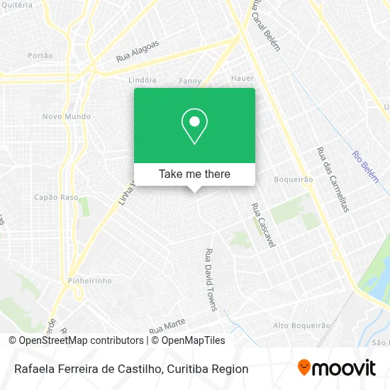
See Rafaela Ferreira de Castilho, Xaxim, on the map
Public Transit to Rafaela Ferreira de Castilho in Xaxim
Wondering how to get to Rafaela Ferreira de Castilho in Xaxim? Moovit helps you find the best way to get to Rafaela Ferreira de Castilho with step-by-step directions from the nearest public transit station.
Moovit provides free maps and live directions to help you navigate through your city. View schedules, routes, timetables, and find out how long does it take to get to Rafaela Ferreira de Castilho in real time.
Looking for the nearest stop or station to Rafaela Ferreira de Castilho? Check out this list of stops closest to your destination: R. Coronel Luiz José Dos Santos; R. Francisco Derosso.
Bus: 526 ITAMARATI / VILA SÃO PEDRO, 629 ALTO BOQUEIRÃO, 519 MAD. SÃO FRANCISCO / IGUAPE, 525 HAUER / CAPÃO RASO.
Want to see if there’s another route that gets you there at an earlier time? Moovit helps you find alternative routes or times. Get directions from and directions to Rafaela Ferreira de Castilho easily from the Moovit App or Website.
We make riding to Rafaela Ferreira de Castilho easy, which is why over 1.5 million users, including users in Xaxim, trust Moovit as the best app for public transit. You don’t need to download an individual bus app or train app, Moovit is your all-in-one transit app that helps you find the best bus time or train time available.
For information on prices of bus, costs and ride fares to Rafaela Ferreira de Castilho, please check the Moovit app.
Use the app to navigate to popular places including to the airport, hospital, stadium, grocery store, mall, coffee shop, school, college, and university.
Rafaela Ferreira de Castilho Address: Rua Francisco Derosso, 1576 Xaxim Curitiba-PR 81710-000 street in Xaxim
- Abaete Consertos de Maquinas de Lavar,
- Fb da Silva Refrigeração,
- Urso Solucoes,
- Salão Ramos,
- Vitoria Flores,
- Auto Peças Canteli,
- Farmacia Preco Popular,
- Bicar,
- Auto Elétrica Maia,
- Sinal Verde Auto Escola,
- Pulgas Tunning,
- Ramos Cabeleireiros,
- Escapamentos Paini,
- Sleep Bom Colchões,
- Construforte Comercio e Construcao,
- Antunes Ferramentas,
- Espetinhos Mr. Boss,
- Madereira Eucaliptus,
- ACN materiais de construção,
- Mega Piscinas
Places Near Rafaela Ferreira de Castilho (Xaxim)
- Hospital de Clínicas (HC - UFPR), Centro,
- Hospital Madalena Sofia, Bairro Alto,
- Hospital Nossa Senhora Das Graças, Mercês,
- Parque Barigui, Mercês,
- Hospital do Rocio, Campo,
- Shopping Estação, Rebouças,
- Jardim Botânico de Curitiba PR, Centro,
- Hospital Erasto Gaertner, Jardim Das Américas,
- Hospital Da Cruz Vermelha, Batel,
- Campo Largo, Campo,
- Hhhhh, Fazendinha,
- Hospital Angelina Caron, Campina Grande Do Sul,
- Arena Da Baixada - Curitiba,
- Jockey Plaza Shopping Center, Tarumã,
- Rua Martim Afonso 558, Mercês,
- Park Shopping Barigüi, Mossunguê,
- Pontifícia Universidade Católica do Paraná (PUCPR), Prado Velho,
- Rua General Mário Tourinho, Campina Do Siqueira,
- Shopping Palladium, Portão,
- Hospital Universitário Evangélico de Curitiba, Bigorrilho
How to get to popular places in Curitiba Region with public transit
Get around Xaxim by public transit!
Traveling around Xaxim has never been so easy. See step by step directions as you travel to any attraction, street or major public transit station. View bus and train schedules, arrival times, service alerts and detailed routes on a map, so you know exactly how to get to anywhere in Xaxim.
When traveling to any destination around Xaxim use Moovit's Live Directions with Get Off Notifications to know exactly where and how far to walk, how long to wait for your line, and how many stops are left. Moovit will alert you when it's time to get off — no need to constantly re-check whether yours is the next stop.
Wondering how to use public transit in Xaxim or how to pay for public transit in Xaxim? Moovit public transit app can help you navigate your way with public transit easily, and at minimum cost. It includes public transit fees, ticket prices, and costs. Looking for a map of Xaxim public transit lines? Moovit public transit app shows all public transit maps in Xaxim with all Bus and Cable Car routes and stops on an interactive map.
Curitiba Region has 2 transit type(s), including: Bus and Cable Car, operated by several transit agencies, including Sistema Integrado de Mobilidade (URBS), Sistema Integrado de Mobilidade (AMEP), URBS (Cartões bancários e Dinheiro), URBS (Cartões bancários / Cartão URBS), AMEP (Cartões bancários / Cartão MetroCard), AMEP (Cartões bancários / Cartão MetroCard / Dinheiro), Viação Colombo (Dinheiro), TRIAR (Cartão TRIAR / Dinheiro), Empresa Curitiba Cerro Azul (Dinheiro), Expresso Nossa Senhora da Penha (Dinheiro), Empresa Campo Alto Tijucas (Dinheiro), Auto Viação São José (Cartão VEM / Dinheiro), BRT S/A (Cartão VEM / Dinheiro), TransPiedade (Cartão Cidadão / Dinheiro) and Oceânica Sul (Cartão Transporte / Dinheiro)