Directions to Rafaella Aniceto Doces Artesanais (Olinda) with public transportation
The following transit lines have routes that pass near Rafaella Aniceto Doces Artesanais
How to get to Rafaella Aniceto Doces Artesanais by bus?
Click on the bus route to see step by step directions with maps, line arrival times and updated time schedules.
From Rua do Progresso, Boa Vista
44 minFrom Vasco/ Boleiro (Complementar), Parnamirim
53 minFrom Rua Barao de Sao Borja, Boa Vista
45 minFrom Graças, Graças
49 minFrom Paratibe, Paulista
52 minFrom rua silva ramos, Boa Vista
38 minFrom Rua Dom Bosco, Boa Vista
40 minFrom Rua das Pernambucanas, Graças
44 minFrom Av. Lindolfo Collor, Paulista
48 minFrom Sede Torcida Jovem do Sport, Boa Vista
38 min
Bus stops near Rafaella Aniceto Doces Artesanais in Olinda
Bus lines to Rafaella Aniceto Doces Artesanais in Olinda
- 1907 PAULISTA / RIO DOCE, Via Nobre E Bultrins,VIEW
- 1940 TI PE-15 (CIRCULAR), Ti Pe-15 (Circular),VIEW
- 1974 JARDIM ATLÂNTICO, Jardim Atlântico,VIEW
- 1982 CONJUNTO BEIRA MAR / DERBY, Conjunto Beira Mar / Derby,VIEW
- 1987 TI RIO DOCE (PRÍNCIPE / CONDE DA BOA VISTA), TI Rio Doce (Príncipe / Conde da Boa Vista),VIEW
- 882 TI XAMBÁ / RIO DOCE (CARLOS DE LIMA CAVALCANTI), Via Bultrins,VIEW
- 1950 ENGENHO MARANGUAPE / VARADOURO, Engenho Maranguape / Varadouro,VIEW
- 1973 CASA CAIADA (CONDE DA BOA VISTA), Casa Caiada (Conde da Boa Vista),VIEW
- 1981 TI RIO DOCE / TI JOANA BEZERRA, Via Rua da Amora (Sentido Rio Doce),VIEW
- 1983 TI RIO DOCE (PRINCESA ISABEL), Via Rua Amora (Sentido Rio Doce),VIEW
- 1985 RIO DOCE (BACURAU), Rio Doce (Bacurau),VIEW
- 1986 TI PE-15 / TI RIO DOCE, TI PE-15 / TI Rio Doce,VIEW
- 1992 PAU AMARELO, Pau Amarelo,VIEW
- 1993 CONJUNTO PRAIA DO JANGA, Conjunto Praia Do Janga,VIEW
- 1994 CONJUNTO BEIRA MAR, Via Cais De Santa Rita,VIEW
- 1995 PAU AMARELO (BACURAU), Pau Amarelo (Bacurau),VIEW
- 2920 TI RIO DOCE / TI CDU, Via Rua Da Amora Na Volta,VIEW
- 2930 TI RIO DOCE / DOIS IRMÃOS, Ti Rio Doce / Dois Irmãos,VIEW
- 881 TI XAMBÁ / RIO DOCE (AV. GETÚLIO VARGAS), Via Atacadão,VIEW
- 884 JARDIM BRASIL / RIO DOCE, Jardim Brasil / Rio Doce,VIEW
What are the closest stations to Rafaella Aniceto Doces Artesanais?
The closest stations to Rafaella Aniceto Doces Artesanais are:
- Av. Carlos De Lima Cavalcanti, 267 | Auto Center 2000 is 161 meters away, 3 min walk.
- Avenida Doutor José Augusto Moreira 160058 is 188 meters away, 3 min walk.
Which bus lines stop near Rafaella Aniceto Doces Artesanais?
These bus lines stop near Rafaella Aniceto Doces Artesanais: 1907 PAULISTA / RIO DOCE, 1940 TI PE-15 (CIRCULAR), 1973 CASA CAIADA (CONDE DA BOA VISTA), 1974 JARDIM ATLÂNTICO, 1981 TI RIO DOCE / TI JOANA BEZERRA, 1987 TI RIO DOCE (PRÍNCIPE / CONDE DA BOA VISTA).
What’s the nearest bus station to Rafaella Aniceto Doces Artesanais in Olinda?
The nearest bus stations to Rafaella Aniceto Doces Artesanais in Olinda are Av. Carlos De Lima Cavalcanti, 267 | Auto Center 2000 and Avenida Doutor José Augusto Moreira 160058. The closest one is a 3 min walk away.
What time is the first bus to Rafaella Aniceto Doces Artesanais in Olinda?
The 1995 PAU AMARELO (BACURAU) is the first bus that goes to Rafaella Aniceto Doces Artesanais in Olinda. It stops nearby at 3:24 AM.
What time is the last bus to Rafaella Aniceto Doces Artesanais in Olinda?
The 1995 PAU AMARELO (BACURAU) is the last bus that goes to Rafaella Aniceto Doces Artesanais in Olinda. It stops nearby at 3:50 AM.
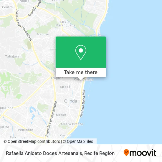
See Rafaella Aniceto Doces Artesanais, Olinda, on the map
Public Transit to Rafaella Aniceto Doces Artesanais in Olinda
Wondering how to get to Rafaella Aniceto Doces Artesanais in Olinda? Moovit helps you find the best way to get to Rafaella Aniceto Doces Artesanais with step-by-step directions from the nearest public transit station.
Moovit provides free maps and live directions to help you navigate through your city. View schedules, routes, timetables, and find out how long does it take to get to Rafaella Aniceto Doces Artesanais in real time.
Looking for the nearest stop or station to Rafaella Aniceto Doces Artesanais? Check out this list of stops closest to your destination: Av. Carlos De Lima Cavalcanti; Avenida Doutor José Augusto Moreira 160058.
Bus: 1907 PAULISTA / RIO DOCE, 1940 TI PE-15 (CIRCULAR), 1973 CASA CAIADA (CONDE DA BOA VISTA), 1974 JARDIM ATLÂNTICO, 1981 TI RIO DOCE / TI JOANA BEZERRA, 1987 TI RIO DOCE (PRÍNCIPE / CONDE DA BOA VISTA), 1982 CONJUNTO BEIRA MAR / DERBY, 1950 ENGENHO MARANGUAPE / VARADOURO, 1983 TI RIO DOCE (PRINCESA ISABEL), 1985 RIO DOCE (BACURAU).
Want to see if there’s another route that gets you there at an earlier time? Moovit helps you find alternative routes or times. Get directions from and directions to Rafaella Aniceto Doces Artesanais easily from the Moovit App or Website.
We make riding to Rafaella Aniceto Doces Artesanais easy, which is why over 1.5 million users, including users in Olinda, trust Moovit as the best app for public transit. You don’t need to download an individual bus app or train app, Moovit is your all-in-one transit app that helps you find the best bus time or train time available.
For information on prices of bus, costs and ride fares to Rafaella Aniceto Doces Artesanais, please check the Moovit app.
Use the app to navigate to popular places including to the airport, hospital, stadium, grocery store, mall, coffee shop, school, college, and university.
Rafaella Aniceto Doces Artesanais Address: Rua Alcina Coelho de Carvalho, 107 Casa Caiada Olinda-PE 53130-400 street in Olinda
- M. A. B. Junior Construtora,
- Climepe,
- Avenida Governador Carlos de Lima Cavalcante 2253,
- Pet Shop Agrofish,
- Empório dos Doces,
- Bem Estar Espaco de Massoterapia,
- Rua Professor Alfeu Rabêlo 169,
- Amais PE - Olinda,
- parada 160025,
- Cia Do Sorriso,
- Nova Pan Delicatessen,
- Clinica Hapvida Olinda,
- Avenida Doutor José Augusto Moreira,
- Sherlock & Dog,
- Galeria HCM,
- Colégio DOM,
- Clinica Dr Frederico Ramalho,
- Colégio Luíza Cora unid. 1,
- Avenida Ministro Marcos Freire 2855,
- Centro Sorriso
Places Near Rafaella Aniceto Doces Artesanais (Olinda)
- Marco Zero, Bairro Do Recife,
- Shopping Recife, Boa Viagem,
- Hospital Maria Lucinda, Parnamirim,
- SHOPPING TACARUNA, Santo Amaro,
- Hospital Universitário Oswaldo Cruz, Santo Amaro,
- Centro de Convenções de Pernambuco, Olinda,
- Imip (Instituto Materno-Infantil De Pernambuco), Coelhos,
- hospital otavio de freitas - UTI, Tejipió,
- Hospital Agamenon Magalhães, Tamarineira,
- Parque da Jaqueira, Jaqueira,
- Shopping Patteo Olinda, Olinda,
- Arena de Pernambuco, São Lourenço Da Mata,
- Hospital Eduardo Campus Da Pessoa Idosa, Areias,
- Shopping RioMar Recife, Pina,
- Imbiribeira, Imbiribeira,
- Hospital Geral De Areias, Areias,
- llll, Fundão,
- Hospital Altino Ventura, Iputinga,
- SHOPPING GUARARAPES, Jaboatão Dos Guararapes,
- tuuuuu, Olinda
How to get to popular places in Recife Region with public transit
Get around Olinda by public transit!
Traveling around Olinda has never been so easy. See step by step directions as you travel to any attraction, street or major public transit station. View bus and train schedules, arrival times, service alerts and detailed routes on a map, so you know exactly how to get to anywhere in Olinda.
When traveling to any destination around Olinda use Moovit's Live Directions with Get Off Notifications to know exactly where and how far to walk, how long to wait for your line, and how many stops are left. Moovit will alert you when it's time to get off — no need to constantly re-check whether yours is the next stop.
Wondering how to use public transit in Olinda or how to pay for public transit in Olinda? Moovit public transit app can help you navigate your way with public transit easily, and at minimum cost. It includes public transit fees, ticket prices, and costs. Looking for a map of Olinda public transit lines? Moovit public transit app shows all public transit maps in Olinda with all Bus, Train, Subway and Ferry routes and stops on an interactive map.
Recife Region has 4 transit type(s), including: Bus, Train, Subway and Ferry, operated by several transit agencies, including CBTU (Metrorec), BRT (Via Livre), Grande Recife, BORBOREMA IMPERIAL (TIP), BORBOREMA IMPERIAL (B.V), RODOVIÁRIA POTENGY, EMPRESA METROPOLITANA, CONSÓRCIO RECIFE, SÃO JUDAS TADEU, Expresso 1002, Rodotur Turismo, Complementar Recife, Sistema Municipal - Jaboatão, Sistema Municipal - Cabo and Sistema Municipal - Ipojuca
Public transit lines with stations closest to Rafaella Aniceto Doces Artesanais in Olinda
Bus lines with stations closest to Rafaella Aniceto Doces Artesanais in Olinda
Avenida Doutor José Augusto Moreira 160058
 1950 ENGENHO MARANGUAPE / VARADOUROEngenho Maranguape / Varadouro
- 1973 CASA CAIADA (CONDE DA BOA VISTA)Casa Caiada (Conde da Boa Vista)
- 1981 TI RIO DOCE / TI JOANA BEZERRATI Rio Doce / TI Joana Bezerra
- 1983 TI RIO DOCE (PRINCESA ISABEL)TI Rio Doce (Princesa Isabel)
- 1985 RIO DOCE (BACURAU)Rio Doce (Bacurau)