How to get to Raft by bus?
Click on the bus route to see step by step directions with maps, line arrival times and updated time schedules.
From Renaissance Golf & Country Club, Cape Coral
75 minFrom Jimenez Used Appliances, Cape Coral
85 minFrom Crossroads Shopping Center, Fort Myers
86 minFrom High Point II, Fort Myers
55 minFrom Executive Home Care of Fort Myers, San Carlos Park
100 minFrom Jacks Place, Fort Myers
83 minFrom Credit Union 1, Cape Coral
82 minFrom Mavis Discount Tire, Cape Coral
79 min
Bus stop near Raft in Lee County
- Metro Pkwy @ Arc Way-Sb, 2 min walk,VIEW
Bus lines to Raft in Lee County
- 80, Edison Mall Transfer Ctr,VIEW
What are the closest stations to Raft?
The closest stations to Raft are:
- Metro Pkwy @ Arc Way-Sb is 89 yards away, 2 min walk.
Which bus lines stop near Raft?
These bus lines stop near Raft: 30, 80.
What’s the nearest bus station to Raft in Lee County?
The nearest bus station to Raft in Lee County is Metro Pkwy @ Arc Way-Sb. It’s a 2 min walk away.
What time is the first bus to Raft in Lee County?
The 80 is the first bus that goes to Raft in Lee County. It stops nearby at 6:59 AM.
What time is the last bus to Raft in Lee County?
The 80 is the last bus that goes to Raft in Lee County. It stops nearby at 7:15 PM.
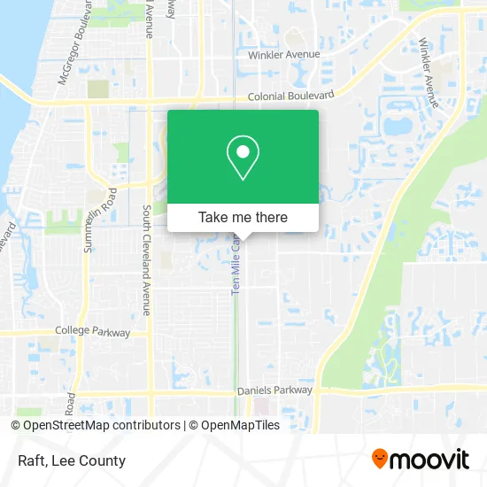
See Raft, Lee County, on the map
Public Transit to Raft in Lee County
Wondering how to get to Raft in Lee County? Moovit helps you find the best way to get to Raft with step-by-step directions from the nearest public transit station.
Moovit provides free maps and live directions to help you navigate through your city. View schedules, routes, timetables, and find out how long does it take to get to Raft in real time.
Looking for the nearest stop or station to Raft? Check out this list of stops closest to your destination: Metro Pkwy @ Arc Way-Sb.
Bus: 30, 80.
Want to see if there’s another route that gets you there at an earlier time? Moovit helps you find alternative routes or times. Get directions from and directions to Raft easily from the Moovit App or Website.
We make riding to Raft easy, which is why over 1.5 million users, including users in Lee County, trust Moovit as the best app for public transit. You don’t need to download an individual bus app or train app, Moovit is your all-in-one transit app that helps you find the best bus time or train time available.
For information on prices of bus, costs and ride fares to Raft, please check the Moovit app.
Use the app to navigate to popular places including to the airport, hospital, stadium, grocery store, mall, coffee shop, school, college, and university.
Raft Address: 11770 Metro Pkwy Fort Myers, FL 33966 street in Lee County
- Blacken Blues Barbecue with A Bakers Mission,
- Yo Samara's,
- The Brunchy Bunch,
- Lovely Grazing Boards,
- Charros Bros on Wheels,
- Pollo Encantado,
- Chill N Lux,
- Firebread,
- Oceano Tacos,
- Crunchxmunch,
- Tee's Taste of Chicago,
- Wicked Streatery,
- JJ's Cafeteria,
- Special Ops,
- Sues Crepes,
- Viet Yum,
- Pizza Noli,
- Seaking Ice Cream,
- Potbellys Eatery,
- Thai Delights
Places Near Raft (Lee County)
- Bonita Springs, FL, Bonita Springs,
- Amazon Warehouse Rsw5,
- Miromar Outlets, Estero,
- Edison Mall, Fort Myers,
- U.S.-41 / Colonial Blvd. Intersection, Fort Myers,
- Flixbus, Fort Myers,
- Pelican Landing Beach Shuttle, Bonita Springs,
- Matlacha Nude Beach, Matlacha Isles-Matlacha Shores,
- Walmart Supercenter, Fort Myers,
- Bonita Beach, Bonita Springs,
- I-75 & Colonial (Exit 136), Fort Myers,
- Bonita Bay Private Beach Club, Bonita Springs,
- Lee County Tax Collector, Cape Coral,
- Ft Myers Airport RSW,
- Rosa Parks Transportation Center, Fort Myers,
- All About U Naples Escorts, Pine Ridge,
- US-41, Fort Myers,
- I-75 & MLK (Exit 138), Fort Myers,
- Seminole Casino Hotel Immokalee,
- Lehigh Acres, FL, Lehigh Acres
How to get to popular places in Lee County with public transit
Get around Lee County by public transit!
Traveling around Lee County has never been so easy. See step by step directions as you travel to any attraction, street or major public transit station. View bus and train schedules, arrival times, service alerts and detailed routes on a map, so you know exactly how to get to anywhere in Lee County.
When traveling to any destination around Lee County use Moovit's Live Directions with Get Off Notifications to know exactly where and how far to walk, how long to wait for your line, and how many stops are left. Moovit will alert you when it's time to get off — no need to constantly re-check whether yours is the next stop.
Wondering how to use public transit in Lee County or how to pay for public transit in Lee County? Moovit public transit app can help you navigate your way with public transit easily, and at minimum cost. It includes public transit fees, ticket prices, and costs. Looking for a map of Lee County public transit lines? Moovit public transit app shows all public transit maps in Lee County with all bus routes and stops on an interactive map.
Lee County has 1 transit type(s), including: bus, operated by several transit agencies, including LeeTran, CAT and FlixBus-us