How to get to Ragged Out Fashion by bus?
Click on the bus route to see step by step directions with maps, line arrival times and updated time schedules.
From Walters Art Museum, Baltimore
38 minFrom Baltimore Arena, Baltimore
45 minFrom I-83 Exit 16 (Timonium Road), Baltimore County
67 minFrom Walmart, Baltimore County
68 minFrom Baltimore Penn Station, Baltimore
47 minFrom Pigtown / Washington Village, Baltimore
43 minFrom I-695 Exit 29 (Loch Raven Blvd (MD 542)/Cromwell Bridge Rd), Baltimore County
57 minFrom Patterson Park, Baltimore
58 minFrom Randallstown, MD, Baltimore County
58 minFrom University Of Maryland Baltimore (Umbc), Baltimore County
74 min
How to get to Ragged Out Fashion by metro?
Click on the metro route to see step by step directions with maps, line arrival times and updated time schedules.
Bus stops near Ragged Out Fashion in Baltimore
Light Rail stations near Ragged Out Fashion in Baltimore
- Mt. Washington, 13 min walk,VIEW
Metro station near Ragged Out Fashion in Baltimore
- West Cold Spring Metro, 20 min walk,VIEW
Bus lines to Ragged Out Fashion in Baltimore
What are the closest stations to Ragged Out Fashion?
The closest stations to Ragged Out Fashion are:
- Belvedere Ave & Pembridge Ave Wb is 329 yards away, 5 min walk.
- Belvedere Ave & Preakness Way Wb Ns is 475 yards away, 6 min walk.
- Park Heights Ave & Garrison Ave Nb is 583 yards away, 7 min walk.
- Lanier Ave & Belvedere Ave is 705 yards away, 9 min walk.
- Mt. Washington is 1093 yards away, 13 min walk.
- West Cold Spring Metro is 1682 yards away, 20 min walk.
Which bus lines stop near Ragged Out Fashion?
These bus lines stop near Ragged Out Fashion: 30, 31, 85, 94.
Which metro line stops near Ragged Out Fashion?
METRO (Towards Owing Mills)
What’s the nearest light rail station to Ragged Out Fashion in Baltimore?
The nearest light rail station to Ragged Out Fashion in Baltimore is Mt. Washington. It’s a 13 min walk away.
What’s the nearest metro station to Ragged Out Fashion in Baltimore?
The nearest metro station to Ragged Out Fashion in Baltimore is West Cold Spring Metro. It’s a 20 min walk away.
What’s the nearest bus station to Ragged Out Fashion in Baltimore?
The nearest bus station to Ragged Out Fashion in Baltimore is Belvedere Ave & Pembridge Ave Wb. It’s a 5 min walk away.
What time is the first light rail to Ragged Out Fashion in Baltimore?
The LIGHT RAILLINK is the first light rail that goes to Ragged Out Fashion in Baltimore. It stops nearby at 4:26 AM.
What time is the last light rail to Ragged Out Fashion in Baltimore?
The LIGHT RAILLINK is the last light rail that goes to Ragged Out Fashion in Baltimore. It stops nearby at 12:47 AM.
What time is the first metro to Ragged Out Fashion in Baltimore?
The METRO is the first metro that goes to Ragged Out Fashion in Baltimore. It stops nearby at 4:56 AM.
What time is the last metro to Ragged Out Fashion in Baltimore?
The METRO is the last metro that goes to Ragged Out Fashion in Baltimore. It stops nearby at 12:19 AM.
What time is the first bus to Ragged Out Fashion in Baltimore?
The 94 is the first bus that goes to Ragged Out Fashion in Baltimore. It stops nearby at 3:39 AM.
What time is the last bus to Ragged Out Fashion in Baltimore?
The 94 is the last bus that goes to Ragged Out Fashion in Baltimore. It stops nearby at 3:04 AM.
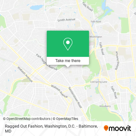
See Ragged Out Fashion, Baltimore, on the map
Public Transit to Ragged Out Fashion in Baltimore
Wondering how to get to Ragged Out Fashion in Baltimore? Moovit helps you find the best way to get to Ragged Out Fashion with step-by-step directions from the nearest public transit station.
Moovit provides free maps and live directions to help you navigate through your city. View schedules, routes, timetables, and find out how long does it take to get to Ragged Out Fashion in real time.
Looking for the nearest stop or station to Ragged Out Fashion? Check out this list of stops closest to your destination: Belvedere Ave & Pembridge Ave Wb; Belvedere Ave & Preakness Way Wb Ns; Park Heights Ave & Garrison Ave Nb; Lanier Ave & Belvedere Ave; Mt. Washington; West Cold Spring Metro.
Bus: 30, 31, 85, 94, 91.Metro: METRO.
Want to see if there’s another route that gets you there at an earlier time? Moovit helps you find alternative routes or times. Get directions from and directions to Ragged Out Fashion easily from the Moovit App or Website.
We make riding to Ragged Out Fashion easy, which is why over 1.5 million users, including users in Baltimore, trust Moovit as the best app for public transit. You don’t need to download an individual bus app or train app, Moovit is your all-in-one transit app that helps you find the best bus time or train time available.
For information on prices of bus, metro and light rail, costs and ride fares to Ragged Out Fashion, please check the Moovit app.
Use the app to navigate to popular places including to the airport, hospital, stadium, grocery store, mall, coffee shop, school, college, and university.
Ragged Out Fashion Address: 2741 Cylburn Ave Baltimore, MD 21215 street in Baltimore
- Belvedere & Park Heights,
- Rent To Retirement,
- Chen Market,
- Moments in Time Daycare,
- CKQ Auto Group,
- Millennium Trucking,
- Auto World Sales,
- Tee's Auto,
- Pimlico Elementary/Middle,
- Center for Hope,
- Palmer Court Apartments,
- Preakness Way Between Northern Parkway & Belvedere Avenue Northbound,
- Serenity Wellness Studio,
- Life Worship Center,
- Rosenbloom Building,
- Levindale,
- True Holiness Pentecostal Church #1,
- 542 Cash,
- Sinai Community Care,
- Sinai Hospital The Hoffberger Building
Places Near Ragged Out Fashion (Baltimore)
- Washington DC VA Medical Center, Washington,
- Amazon Hq2, Arlington County,
- Capital One Arena, Washington,
- Westfield Montgomery Mall, Montgomery County,
- Sibley Memorial Hospital, Washington,
- PG Mall, Prince George's County,
- The Anthem, Washington,
- Camden Yards, Baltimore,
- Basilica of the National Shrine, Washington,
- National Mall, Washington,
- Warner Theatre, Washington,
- M&T Bank Stadium, Baltimore,
- Pennsylvania Ave NW (3rd st and pennsylvania), Washington,
- Rock Creek Tennis Center, Washington,
- Marriott Marquis Washington, DC, Washington,
- Museum Of The Bible, Washington,
- Georgetown, Washington,
- Washington National Cathedral, Washington,
- National Zoo, Washington,
- National Museum of African American History and Culture, Washington
How to get to popular places in Washington, D.C. - Baltimore, MD with public transit
Get around Baltimore by public transit!
Traveling around Baltimore has never been so easy. See step by step directions as you travel to any attraction, street or major public transit station. View bus and train schedules, arrival times, service alerts and detailed routes on a map, so you know exactly how to get to anywhere in Baltimore.
When traveling to any destination around Baltimore use Moovit's Live Directions with Get Off Notifications to know exactly where and how far to walk, how long to wait for your line, and how many stops are left. Moovit will alert you when it's time to get off — no need to constantly re-check whether yours is the next stop.
Wondering how to use public transit in Baltimore or how to pay for public transit in Baltimore? Moovit public transit app can help you navigate your way with public transit easily, and at minimum cost. It includes public transit fees, ticket prices, and costs. Looking for a map of Baltimore public transit lines? Moovit public transit app shows all public transit maps in Baltimore with all Bus, Train, Metro, Light Rail and Ferry routes and stops on an interactive map.
Washington, D.C. - Baltimore, MD has 5 transit type(s), including: Bus, Train, Metro, Light Rail and Ferry, operated by several transit agencies, including WMATA, Montgomery County Ride On, Fairfax Connector, TheBus, PRTC, DASH - Alexandria, Arlington Transit (ART), RTA of Central Maryland, MDOT MTA, MDOT MTA Light RailLink, MDOT MTA Commuter Bus, MDOT MTA Local Bus, FXBGO!, Virginia Railway Express (VRE) and MARC