How to get to Rahul Medical & General Store by bus?
Click on the bus route to see step by step directions with maps, line arrival times and updated time schedules.
From The Westin Pune Koregaon Park, Pune & Velhe
67 minFrom Amazon-PNQJ, Pune & Velhe
73 minFrom M G Road, Pune & Velhe
42 minFrom Sasane nagar, Pune & Velhe
63 minFrom Dyaneshwar Paduka Chowk, Pune & Velhe
47 minFrom Karve Nagar, Pune & Velhe
52 minFrom Hadapsar Railway Station, Pune & Velhe
72 minFrom Bhusari Colony, Paud
57 minFrom PSK, pune, Pune & Velhe
72 minFrom Kayani Bakery, Pune & Velhe
45 min
Metro station near Rahul Medical & General Store in Pune & Velhe
- Swargate, 6 min walk,VIEW
Bus stops near Rahul Medical & General Store in Pune & Velhe
Bus lines to Rahul Medical & General Store in Pune & Velhe
- METRO SHUTTLE 13A, Lake Town Society,VIEW
- 12, Lokshahir Hon.Annabhau Sathe Bus Stand Upper Depot - Shivajinagar,VIEW
- 13, Lokshahir Hon.Annabhau Sathe Bus Stand Upper Depot - Shivajinagar,VIEW
- 41, Lokshahir Hon.Annabhau Sathe Bus Stand Upper Depot - Sangvi Gaon,VIEW
- 68, Lokshahir Hon.Annabhau Sathe Bus Stand Upper Depot - Sutardara,VIEW
- 71, Kothrud Depot ⟲ Kothrud Depot Via Sukhsagar Nagar (Circular),VIEW
- 72, Sukhsagarnagar - NDA Gate No.10,VIEW
- 140, Lokshahir Hon.Annabhau Sathe Bus Stand Upper Depot - Pune Station,VIEW
- 172, Yewalewadi - Pune Station,VIEW
- 72A, Sukhsagarnagar - Ganpati Matha,VIEW
- 13B, Lokshahir Hon.Annabhau Sathe Bus Stand Upper Depot - Khadki Railway Station,VIEW
- 140B, Lokshahir Hon.Annabhau Sathe Bus Stand Upper Depot - Sangamwadi Phata,VIEW
- 13M, Lokshahir Hon.Annabhau Sathe Bus Stand Upper Depot - Shivajinagar (Ladies Sp),VIEW
- METRO SHUTTLE 13, Lokshahir Hon.Annabhau Sathe Bus Stand Upper Depot - Swargate,VIEW
- AP2, Lokshahir Hon.Annabhau Sathe Bus Stand Upper Depot,VIEW
- 297, Shivajinagar,VIEW
What are the closest stations to Rahul Medical & General Store?
The closest stations to Rahul Medical & General Store are:
- Swargate is 465 meters away, 6 min walk.
- Lake Town Society is 479 meters away, 7 min walk.
- Upper Indira Nagar is 492 meters away, 7 min walk.
- Sukhasagar Nagar is 589 meters away, 8 min walk.
- Rajas Society is 635 meters away, 9 min walk.
Which bus lines stop near Rahul Medical & General Store?
These bus lines stop near Rahul Medical & General Store: 13, 140, 71, AP2.
What’s the nearest metro station to Rahul Medical & General Store in Pune & Velhe?
The nearest metro station to Rahul Medical & General Store in Pune & Velhe is Swargate. It’s a 6 min walk away.
What’s the nearest bus station to Rahul Medical & General Store in Pune & Velhe?
The nearest bus stations to Rahul Medical & General Store in Pune & Velhe are Lake Town Society and Upper Indira Nagar. The closest one is a 7 min walk away.
What time is the first metro to Rahul Medical & General Store in Pune & Velhe?
The PURPLE is the first metro that goes to Rahul Medical & General Store in Pune & Velhe. It stops nearby at 6:00 AM.
What time is the last metro to Rahul Medical & General Store in Pune & Velhe?
The PURPLE is the last metro that goes to Rahul Medical & General Store in Pune & Velhe. It stops nearby at 11:33 PM.
What time is the first bus to Rahul Medical & General Store in Pune & Velhe?
The 12 is the first bus that goes to Rahul Medical & General Store in Pune & Velhe. It stops nearby at 5:07 AM.
What time is the last bus to Rahul Medical & General Store in Pune & Velhe?
The 13 is the last bus that goes to Rahul Medical & General Store in Pune & Velhe. It stops nearby at 12:18 AM.
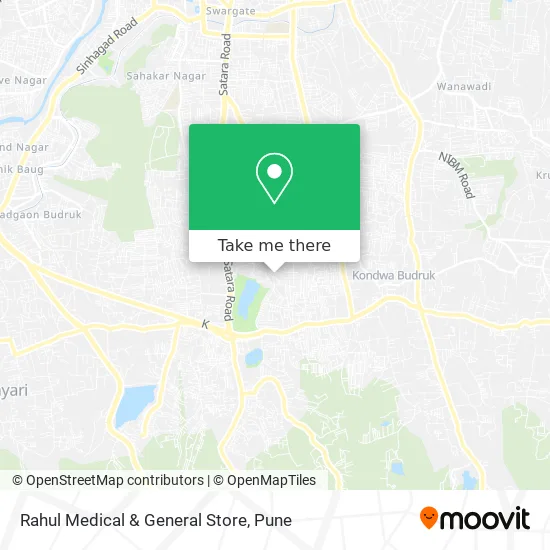
See Rahul Medical & General Store, Pune & Velhe, on the map
Public Transit to Rahul Medical & General Store in Pune & Velhe
Wondering how to get to Rahul Medical & General Store in Pune & Velhe? Moovit helps you find the best way to get to Rahul Medical & General Store with step-by-step directions from the nearest public transit station.
Moovit provides free maps and live directions to help you navigate through your city. View schedules, routes, timetables, and find out how long does it take to get to Rahul Medical & General Store in real time.
Looking for the nearest stop or station to Rahul Medical & General Store? Check out this list of stops closest to your destination: Swargate; Lake Town Society; Upper Indira Nagar; Sukhasagar Nagar; Rajas Society.
Bus: 13, 140, 71, AP2, METRO SHUTTLE 13A, 12, 41, 68, 297.Metro: PURPLE.
Want to see if there’s another route that gets you there at an earlier time? Moovit helps you find alternative routes or times. Get directions from and directions to Rahul Medical & General Store easily from the Moovit App or Website.
We make riding to Rahul Medical & General Store easy, which is why over 1.5 million users, including users in Pune & Velhe, trust Moovit as the best app for public transit. You don’t need to download an individual bus app or train app, Moovit is your all-in-one transit app that helps you find the best bus time or train time available.
For information on prices of bus and train, costs and ride fares to Rahul Medical & General Store, please check the Moovit app.
Use the app to navigate to popular places including to the airport, hospital, stadium, grocery store, mall, coffee shop, school, college, and university.
Rahul Medical & General Store Address: पुणे 411046 MH street in Pune & Velhe
- Dnyaneshwari Mahila Nagari Sahakari Patsanstha Maryadit,
- Sukhsagar Nagar Galli No-9,
- Lake Town,
- Lake Town Society,
- Chocolate Biclate,
- Dr. Niranjan Prashad Dental Clinic,
- Seema sagar society, sukhsagar nagar,
- Ganga Osian Park,
- Om Apartment,
- Bharati Vidyapeeth Deemed University COE,
- Padma Kunj,
- Dattaprasad Nagari Sahakari Patsanstha-Bibwewadi,
- Vasant More Hospital,
- Late V. V. Pasalkar Chowk,
- Indira Nagar Upper Galli No-4,
- Munja Temple,
- Aarohi Art & Events,
- VIT instru dept,
- Grand Buffet,
- Mangal Chappal Mart
Places Near Rahul Medical & General Store (Pune & Velhe)
- Laxmi Road, Pune & Velhe,
- ISKCON Nvcc Temple, Pune & Velhe,
- BAPS Shri Swaminarayan Mandir, Pune & Velhe,
- Cognizant Deccan Campus (CDC), Paud,
- Westend Mall, Pune & Velhe,
- Dagdusheth Halwai Ganpati Mandir, Pune & Velhe,
- Dagadusheth Halwai Ganapati Temple, Pune & Velhe,
- Pune Okayama Friendship Garden, Pune & Velhe,
- Fc Road, Pune & Velhe,
- Chaturshringi Temple, Pune & Velhe,
- Senapati Bapat Road, Pune & Velhe,
- Tulshibaug, Pune & Velhe,
- Pvr Icon - Pavilion Mall, Pune & Velhe,
- Ion Digital Zone, Pune & Velhe,
- Symbiosis Lavale Bus Stop, Pune & Velhe,
- ISKCON Pune, Pune & Velhe,
- Swaminarayan Mandir, Pune & Velhe,
- M G Road, Pune & Velhe,
- Vishwakarma Institute Of Technology (Vit), Pune & Velhe,
- Sarasbaug, Pune & Velhe
How to get to popular places in Pune with public transit
Get around Pune & Velhe by public transit!
Traveling around Pune & Velhe has never been so easy. See step by step directions as you travel to any attraction, street or major public transit station. View bus and train schedules, arrival times, service alerts and detailed routes on a map, so you know exactly how to get to anywhere in Pune & Velhe.
When traveling to any destination around Pune & Velhe use Moovit's Live Directions with Get Off Notifications to know exactly where and how far to walk, how long to wait for your line, and how many stops are left. Moovit will alert you when it's time to get off — no need to constantly re-check whether yours is the next stop.
Wondering how to use public transit in Pune & Velhe or how to pay for public transit in Pune & Velhe? Moovit public transit app can help you navigate your way with public transit easily, and at minimum cost. It includes public transit fees, ticket prices, and costs. Looking for a map of Pune & Velhe public transit lines? Moovit public transit app shows all public transit maps in Pune & Velhe with all Bus, Train and Metro routes and stops on an interactive map.
Pune has 3 transit type(s), including: Bus, Train and Metro, operated by several transit agencies, including Pune Metro (Maha Metro), PMPML, PMPML Night Bus Service (Ratrani) and Central Railways (Indian Railways)
Public transit lines with stations closest to Rahul Medical & General Store in Pune & Velhe
Metro lines with stations closest to Rahul Medical & General Store in Pune & Velhe
Bus lines with stations closest to Rahul Medical & General Store in Pune & Velhe
Upper Indira Nagar
 12Lokshahir Hon.Annabhau Sathe Bus Stand Upper Depot - Shivajinagar
- 13Lokshahir Hon.Annabhau Sathe Bus Stand Upper Depot - Shivajinagar
- 41Lokshahir Hon.Annabhau Sathe Bus Stand Upper Depot - Sangvi Gaon
- 68Lokshahir Hon.Annabhau Sathe Bus Stand Upper Depot - Sutardara
- 71Kothrud Depot ⟲ Kothrud Depot Via Sukhsagar Nagar (Circular)