How to get to Rai Niwas by bus?
Click on the bus route to see step by step directions with maps, line arrival times and updated time schedules.
From PYC Hindu Gymkhana, Pune & Velhe
43 minFrom Symbiosis University Hospital & Research Centre, Paud
102 minFrom Symbiosis Institute for Distance Learning, Pune & Velhe
51 minFrom Deccan Gymkhana, Pune & Velhe
40 minFrom Baner Pashan Link road, Pune & Velhe
83 minFrom Tulshibaug Ganpati Mandir, Pune & Velhe
55 minFrom Matrix School of Management Studies, Pune & Velhe
66 minFrom MIT Junior College, Paud
65 minFrom Lupin Ltd Research Park, Paud
104 minFrom ICC Tech Tower, Pune & Velhe
49 min
Bus stops near Rai Niwas in Pune & Velhe
Bus lines to Rai Niwas in Pune & Velhe
- 64, Bhekrainagar Depot - NDA Gate No.10,VIEW
- 66, Thakarwadi - Marketyard,VIEW
- 72, Sukhsagarnagar - NDA Gate No.10,VIEW
- 78, Marketyard - NDA Gate No.10,VIEW
- 82, NDA Gate No.10 ⟲ NDA Gate No.10 Via Ma.Na.Pa Bhavan (Circular),VIEW
- 83, NDA Gate No.10 - Alandi ST Stand,VIEW
- 84, Deccan Gymkhana - Mutha Gaon,VIEW
- 85, Khadewadi Ahiregaon - Ma.Na.Pa Bhavan,VIEW
- 96, Swargate - Jambhali Nilkantheshwar Mandir Paytha,VIEW
- 144, NDA Gate No.10 - Pune Station,VIEW
- 174, Pune Station - NDA Gate No.10,VIEW
- 50A, Deccan Gymkhana - Sinhgad Paytha,VIEW
- 66A, Thakarwadi - Deccan Gymkhana,VIEW
- 84A, Deccan Gymkhana - Sangrun,VIEW
- 85A, Kothrud Stand - Khadewadi Ahiregaon,VIEW
- 276A, Chinchwad SKF Company - NDA Gate No.10,VIEW
- 84AC, Sangrun To Kothrud Stand,VIEW
- 82B, Kothrud Stand - NDA Gate No.10,VIEW
- 84B, Mutha Gaon To Kothrud Stand,VIEW
- 144B, Kothrud Stand - NDA Gate No.10,VIEW
What are the closest stations to Rai Niwas?
The closest stations to Rai Niwas are:
- Ahire Gate / More Colony is 681 meters away, 9 min walk.
- Ingvale Wasti Nanded City is 3090 meters away, 40 min walk.
Which bus lines stop near Rai Niwas?
These bus lines stop near Rai Niwas: 174, 276A, 50A, 64.
What’s the nearest bus station to Rai Niwas in Pune & Velhe?
The nearest bus station to Rai Niwas in Pune & Velhe is Ahire Gate / More Colony. It’s a 9 min walk away.
What time is the first bus to Rai Niwas in Pune & Velhe?
The RATRANI 7 is the first bus that goes to Rai Niwas in Pune & Velhe. It stops nearby at 4:44 AM.
What time is the last bus to Rai Niwas in Pune & Velhe?
The RATRANI 7 is the last bus that goes to Rai Niwas in Pune & Velhe. It stops nearby at 1:56 AM.
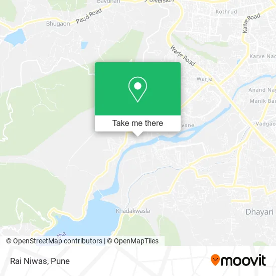
See Rai Niwas, Pune & Velhe, on the map
Public Transit to Rai Niwas in Pune & Velhe
Wondering how to get to Rai Niwas in Pune & Velhe? Moovit helps you find the best way to get to Rai Niwas with step-by-step directions from the nearest public transit station.
Moovit provides free maps and live directions to help you navigate through your city. View schedules, routes, timetables, and find out how long does it take to get to Rai Niwas in real time.
Looking for the nearest stop or station to Rai Niwas? Check out this list of stops closest to your destination: Ahire Gate / More Colony; Ingvale Wasti Nanded City.
Bus: 174, 276A, 50A, 64, 66, 72, 78, 82, 276C, 118C.
Want to see if there’s another route that gets you there at an earlier time? Moovit helps you find alternative routes or times. Get directions from and directions to Rai Niwas easily from the Moovit App or Website.
We make riding to Rai Niwas easy, which is why over 1.5 million users, including users in Pune & Velhe, trust Moovit as the best app for public transit. You don’t need to download an individual bus app or train app, Moovit is your all-in-one transit app that helps you find the best bus time or train time available.
For information on prices of bus, costs and ride fares to Rai Niwas, please check the Moovit app.
Use the app to navigate to popular places including to the airport, hospital, stadium, grocery store, mall, coffee shop, school, college, and university.
Rai Niwas Address: पुणे 411023 MH street in Pune & Velhe
- Matoshree Apartment,
- Shivtej Building,
- Aai Nursing Bureau and Old Age Home,
- Sajan Siddhi,
- Sai Nilayam,
- Ayushya Path Lab,
- Balaji Cash Garage,
- Aayasha Store,
- Meenvarha Hospital,
- Aarohi Chinese Point,
- Durvesh Enterprises,
- Dr. Ketan Dental Clinic,
- Novel Sheevan Yantra-Vedant Home Care,
- Swad Hotel & Chinese,
- Deshmukh Wadi Laxmi Garden,
- Good Luck Shop,
- Samarth Pav Bhaji Stall,
- Nikhara Biryani,
- Bhairawnath Decoration,
- Jai Shri Trading Company
Places Near Rai Niwas (Pune & Velhe)
- Symbiosis Lavale Bus Stop, Pune & Velhe,
- Senapati Bapat Road, Pune & Velhe,
- Dagadusheth Halwai Ganapati Temple, Pune & Velhe,
- Chaturshringi Temple, Pune & Velhe,
- ISKCON Pune, Pune & Velhe,
- Laxmi Road, Pune & Velhe,
- Vishwakarma Institute Of Technology (Vit), Pune & Velhe,
- Swaminarayan Mandir, Pune & Velhe,
- ISKCON Nvcc Temple, Pune & Velhe,
- Pune Okayama Friendship Garden, Pune & Velhe,
- Ion Digital Zone, Pune & Velhe,
- Pvr Icon - Pavilion Mall, Pune & Velhe,
- Dagdusheth Halwai Ganpati Mandir, Pune & Velhe,
- Sarasbaug, Pune & Velhe,
- M G Road, Pune & Velhe,
- Cognizant Deccan Campus (CDC), Paud,
- BAPS Shri Swaminarayan Mandir, Pune & Velhe,
- Westend Mall, Pune & Velhe,
- Tulshibaug, Pune & Velhe,
- Fc Road, Pune & Velhe
How to get to popular places in Pune with public transit
Get around Pune & Velhe by public transit!
Traveling around Pune & Velhe has never been so easy. See step by step directions as you travel to any attraction, street or major public transit station. View bus and train schedules, arrival times, service alerts and detailed routes on a map, so you know exactly how to get to anywhere in Pune & Velhe.
When traveling to any destination around Pune & Velhe use Moovit's Live Directions with Get Off Notifications to know exactly where and how far to walk, how long to wait for your line, and how many stops are left. Moovit will alert you when it's time to get off — no need to constantly re-check whether yours is the next stop.
Wondering how to use public transit in Pune & Velhe or how to pay for public transit in Pune & Velhe? Moovit public transit app can help you navigate your way with public transit easily, and at minimum cost. It includes public transit fees, ticket prices, and costs. Looking for a map of Pune & Velhe public transit lines? Moovit public transit app shows all public transit maps in Pune & Velhe with all Bus, Train and Metro routes and stops on an interactive map.
Pune has 3 transit type(s), including: Bus, Train and Metro, operated by several transit agencies, including Pune Metro (Maha Metro), PMPML, PMPML Night Bus Service (Ratrani) and Central Railways (Indian Railways)