Directions to Raif (Mudanya) with public transportation
The following transit lines have routes that pass near Raif
 Bus: 1SY, B36C.
- Cable Car: ORGANIZE SANAYI - MUDANYA, ORGANIZE SANAYI- GÜZELYALI İSKELESI.
How to get to Raif by bus?
Click on the bus route to see step by step directions with maps, line arrival times and updated time schedules.
From Bursa E Tipi Kapalı Açık Cezaevi, Nilüfer
86 minFrom Hasköy Mezarlığı, Mudanya
98 minFrom Hasköy, Mudanya
98 minFrom 1/M Mudanya - Emek İst., Nilüfer
56 minFrom Simit-çii, Osmangazi
53 minFrom Kumyaka, Mudanya
86 minFrom Bursa Nilüfer, Mudanya
91 minFrom Emek Metro İstasyonu, Nilüfer
56 minFrom EMEK MAHALLESİ, Osmangazi
56 minFrom Dereköy, Mudanya
143 min
Bus stop near Raif in Mudanya
- Yörükali, 2 min walk,VIEW
Cable Car station near Raif in Mudanya
- Güzelyalı 2, 41 min walk,VIEW
Bus lines to Raif in Mudanya
- B36C, Yörükali Mah. - Organize San. İst.,VIEW
What are the closest stations to Raif?
The closest stations to Raif are:
- Yörükali is 85 meters away, 2 min walk.
- Güzelyalı 2 is 3224 meters away, 41 min walk.
Which bus lines stop near Raif?
These bus lines stop near Raif: 1SY, B36C.
What’s the nearest bus station to Raif in Mudanya?
The nearest bus station to Raif in Mudanya is Yörükali. It’s a 2 min walk away.
What time is the first bus to Raif in Mudanya?
The B36C is the first bus that goes to Raif in Mudanya. It stops nearby at 8:10 AM.
What time is the last bus to Raif in Mudanya?
The B36C is the last bus that goes to Raif in Mudanya. It stops nearby at 5:27 PM.
What time is the first cable car to Raif in Mudanya?
The ORGANIZE SANAYI- GÜZELYALI İSKELESI is the first cable car that goes to Raif in Mudanya. It stops nearby at 7:07 AM.
What time is the last cable car to Raif in Mudanya?
The ORGANIZE SANAYI - MUDANYA is the last cable car that goes to Raif in Mudanya. It stops nearby at 12:25 AM.
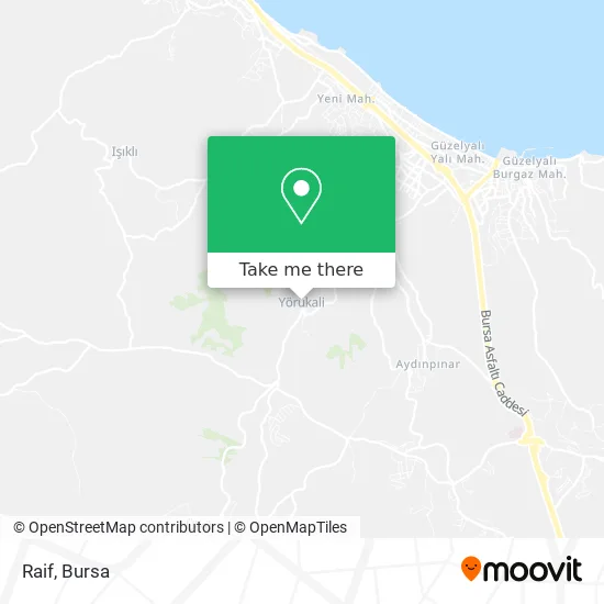
See Raif, Mudanya, on the map
Public Transit to Raif in Mudanya
Wondering how to get to Raif in Mudanya? Moovit helps you find the best way to get to Raif with step-by-step directions from the nearest public transit station.
Moovit provides free maps and live directions to help you navigate through your city. View schedules, routes, timetables, and find out how long does it take to get to Raif in real time.
Looking for the nearest stop or station to Raif? Check out this list of stops closest to your destination: Yörükali; Güzelyalı 2.
Bus: 1SY, B36C.Cable Car: ORGANIZE SANAYI - MUDANYA, ORGANIZE SANAYI- GÜZELYALI İSKELESI.
Want to see if there’s another route that gets you there at an earlier time? Moovit helps you find alternative routes or times. Get directions from and directions to Raif easily from the Moovit App or Website.
We make riding to Raif easy, which is why over 1.5 million users, including users in Mudanya, trust Moovit as the best app for public transit. You don’t need to download an individual bus app or train app, Moovit is your all-in-one transit app that helps you find the best bus time or train time available.
For information on prices of bus, costs and ride fares to Raif, please check the Moovit app.
Use the app to navigate to popular places including to the airport, hospital, stadium, grocery store, mall, coffee shop, school, college, and university.
Raif Address: Yörükali 4. Sokak, 16940 Yörükali, Mudanya street in Mudanya
- Yörükali,
- Bursa-Karaman Yolu,
- Yoruk Ali Mahalesi,
- Kuran Kursu,
- Marmara Birlik Yörükali Deposu,
- Çamlık köyü,
- Tren Yolu,
- istanbul ucuzluk pazarı,
- Yörükali İstasyon,
- Lik Yapı Hafriyat-Döküm Sahası,
- Eski Tren Yolu,
- İnşaat Mühendisleri Yapı Koopararifi,
- İnşaat Mühendisleri Villaları Havuzbaşı,
- Limit Etüt Merkezi,
- Aksoy Teknık,
- Akkaya Teknık Servıs,
- Seyhanlar Kerpıc Ekspr,
- Guzelyalı Veterıner,
- Calık Market,
- Buskı Mudanya Atıksu Arıtma Tesisi
Places Near Raif (Mudanya)
- Bursa Cumalıkızık Köyü, Osmangazi,
- Millet Mahallesi,
- Bursa Hayvanat Bahçesi, Osmangazi,
- Podyum Park, Nilüfer,
- Şevket Yılmaz Eğitim ve Araştırma Hastanesi, Yıldırım,
- Mustafakemalpaşa Karacabey Dolmuş Durağı, Mustafakemalpaşa,
- FSM Bulvarı, Nilüfer,
- Sur Yapı Marka, Nilüfer,
- Dörtçelik Çocuk Hastanesi, Nilüfer,
- Bursa Teleferik, Yıldırım,
- Bursa, Osmangazi,
- Bursa Terminal, Nilüfer,
- Ali Osman Sönmez Onkoloji Hastanesi, Osmangazi,
- Çekirge Devlet Hastanesi Otobüs Durağı, Osmangazi,
- Nilüfer Ağız ve Diş Sağlığı Merkezi, Nilüfer,
- Bursa Yüksek İhtisas Eğitim ve Araştırma Hastanesi Nilüfer Ek Binası, Nilüfer,
- ÖzdilekPark Bursa Nilüfer, Nilüfer,
- Sur Yapı Marka Avm, Osmangazi,
- Şehir Hastanesi, Nilüfer,
- bursa mudanya, Mudanya
How to get to popular places in Bursa with public transit
Get around Mudanya by public transit!
Traveling around Mudanya has never been so easy. See step by step directions as you travel to any attraction, street or major public transit station. View bus and train schedules, arrival times, service alerts and detailed routes on a map, so you know exactly how to get to anywhere in Mudanya.
When traveling to any destination around Mudanya use Moovit's Live Directions with Get Off Notifications to know exactly where and how far to walk, how long to wait for your line, and how many stops are left. Moovit will alert you when it's time to get off — no need to constantly re-check whether yours is the next stop.
Wondering how to use public transit in Mudanya or how to pay for public transit in Mudanya? Moovit public transit app can help you navigate your way with public transit easily, and at minimum cost. It includes public transit fees, ticket prices, and costs. Looking for a map of Mudanya public transit lines? Moovit public transit app shows all public transit maps in Mudanya with all Bus, Metro, Light Rail, Cable Car and Gondola routes and stops on an interactive map.
Bursa has 5 transit type(s), including: Bus, Metro, Light Rail, Cable Car and Gondola, operated by several transit agencies, including BursaRay, BurTram, BBBUS, Burulaş, Minibüs, İlçe Otobüsleri and Bursa Teleferik