How to get to Rainer Rasch by bus?
Click on the bus route to see step by step directions with maps, line arrival times and updated time schedules.
How to get to Rainer Rasch by train?
Click on the train route to see step by step directions with maps, line arrival times and updated time schedules.
From Mooserwirt, Gemeinde Sankt Anton am Arlberg
109 minFrom Bregenzer Festspiele, Stadt Bregenz
70 minFrom Ams Bregenz, Stadt Bregenz
67 minFrom TUI Blue Montafon, Gemeinde Tschagguns
105 minFrom Landeskrankenhaus Feldkirch-Notaufnahme, Stadt Feldkirch
72 minFrom Baywa, Marktgemeinde Lauterach
71 minFrom Wildpark Feldkirch, Stadt Feldkirch
57 min
Bus stops near Rainer Rasch in Gemeinde Weiler
Train stations near Rainer Rasch in Gemeinde Weiler
Bus lines to Rainer Rasch in Gemeinde Weiler
- 430, Klaus-Weiler-Röthis-Rankweil-Feldkirch Bahnhof-Tisis Landeskrankenhaus,VIEW
- 431, Götzis Bahnhof-St. Arbogast-Röthis Rössle-Rankweil Frutzolen-Bahnhof,VIEW
- 440, Brederis Krönele-Interpark FOCUS-Klaus Bahnhof-Röthis-Rankweil-Feldkirch Busplatz-Tisis LKH,VIEW
- 441, Götzis Bahnhof-St. Arbogast-Röthis Rössle-Muntlix-Rankweil Gewerbepark-Bahnhof,VIEW
- 445, Götzis-Klaus-Weiler-Röthis-Sulz-Muntlix-Rankweil-Feldkirch LKH,VIEW
- 470, Klaus Bahnhof-Rankweil-Feldkirch-Eschen-Schaan Bahnhof,VIEW
- 492, Fraxern-Weiler (-Klaus),VIEW
- 493, Sulz Lonserstraße,VIEW
- 494, Dafins Morsch,VIEW
What are the closest stations to Rainer Rasch?
The closest stations to Rainer Rasch are:
- Weiler Dorfmitte is 303 meters away, 4 min walk.
- Röthis Alte Landstraße is 910 meters away, 12 min walk.
- Klaus Bahnhof is 2550 meters away, 33 min walk.
- Rankweil Bahnhof is 4584 meters away, 59 min walk.
Which train line stops near Rainer Rasch?
S1 (Bregenz Hafen Bahnhof)
Which bus lines stop near Rainer Rasch?
These bus lines stop near Rainer Rasch: 430, 431, 440, 441.
What’s the nearest bus station to Rainer Rasch in Gemeinde Weiler?
The nearest bus station to Rainer Rasch in Gemeinde Weiler is Weiler Dorfmitte. It’s a 4 min walk away.
What time is the first train to Rainer Rasch in Gemeinde Weiler?
The S1 is the first train that goes to Rainer Rasch in Gemeinde Weiler. It stops nearby at 4:35 AM.
What time is the last train to Rainer Rasch in Gemeinde Weiler?
The A3 is the last train that goes to Rainer Rasch in Gemeinde Weiler. It stops nearby at 7:59 AM.
What time is the first bus to Rainer Rasch in Gemeinde Weiler?
The 470 is the first bus that goes to Rainer Rasch in Gemeinde Weiler. It stops nearby at 4:08 AM.
What time is the last bus to Rainer Rasch in Gemeinde Weiler?
The 430 is the last bus that goes to Rainer Rasch in Gemeinde Weiler. It stops nearby at 11:57 PM.
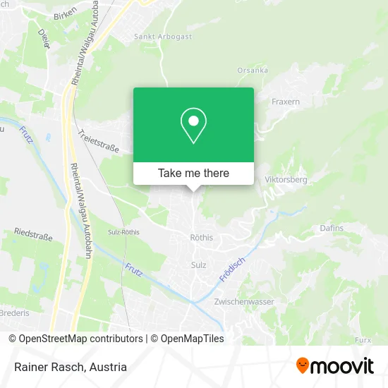
See Rainer Rasch, Gemeinde Weiler, on the map
Public Transit to Rainer Rasch in Gemeinde Weiler
Wondering how to get to Rainer Rasch in Gemeinde Weiler? Moovit helps you find the best way to get to Rainer Rasch with step-by-step directions from the nearest public transit station.
Moovit provides free maps and live directions to help you navigate through your city. View schedules, routes, timetables, and find out how long does it take to get to Rainer Rasch in real time.
Looking for the nearest stop or station to Rainer Rasch? Check out this list of stops closest to your destination: Weiler Dorfmitte; Röthis Alte Landstraße; Klaus Bahnhof; Rankweil Bahnhof.
Train: S1, 1, R5, R1, A3, A3, A3, A5, REX1.Bus: 430, 431, 440, 441, 445, 493, 494.
Want to see if there’s another route that gets you there at an earlier time? Moovit helps you find alternative routes or times. Get directions from and directions to Rainer Rasch easily from the Moovit App or Website.
We make riding to Rainer Rasch easy, which is why over 1.5 million users, including users in Gemeinde Weiler, trust Moovit as the best app for public transit. You don’t need to download an individual bus app or train app, Moovit is your all-in-one transit app that helps you find the best bus time or train time available.
For information on prices of bus and train, costs and ride fares to Rainer Rasch, please check the Moovit app.
Use the app to navigate to popular places including to the airport, hospital, stadium, grocery store, mall, coffee shop, school, college, and university.
Rainer Rasch Address: Walgaustraße 25 6837 Weiler street in Gemeinde Weiler
- Summer Rainer,
- Eugen Summer - Malermeister E.U.,
- Elektro Decker GmbH,
- Charlys Grillbar,
- ebenhoch,
- Hubert Summer,
- Mag. Pharm. Andreas Gmeiner KG,
- Coaching - Seminare Brigitte Bernhard,
- Gstort Industr,
- Nicole Annemarie Marte,
- NICOLE MARTE,
- Harry's Beiz U Weinstüble,
- Harry's Beiz Weiler,
- Malerbetrieb Fleisch,
- Apollon Industriebeteiligungs GmbH,
- Martin Lorunse,
- Günter Abentung,
- Biker Shop Elmar Erath,
- Marte Feuerwehrfahrzeuge Feuerwehrtechnologie GmbH,
- Kurt Schörgenhofer
Places Near Rainer Rasch (Gemeinde Weiler)
- 10er Marie, Ottakring,
- Wien Rennbahn Freudenau, Leopoldstadt,
- Schweizerhaus (Karl Kolariks Schweizerhaus), Leopoldstadt,
- Mariahilfer Strasse, Mariahilf,
- Raimund-Theater, Mariahilf,
- Kabarett Simpl, 1., Innere Stadt,
- Klinik Floridsdorf (Krankenhaus Nord), Floridsdorf,
- Ronacher, 1., Innere Stadt,
- Setagayapark, Döbling,
- Lugner City, Rudolfsheim-Fünfhaus,
- Feuerhalle Simmering, Simmering,
- Ghegastraße 3, Landstraße,
- Donauzentrum, Donaustadt,
- Schiffsanleger Wien-Nussdorf, Döbling,
- Strandbad Gänsehäufel, Donaustadt,
- Zentralfriedhof Halle 3, Simmering,
- Thomas-Klestil-Platz, Landstraße,
- Leopoldauer Alm, Floridsdorf,
- Auhof-Center, Penzing,
- Türkenschanzpark, Währing
How to get to popular places in Austria with public transit
Get around Gemeinde Weiler by public transit!
Traveling around Gemeinde Weiler has never been so easy. See step by step directions as you travel to any attraction, street or major public transit station. View bus and train schedules, arrival times, service alerts and detailed routes on a map, so you know exactly how to get to anywhere in Gemeinde Weiler.
When traveling to any destination around Gemeinde Weiler use Moovit's Live Directions with Get Off Notifications to know exactly where and how far to walk, how long to wait for your line, and how many stops are left. Moovit will alert you when it's time to get off — no need to constantly re-check whether yours is the next stop.
Wondering how to use public transit in Gemeinde Weiler or how to pay for public transit in Gemeinde Weiler? Moovit public transit app can help you navigate your way with public transit easily, and at minimum cost. It includes public transit fees, ticket prices, and costs. Looking for a map of Gemeinde Weiler public transit lines? Moovit public transit app shows all public transit maps in Gemeinde Weiler with all Bus, Train, Subway, Light Rail, Ferry and Funicular routes and stops on an interactive map.
Austria has 6 transit type(s), including: Bus, Train, Subway, Light Rail, Ferry and Funicular, operated by several transit agencies, including Wiener Linien GmbH & Co KG, Vienna Airport Lines, OEBB Personenverkehr AG Kundenservice, Wiener Lokalbahnen GmbH, City Air Terminal Betriebsgesellschaft m.b.H., CAT, Österreichische Postbus AG, VOR GmbH, Graz Linien, Graz-Köflacher Bahn und Busbetrieb GmbH, Steiermarkbahn und Bus GmbH, Linz Linien GmbH, Salzburg AG (Salzburger Lokalbahn), Salzburg AG (OBus) and KMG Klagenfurt Mobil GmbH
Public transit lines with stations closest to Rainer Rasch in Gemeinde Weiler
Train lines with stations closest to Rainer Rasch in Gemeinde Weiler
Bus lines with stations closest to Rainer Rasch in Gemeinde Weiler
Weiler Dorfmitte
 430Klaus-Weiler-Röthis-Rankweil-Feldkirch Bahnhof-Tisis Landeskrankenhaus
- 431Götzis Bahnhof-St. Arbogast-Röthis Rössle-Rankweil Frutzolen-Bahnhof
- 440Brederis Krönele-Interpark FOCUS-Klaus Bahnhof-Röthis-Rankweil-Feldkirch Busplatz-Tisis LKH
- 441Götzis Bahnhof-St. Arbogast-Röthis Rössle-Muntlix-Rankweil Gewerbepark-Bahnhof
- 445Götzis-Klaus-Weiler-Röthis-Sulz-Muntlix-Rankweil-Feldkirch LKH