How to get to Rainer Zerback by bus?
Click on the bus route to see step by step directions with maps, line arrival times and updated time schedules.
How to get to Rainer Zerback by train?
Click on the train route to see step by step directions with maps, line arrival times and updated time schedules.
From FH 1863, Neckarstadt-Ost/Wohlgelegen
95 minFrom MVV Energie Ladestation, Käfertal
108 minFrom Marie-Baum-Schule Heidelberg, Wieblingen
62 minFrom Hauptfeuerwache, Berufsfeuerwehr Mannheim, Neckarau
76 minFrom Möbel Höffner, Schwetzingen
81 minFrom Bad Dürkheim Reha, Bad Dürkheim
124 minFrom GRN-Klinik Schwetzingen, Schwetzingen
86 min
Bus stops near Rainer Zerback in Ludwigshafen-Mundenheim
Train station near Rainer Zerback in Ludwigshafen-Mundenheim
- Lu-Mundenheim, Bahnhof, 12 min walk,VIEW
Light Rail stations near Rainer Zerback in Ludwigshafen-Mundenheim
Bus lines to Rainer Zerback in Ludwigshafen-Mundenheim
- 75, Rheingönheim,VIEW
- 78, Basf Süd,VIEW
- 95, Berliner Platz,VIEW
- 75E, Lu Hauptbahnhof,VIEW
- 78E, Basf Süd,VIEW
- E, Schulbus,VIEW
- 80E, Bbs Franz-Zang-Str,VIEW
- 76, Berliner Platz Bf LU Mitte – Rhein-Galerie – LU Hochschule – Marienkrankenhaus – Maudach Kleestraße,VIEW
- E, Berliner Platz, Bf LU Mitte - Maudach Kleestraße,VIEW
- E, Valentin-Bauer-Siedlung - Maudach Kleestraße,VIEW
- 80, Basf,VIEW
- E, Maudach Kleestraße - Berliner Platz, Bf LU Mitte,VIEW
- E, Von-Kieffer-Straße - Berliner Platz, Bf LU Mitte,VIEW
- 74, Berliner Platz,VIEW
- 74E, Leininger Straße,VIEW
- 94, Berliner Platz,VIEW
- 73, Otto-Thiele-Platz,VIEW
What are the closest stations to Rainer Zerback?
The closest stations to Rainer Zerback are:
- Mundenheim Friedhof is 183 meters away, 3 min walk.
- Bbs Franz-Zang-Straße is 453 meters away, 6 min walk.
- Achtmorgenstraße is 474 meters away, 7 min walk.
- Hochfeldstraße is 567 meters away, 8 min walk.
- Lu-Mundenheim, Bahnhof is 856 meters away, 12 min walk.
- Mundenheim, am Schwanen is 1560 meters away, 20 min walk.
Which bus lines stop near Rainer Zerback?
These bus lines stop near Rainer Zerback: 73, 75, 76.
Which train line stops near Rainer Zerback?
S3 (Germersheim)
Which light rail line stops near Rainer Zerback?
S2 (Kaiserslautern, Hbf)
What’s the nearest light rail station to Rainer Zerback in Ludwigshafen-Mundenheim?
The nearest light rail station to Rainer Zerback in Ludwigshafen-Mundenheim is Lu-Mundenheim, Bahnhof. It’s a 13 min walk away.
What’s the nearest train station to Rainer Zerback in Ludwigshafen-Mundenheim?
The nearest train station to Rainer Zerback in Ludwigshafen-Mundenheim is Lu-Mundenheim, Bahnhof. It’s a 12 min walk away.
What’s the nearest bus station to Rainer Zerback in Ludwigshafen-Mundenheim?
The nearest bus station to Rainer Zerback in Ludwigshafen-Mundenheim is Mundenheim Friedhof. It’s a 3 min walk away.
What time is the first light rail to Rainer Zerback in Ludwigshafen-Mundenheim?
The S3 is the first light rail that goes to Rainer Zerback in Ludwigshafen-Mundenheim. It stops nearby at 4:03 AM.
What time is the last light rail to Rainer Zerback in Ludwigshafen-Mundenheim?
The S4 is the last light rail that goes to Rainer Zerback in Ludwigshafen-Mundenheim. It stops nearby at 12:39 AM.
What time is the first train to Rainer Zerback in Ludwigshafen-Mundenheim?
The S3 is the first train that goes to Rainer Zerback in Ludwigshafen-Mundenheim. It stops nearby at 4:03 AM.
What time is the last train to Rainer Zerback in Ludwigshafen-Mundenheim?
The S3 is the last train that goes to Rainer Zerback in Ludwigshafen-Mundenheim. It stops nearby at 11:59 PM.
What time is the first bus to Rainer Zerback in Ludwigshafen-Mundenheim?
The 74 is the first bus that goes to Rainer Zerback in Ludwigshafen-Mundenheim. It stops nearby at 4:26 AM.
What time is the last bus to Rainer Zerback in Ludwigshafen-Mundenheim?
The 94 is the last bus that goes to Rainer Zerback in Ludwigshafen-Mundenheim. It stops nearby at 12:50 AM.
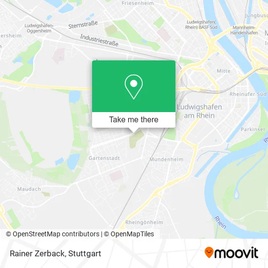
See Rainer Zerback, Ludwigshafen-Mundenheim, on the map
Public Transit to Rainer Zerback in Ludwigshafen-Mundenheim
Wondering how to get to Rainer Zerback in Ludwigshafen-Mundenheim? Moovit helps you find the best way to get to Rainer Zerback with step-by-step directions from the nearest public transit station.
Moovit provides free maps and live directions to help you navigate through your city. View schedules, routes, timetables, and find out how long does it take to get to Rainer Zerback in real time.
Looking for the nearest stop or station to Rainer Zerback? Check out this list of stops closest to your destination: Mundenheim Friedhof; Bbs Franz-Zang-Straße; Achtmorgenstraße; Hochfeldstraße; Lu-Mundenheim; Mundenheim.
Bus: 73, 75, 76, 78, 95, 75E, 78E, E, 80E, E, E, 80.Train: S3, S44.Light Rail: S2.
Want to see if there’s another route that gets you there at an earlier time? Moovit helps you find alternative routes or times. Get directions from and directions to Rainer Zerback easily from the Moovit App or Website.
We make riding to Rainer Zerback easy, which is why over 1.5 million users, including users in Ludwigshafen-Mundenheim, trust Moovit as the best app for public transit. You don’t need to download an individual bus app or train app, Moovit is your all-in-one transit app that helps you find the best bus time or train time available.
For information on prices of bus, light rail and train, costs and ride fares to Rainer Zerback, please check the Moovit app.
Use the app to navigate to popular places including to the airport, hospital, stadium, grocery store, mall, coffee shop, school, college, and university.
Rainer Zerback Address: Raschigstraße 19A Mundenheim, 67065 Ludwigshafen am Rhein street in Ludwigshafen-Mundenheim
- Atelier/Altes Umspannwerk,
- Buero für Angewandten Realismus,
- Druckwerkstatt Slowtype,
- Kunst Im Twl-Umspannwerk,
- Friedhof Mundenheim,
- Berninger Thomas,
- Vertrauensband,
- Hundeschule Michelle Brill,
- Trauerhalle,
- Friedhofs-Blumenladen,
- Friedhof Mundenheim,
- Pneuhage,
- Huk Coburg,
- T.C.P Toni's Car Point,
- Baron Willi und Sven Metallbau,
- Premier Auto Service,
- Huk-Coburg Versicherungen,
- Mo's Garage,
- Wegkapelle,
- Kfz-Meisterbetrieb Cephas Bansah
Places Near Rainer Zerback (Ludwigshafen-Mundenheim)
- Mercedes-Benz Museum (Mercedes Museum Stuttgart), Bad Cannstatt,
- Porsche-Arena, Bad Cannstatt,
- Klinikum Stuttgart - Katharinenhospital, Stuttgart-Mitte,
- Waldfriedhof, Degerloch,
- Mercedes-Benz Museum, Bad Cannstatt,
- Hanns-Martin-Schleyer-Halle (Stuttgart Hans-Martin-Schleyerhalle), Bad Cannstatt,
- Im Wizemann (Halle), Bad Cannstatt,
- FlixBus Haltestelle, Stuttgart,
- Porsche Museum, Zuffenhausen,
- Gasometer Pforzheim, Pforzheim,
- Hanns-Martin-Schleyer-Halle, Bad Cannstatt,
- Marmorsaal Im Weissenburgpark, Stuttgart-Süd,
- SI-Centrum, Möhringen,
- Pariser Platz Stuttgart, Stuttgart-Mitte,
- Mettingen Eros-Center Puff Laufhaus, Esslingen Am Neckar,
- Gleis 101/102 (tief), Stuttgart-Mitte,
- Schleyerhalle, Bad Cannstatt,
- Hauptbahnhof Stuttgart, Stuttgart-Mitte,
- Wilhelma (U-Bahn Wilhelma), Bad Cannstatt,
- Geilhaus Haus 33a, Reutlingen-Betzingen
How to get to popular places in Stuttgart with public transit
Get around Ludwigshafen-Mundenheim by public transit!
Traveling around Ludwigshafen-Mundenheim has never been so easy. See step by step directions as you travel to any attraction, street or major public transit station. View bus and train schedules, arrival times, service alerts and detailed routes on a map, so you know exactly how to get to anywhere in Ludwigshafen-Mundenheim.
When traveling to any destination around Ludwigshafen-Mundenheim use Moovit's Live Directions with Get Off Notifications to know exactly where and how far to walk, how long to wait for your line, and how many stops are left. Moovit will alert you when it's time to get off — no need to constantly re-check whether yours is the next stop.
Wondering how to use public transit in Ludwigshafen-Mundenheim or how to pay for public transit in Ludwigshafen-Mundenheim? Moovit public transit app can help you navigate your way with public transit easily, and at minimum cost. It includes public transit fees, ticket prices, and costs. Looking for a map of Ludwigshafen-Mundenheim public transit lines? Moovit public transit app shows all public transit maps in Ludwigshafen-Mundenheim with all Bus, Train, Subway, Light Rail, Ferry, S-Bahn and Funicular routes and stops on an interactive map.
Stuttgart has 7 transit type(s), including: Bus, Train, Subway, Light Rail, Ferry, S-Bahn and Funicular, operated by several transit agencies, including SSB - Stadtbahn, SSB, SSB - Seilbahn / Zacke, S-Bahn Stuttgart, Rhein-Neckar-Verkehr GmbH (rnv), Karlsruher Verkehrsverbund, DB AG, DB Regiobus BW, Arverio Baden-Württemberg GmbH, DB RegioNetz Verkehrs GmbH Westfrankenbahn, DB Regio AG Baden-Württemberg, Südwestdeutsche Verkehrs-AG, DB Regio AG Mitte Region Hessen, DB and Bodensee-Oberschwaben-Bahn
Public transit lines with stations closest to Rainer Zerback in Ludwigshafen-Mundenheim
Train lines with stations closest to Rainer Zerback in Ludwigshafen-Mundenheim
Bus lines with stations closest to Rainer Zerback in Ludwigshafen-Mundenheim
Mundenheim Friedhof
 75Berliner Platz Bf LU Mitte – LU Hauptbahnhof – LU Hochschule – Marienkrankenhaus – Rheingönheim Bf – Rheingönheim Neubruch
- 78BASF Süd (Tor 1+7) – LU Hauptbahnhof – LU Hochschule – Kallstadter Str. – Maudach Kleestraße
- 95Berliner Platz Bf LU Mitte - Valentin-Bauer Siedlung - Marienkrankenhaus - Maudach