How to get to Rainer Zickler by bus?
Click on the bus route to see step by step directions with maps, line arrival times and updated time schedules.
From Hauptfeuerwache, Berufsfeuerwehr Mannheim, Neckarau
65 minFrom Globus Getränkecenter, Ludwigshafen-Oggersheim
113 minFrom BG-Unfallklinik, Ludwigshafen-Nördliche Innenstadt
79 minFrom Berufsbildende Schule Technik 2, Ludwigshafen-Mundenheim
221 minFrom Hans-Warsch-Platz,Ludwigshafen Oggersheim, Ludwigshafen-Oggersheim
71 minFrom Globus Getränkemarkt, Ludwigshafen-Oggersheim
114 minFrom Möbel Höffner, Schwetzingen
63 minFrom Marie-Baum-Schule Heidelberg, Wieblingen
130 min
How to get to Rainer Zickler by train?
Click on the train route to see step by step directions with maps, line arrival times and updated time schedules.
From Hauptfeuerwache, Berufsfeuerwehr Mannheim, Neckarau
72 minFrom Krankenhaus GRN, Weinheim
111 minFrom BG-Unfallklinik, Ludwigshafen-Nördliche Innenstadt
78 minFrom Berufsbildende Schule Technik 2, Ludwigshafen-Mundenheim
88 minFrom Hans-Warsch-Platz,Ludwigshafen Oggersheim, Ludwigshafen-Oggersheim
73 minFrom Schön Klinik Lorsch Se, Lorsch
84 minFrom Möbel Höffner, Schwetzingen
77 minFrom Marie-Baum-Schule Heidelberg, Wieblingen
88 min
Bus stops near Rainer Zickler in Käfertal
Light Rail stations near Rainer Zickler in Käfertal
Bus lines to Rainer Zickler in Käfertal
What are the closest stations to Rainer Zickler?
The closest stations to Rainer Zickler are:
- Käfertal, Äußere Wingertstraße is 175 meters away, 3 min walk.
- Käfertal, Feuerwache Nord is 398 meters away, 6 min walk.
- Feuerwache Nord is 399 meters away, 6 min walk.
- Käfertal, Friedhof is 520 meters away, 7 min walk.
- Käfertal Bahnhof is 1090 meters away, 15 min walk.
- Käfertal, Franklinschule is 1126 meters away, 15 min walk.
- Franklinschule is 1164 meters away, 16 min walk.
Which bus lines stop near Rainer Zickler?
These bus lines stop near Rainer Zickler: 45, 50, 55, RNV 45, RNV 50, RNV 53, RNV 7.
Which train lines stop near Rainer Zickler?
These train lines stop near Rainer Zickler: RE70, S10, S9.
What’s the nearest light rail station to Rainer Zickler in Käfertal?
The nearest light rail stations to Rainer Zickler in Käfertal are Käfertal Bahnhof and Käfertal, Franklinschule. The closest one is a 15 min walk away.
What’s the nearest bus station to Rainer Zickler in Käfertal?
The nearest bus station to Rainer Zickler in Käfertal is Käfertal, Äußere Wingertstraße. It’s a 3 min walk away.
What time is the first light rail to Rainer Zickler in Käfertal?
The 5 is the first light rail that goes to Rainer Zickler in Käfertal. It stops nearby at 3:56 AM.
What time is the last light rail to Rainer Zickler in Käfertal?
The 5 is the last light rail that goes to Rainer Zickler in Käfertal. It stops nearby at 1:44 AM.
What time is the first bus to Rainer Zickler in Käfertal?
The 55 is the first bus that goes to Rainer Zickler in Käfertal. It stops nearby at 5:07 AM.
What time is the last bus to Rainer Zickler in Käfertal?
The RNV 53 is the last bus that goes to Rainer Zickler in Käfertal. It stops nearby at 12:51 AM.
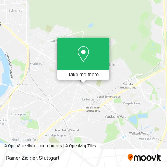
See Rainer Zickler, Käfertal, on the map
Public Transit to Rainer Zickler in Käfertal
Wondering how to get to Rainer Zickler in Käfertal? Moovit helps you find the best way to get to Rainer Zickler with step-by-step directions from the nearest public transit station.
Moovit provides free maps and live directions to help you navigate through your city. View schedules, routes, timetables, and find out how long does it take to get to Rainer Zickler in real time.
Looking for the nearest stop or station to Rainer Zickler? Check out this list of stops closest to your destination: Käfertal, Äußere Wingertstraße; Käfertal, Feuerwache Nord; Feuerwache Nord; Käfertal, Friedhof; Käfertal Bahnhof; Käfertal, Franklinschule; Franklinschule.
Bus: 45, 50, 55, RNV 45, RNV 50, RNV 53, RNV 7, 41, RNV 55, RNV 56, RNV 67.Train: RE70, S10, S9.
Want to see if there’s another route that gets you there at an earlier time? Moovit helps you find alternative routes or times. Get directions from and directions to Rainer Zickler easily from the Moovit App or Website.
We make riding to Rainer Zickler easy, which is why over 1.5 million users, including users in Käfertal, trust Moovit as the best app for public transit. You don’t need to download an individual bus app or train app, Moovit is your all-in-one transit app that helps you find the best bus time or train time available.
For information on prices of bus, light rail and train, costs and ride fares to Rainer Zickler, please check the Moovit app.
Use the app to navigate to popular places including to the airport, hospital, stadium, grocery store, mall, coffee shop, school, college, and university.
Rainer Zickler Address: Dornheimer Ring 69 Käfertal, 68309 Mannheim street in Käfertal
- Bernd Hoffmann,
- Abschleppservice Mannheim Premium-Kfz-Handel,
- Adolf-H. Schaffors,
- Josef Wabnigg,
- C&M Gebäudereinigung und Haushaltsauflösung,
- Günter Back,
- Christina Panzer,
- Dr. med. Univ. Veronika Wieland,
- Dr. med. Dominik Schubert,
- Tchibo,
- Zorn GmbH&Co.Kg Bäckerei,
- DHL,
- REWE,
- Spielzeuggutachter,
- Htsev,
- Susanne Weber-Kässer,
- Nierenzentrum Mannheim,
- Dr. med. M. Sc. Frank Leistikow,
- Dr. med. Günter Sandner,
- Dr. med. Syrus Hafezi Rachti
Places Near Rainer Zickler (Käfertal)
- Waldfriedhof, Degerloch,
- Pariser Platz Stuttgart, Stuttgart-Mitte,
- Hauptbahnhof Stuttgart, Stuttgart-Mitte,
- Mettingen Eros-Center Puff Laufhaus, Esslingen Am Neckar,
- Hanns-Martin-Schleyer-Halle (Stuttgart Hans-Martin-Schleyerhalle), Bad Cannstatt,
- Im Wizemann (Halle), Bad Cannstatt,
- Geilhaus Haus 33a, Reutlingen-Betzingen,
- Schleyerhalle, Bad Cannstatt,
- SI-Centrum, Möhringen,
- Mercedes-Benz Museum (Mercedes Museum Stuttgart), Bad Cannstatt,
- Hanns-Martin-Schleyer-Halle, Bad Cannstatt,
- Marmorsaal Im Weissenburgpark, Stuttgart-Süd,
- Wilhelma (U-Bahn Wilhelma), Bad Cannstatt,
- Gleis 101/102 (tief), Stuttgart-Mitte,
- Gasometer Pforzheim, Pforzheim,
- Porsche-Arena, Bad Cannstatt,
- Porsche Museum, Zuffenhausen,
- Mercedes-Benz Museum, Bad Cannstatt,
- Klinikum Stuttgart - Katharinenhospital, Stuttgart-Mitte,
- FlixBus Haltestelle, Stuttgart
How to get to popular places in Stuttgart with public transit
Get around Käfertal by public transit!
Traveling around Käfertal has never been so easy. See step by step directions as you travel to any attraction, street or major public transit station. View bus and train schedules, arrival times, service alerts and detailed routes on a map, so you know exactly how to get to anywhere in Käfertal.
When traveling to any destination around Käfertal use Moovit's Live Directions with Get Off Notifications to know exactly where and how far to walk, how long to wait for your line, and how many stops are left. Moovit will alert you when it's time to get off — no need to constantly re-check whether yours is the next stop.
Wondering how to use public transit in Käfertal or how to pay for public transit in Käfertal? Moovit public transit app can help you navigate your way with public transit easily, and at minimum cost. It includes public transit fees, ticket prices, and costs. Looking for a map of Käfertal public transit lines? Moovit public transit app shows all public transit maps in Käfertal with all Bus, Train, Subway, Light Rail, Ferry, S-Bahn and Funicular routes and stops on an interactive map.
Stuttgart has 7 transit type(s), including: Bus, Train, Subway, Light Rail, Ferry, S-Bahn and Funicular, operated by several transit agencies, including SSB - Stadtbahn, SSB, SSB - Seilbahn / Zacke, S-Bahn Stuttgart, Rhein-Neckar-Verkehr GmbH (rnv), Karlsruher Verkehrsverbund, DB AG, DB Regiobus BW, Arverio Baden-Württemberg GmbH, DB RegioNetz Verkehrs GmbH Westfrankenbahn, DB Regio AG Baden-Württemberg, Südwestdeutsche Verkehrs-AG, DB Regio AG Mitte Region Hessen, DB and Bodensee-Oberschwaben-Bahn