Directions to Raines Polygraph Services (Tulsa) with public transportation
The following transit lines have routes that pass near Raines Polygraph Services
 Bus: 490.
How to get to Raines Polygraph Services by bus?
Click on the bus route to see step by step directions with maps, line arrival times and updated time schedules.
From Sampson Commercial Real Estate Services, Tulsa
97 minFrom Frontiers, Tulsa
76 minFrom Tuff Truck Towing, Broken Arrow
92 minFrom Papa Doyle's Used Auto Sales, Tulsa
80 minFrom Powerstride, Jenks
75 minFrom Catrina Fresh Mex, Tulsa
58 minFrom Jenks Aquarium, Jenks
78 minFrom Amazon Locker-Order, Tulsa
44 minFrom So Gifted Learning Academy, Broken Arrow
87 minFrom Okmulgee Bee-Line, Tulsa
67 min
Bus stop near Raines Polygraph Services in Tulsa
- (7334) 71st St & 73rd E Ave Eb, 11 min walk,VIEW
Bus lines to Raines Polygraph Services in Tulsa
- 490, To Woodland Hills,VIEW
What are the closest stations to Raines Polygraph Services?
The closest stations to Raines Polygraph Services are:
- (7334) 71st St & 73rd E Ave Eb is 851 yards away, 11 min walk.
Which bus line stops near Raines Polygraph Services?
490 (To T Hills)
What’s the nearest bus station to Raines Polygraph Services in Tulsa?
The nearest bus station to Raines Polygraph Services in Tulsa is (7334) 71st St & 73rd E Ave Eb. It’s a 11 min walk away.
What time is the first bus to Raines Polygraph Services in Tulsa?
The 490 is the first bus that goes to Raines Polygraph Services in Tulsa. It stops nearby at 6:39 AM.
What time is the last bus to Raines Polygraph Services in Tulsa?
The 490 is the last bus that goes to Raines Polygraph Services in Tulsa. It stops nearby at 7:14 PM.
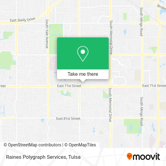
See Raines Polygraph Services, Tulsa, on the map
Public Transit to Raines Polygraph Services in Tulsa
Wondering how to get to Raines Polygraph Services in Tulsa? Moovit helps you find the best way to get to Raines Polygraph Services with step-by-step directions from the nearest public transit station.
Moovit provides free maps and live directions to help you navigate through your city. View schedules, routes, timetables, and find out how long does it take to get to Raines Polygraph Services in real time.
Looking for the nearest stop or station to Raines Polygraph Services? Check out this list of stops closest to your destination: (7334) 71st St & 73rd E Ave Eb.
Bus: 490.
Want to see if there’s another route that gets you there at an earlier time? Moovit helps you find alternative routes or times. Get directions from and directions to Raines Polygraph Services easily from the Moovit App or Website.
We make riding to Raines Polygraph Services easy, which is why over 1.5 million users, including users in Tulsa, trust Moovit as the best app for public transit. You don’t need to download an individual bus app or train app, Moovit is your all-in-one transit app that helps you find the best bus time or train time available.
For information on prices of bus, costs and ride fares to Raines Polygraph Services, please check the Moovit app.
Use the app to navigate to popular places including to the airport, hospital, stadium, grocery store, mall, coffee shop, school, college, and university.
Raines Polygraph Services Address: 6931 S 66th Ave E Tulsa, OK 74133 street in Tulsa
- Shic Asian Health Services Exchange,
- Purewellness,
- Judy Hays Reading,
- Marshall Spinal Care,
- Beale Co Builders,
- Ed Lodes Insurance,
- Dan E Calhoun MD,
- Phillips 66,
- Communidad de Esperanza,
- 71st & Sheridan,
- Love the Pearls,
- Brian and Co,
- KL Mosely Ministries,
- Lydia's Pink Hairitage at Casa Blanca,
- Owings Dee Dee,
- Crown Hospice,
- Susan Willard do (Dr. Susan Chaiser Willard do),
- Launch Car Wash,
- Dr Michael Parsons MD,
- Tech Evolutions
Places Near Raines Polygraph Services (Tulsa)
- Tulsa State Fair, Tulsa,
- Fallout Shelter, Tulsa,
- Bixby, OK, Bixby,
- Broken Arrow, OK, Broken Arrow,
- S Garnett Rd / E 21st St, Tulsa,
- Woodland Hills Mall, Tulsa,
- Tulsa Ok, Tulsa,
- Osage Casino, Tulsa,
- Plaza Santa Cecilia, Tulsa,
- Amazon Fulfillment Center-TUL2, Tulsa,
- Walmart, Tulsa,
- Hard Rock Casino, Tulsa,
- Alagon Spa (Olympus Spa), Tulsa,
- 71st & Memorial, Tulsa,
- River Spirit Casino, Tulsa,
- St Francis South Cardinal Building, Tulsa,
- Zavala Plus, Tulsa,
- Saint Francis Hospital, Tulsa,
- Tulsa Zoo, Tulsa,
- St. Francis Hospital Outpatient Infusion, Tulsa
How to get to popular places in Tulsa with public transit
Get around Tulsa by public transit!
Traveling around Tulsa has never been so easy. See step by step directions as you travel to any attraction, street or major public transit station. View bus and train schedules, arrival times, service alerts and detailed routes on a map, so you know exactly how to get to anywhere in Tulsa.
When traveling to any destination around Tulsa use Moovit's Live Directions with Get Off Notifications to know exactly where and how far to walk, how long to wait for your line, and how many stops are left. Moovit will alert you when it's time to get off — no need to constantly re-check whether yours is the next stop.
Wondering how to use public transit in Tulsa or how to pay for public transit in Tulsa? Moovit public transit app can help you navigate your way with public transit easily, and at minimum cost. It includes public transit fees, ticket prices, and costs. Looking for a map of Tulsa public transit lines? Moovit public transit app shows all public transit maps in Tulsa with all bus routes and stops on an interactive map.
Tulsa has 1 transit type(s), including: bus, operated by several transit agencies, including MetroLink Tulsa and Greyhound-us