How to get to Rainshower Mfg. by bus?
Click on the bus route to see step by step directions with maps, line arrival times and updated time schedules.
From Veterinary Emergency Group, Las Vegas
55 minFrom Meadows Mall, Las Vegas
29 minFrom Main Street Station RV Park, Las Vegas
53 minFrom The Meadows Mall, Las Vegas
31 minFrom Punk Rock Museum, Las Vegas
57 minFrom S 1st St / E Bonneville Ave, Las Vegas
46 minFrom Omega Mart, Las Vegas
46 minFrom Salvation Army Lied Kit & Dining, Las Vegas
59 minFrom Goodwill, Las Vegas
52 minFrom Circa Resort & Casino, Las Vegas
52 min
Bus stops near Rainshower Mfg. in Las Vegas
Bus lines to Rainshower Mfg. in Las Vegas
What are the closest stations to Rainshower Mfg.?
The closest stations to Rainshower Mfg. are:
- Wb Smoke Ranch After Rock Springs is 66 yards away, 1 min walk.
- Sb Rainbow After Smoke Ranch is 509 yards away, 6 min walk.
- Wb Lake Mead After Rock Springs is 1044 yards away, 13 min walk.
Which bus line stops near Rainshower Mfg.?
104 (104 Valley View Northbound)
What’s the nearest bus station to Rainshower Mfg. in Las Vegas?
The nearest bus station to Rainshower Mfg. in Las Vegas is Wb Smoke Ranch After Rock Springs. It’s a 1 min walk away.
What time is the first bus to Rainshower Mfg. in Las Vegas?
The 210 is the first bus that goes to Rainshower Mfg. in Las Vegas. It stops nearby at 3:49 AM.
What time is the last bus to Rainshower Mfg. in Las Vegas?
The 210 is the last bus that goes to Rainshower Mfg. in Las Vegas. It stops nearby at 2:51 AM.
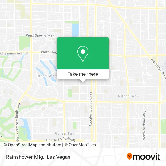
See Rainshower Mfg., Las Vegas, on the map
Public Transit to Rainshower Mfg. in Las Vegas
Wondering how to get to Rainshower Mfg. in Las Vegas? Moovit helps you find the best way to get to Rainshower Mfg. with step-by-step directions from the nearest public transit station.
Moovit provides free maps and live directions to help you navigate through your city. View schedules, routes, timetables, and find out how long does it take to get to Rainshower Mfg. in real time.
Looking for the nearest stop or station to Rainshower Mfg.? Check out this list of stops closest to your destination: Wb Smoke Ranch After Rock Springs; Sb Rainbow After Smoke Ranch; Wb Lake Mead After Rock Springs.
Bus: 104, 101, 210.
Want to see if there’s another route that gets you there at an earlier time? Moovit helps you find alternative routes or times. Get directions from and directions to Rainshower Mfg. easily from the Moovit App or Website.
We make riding to Rainshower Mfg. easy, which is why over 1.7 million users, including users in Las Vegas, trust Moovit as the best app for public transit. You don’t need to download an individual bus app or train app, Moovit is your all-in-one transit app that helps you find the best bus time or train time available.
For information on prices of bus, costs and ride fares to Rainshower Mfg., please check the Moovit app.
Use the app to navigate to popular places including to the airport, hospital, stadium, grocery store, mall, coffee shop, school, college, and university.
Rainshower Mfg. Address: 7251 Cathedral Rock Dr street in Las Vegas
- BART,
- N Tenaya Way / Cathedral Rock Dr,
- Medical Building @ 7200 Cathedral Rock,
- Red Rock,
- Navy Federal Credit Union,
- Navy Federal Credit Union,
- Sunrise Mountain High School,
- Cimarron-Memorial High School,
- Northwest Career College,
- Hobby Lobby,
- Good Shepherd Integrated Healthcare Services,
- Bettye Wilson Soccer Complex,
- La Quinta Inn & Suites-Las Vegas,
- Barnes & Noble Booksellers,
- P3 Medical Group Business Park,
- Marshalls,
- T.J.Maxx,
- Ulta Beauty,
- Laboratory Corporation of America,
- In-N-Out Burger (innout)
Places Near Rainshower Mfg. (Las Vegas)
- Area15, Las Vegas,
- Walmart, Las Vegas,
- The Palms Casino Resort, Paradise,
- Omega Mart, Las Vegas,
- Meow Wolf - Las Vegas (Meow Wolf's Omega Mart), Las Vegas,
- Trump International Hotel Las Vegas, Paradise,
- Welcome To Fabulous Las Vegas Sign, Paradise,
- Las Vegas Premium Outlets-North, Enterprise,
- Koolsville Tattoos, Las Vegas,
- Arte Museum Las Vegas, Paradise,
- Lee Canyon, Las Vegas,
- The Neon Museum, Las Vegas,
- Gold & Silver Pawn Shop, Las Vegas,
- Las Vegas North Premium Outlets, Las Vegas,
- Walmart Supercenter, Las Vegas,
- Zak Bagans Haunted Museum, Las Vegas,
- Allegiant Stadium, Paradise,
- Town Square, Enterprise,
- Las Vegas South Premium Outlets, Enterprise,
- The Deuce Bus Stop at Fremont St, Las Vegas
How to get to popular places in Las Vegas with public transit
Get around Las Vegas by public transit!
Traveling around Las Vegas has never been so easy. See step by step directions as you travel to any attraction, street or major public transit station. View bus and train schedules, arrival times, service alerts and detailed routes on a map, so you know exactly how to get to anywhere in Las Vegas.
When traveling to any destination around Las Vegas use Moovit's Live Directions with Get Off Notifications to know exactly where and how far to walk, how long to wait for your line, and how many stops are left. Moovit will alert you when it's time to get off — no need to constantly re-check whether yours is the next stop.
Wondering how to use public transit in Las Vegas or how to pay for public transit in Las Vegas? Moovit public transit app can help you navigate your way with public transit easily, and at minimum cost. It includes public transit fees, ticket prices, and costs. Looking for a map of Las Vegas public transit lines? Moovit public transit app shows all public transit maps in Las Vegas with all Bus and Monorail routes and stops on an interactive map.
Las Vegas has 2 transit type(s), including: Bus and Monorail, operated by several transit agencies, including RTCSNV, City of Las Vegas, Alvand Transportation, Vegas Airporter, Las Vegas Monorail, FlixBus-us and Greyhound-us