How to get to Raintree Mkt. by bus?
Click on the bus route to see step by step directions with maps, line arrival times and updated time schedules.
From Dr Andrea Cmejla, Od, Indianapolis City (Balance)
27 minFrom 1314 N Meridian St Parking, Indianapolis City (Balance)
37 minFrom IU Health People Mover (Methodist Hospital Station), Indianapolis City (Balance)
35 minFrom Lincoln College of Technology, Indianapolis City (Balance)
76 minFrom Tecta America Corporation, Indianapolis City (Balance)
86 minFrom RecycleForce, Indianapolis City (Balance)
50 minFrom iu methodist hospital neuro critical care, Indianapolis City (Balance)
33 minFrom Llantas Durango, Indianapolis City (Balance)
68 minFrom Binford Blvd & 75th St, Indianapolis City (Balance)
71 minFrom TSA Indianapolis Str 3, Indianapolis City (Balance)
48 min
Bus stops near Raintree Mkt. in Indianapolis City (Balance)
Bus lines to Raintree Mkt. in Indianapolis City (Balance)
What are the closest stations to Raintree Mkt.?
The closest stations to Raintree Mkt. are:
- Broad Ripple Ave & Carrollton Ave is 72 yards away, 1 min walk.
- Broad Ripple Station Nb is 194 yards away, 3 min walk.
Which bus lines stop near Raintree Mkt.?
These bus lines stop near Raintree Mkt.: 82, 90.
What’s the nearest bus station to Raintree Mkt. in Indianapolis City (Balance)?
The nearest bus station to Raintree Mkt. in Indianapolis City (Balance) is Broad Ripple Ave & Carrollton Ave. It’s a 1 min walk away.
What time is the first bus to Raintree Mkt. in Indianapolis City (Balance)?
The 90 is the first bus that goes to Raintree Mkt. in Indianapolis City (Balance). It stops nearby at 4:53 AM.
What time is the last bus to Raintree Mkt. in Indianapolis City (Balance)?
The 90 is the last bus that goes to Raintree Mkt. in Indianapolis City (Balance). It stops nearby at 1:10 AM.
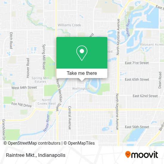
See Raintree Mkt., Indianapolis City (Balance), on the map
Public Transit to Raintree Mkt. in Indianapolis City (Balance)
Wondering how to get to Raintree Mkt. in Indianapolis City (Balance)? Moovit helps you find the best way to get to Raintree Mkt. with step-by-step directions from the nearest public transit station.
Moovit provides free maps and live directions to help you navigate through your city. View schedules, routes, timetables, and find out how long does it take to get to Raintree Mkt. in real time.
Looking for the nearest stop or station to Raintree Mkt.? Check out this list of stops closest to your destination: Broad Ripple Ave & Carrollton Ave; Broad Ripple Station Nb.
Bus: 82, 90, 19.
Want to see if there’s another route that gets you there at an earlier time? Moovit helps you find alternative routes or times. Get directions from and directions to Raintree Mkt. easily from the Moovit App or Website.
We make riding to Raintree Mkt. easy, which is why over 1.5 million users, including users in Indianapolis City (Balance), trust Moovit as the best app for public transit. You don’t need to download an individual bus app or train app, Moovit is your all-in-one transit app that helps you find the best bus time or train time available.
For information on prices of bus, costs and ride fares to Raintree Mkt., please check the Moovit app.
Use the app to navigate to popular places including to the airport, hospital, stadium, grocery store, mall, coffee shop, school, college, and university.
Raintree Mkt. Address: 882 E Coil St street in Indianapolis City (Balance)
- Bardales Seafood,
- Source Indy,
- Indianapolis Restaurant,
- Indianapolis Colts,
- Daniel Coffey, Attorney at Law,
- Darrow A Owens Attorney,
- Sturman Whitfield Group,
- Trek Bicycle Store,
- Create Art Studio,
- Johenna Design,
- Indy Home Shop,
- Ripple Chiropractic,
- Belladonna Salon,
- Ambre Blends Studio,
- Vintage Clothing Company,
- Litz Development,
- The Sapling School,
- Gary Halberstadt Dr do,
- Polish Interior and Art Design,
- Nomadic Skincare
Places Near Raintree Mkt. (Indianapolis City (Balance))
- Cotter's Massage Parlor With Happy Endings, Indianapolis City (Balance),
- Gainbridge Fieldhouse, Indianapolis City (Balance),
- Methodist Hospital of Indianapolis, Indianapolis City (Balance),
- St. Vincent Hospital - Indianapolis, Indianapolis City (Balance),
- Indianapolis Motor Speedway, Speedway,
- Castleton Square Mall, Indianapolis,
- Plainfield, IN, Plainfield,
- Lilly Corporate Center (Eli Lilly & Co), Indianapolis City (Balance),
- Indiana, Indianapolis City (Balance),
- Indiana Convention Center, Indianapolis City (Balance),
- Jersey Barn, Indianapolis City (Balance),
- I U Health Methodist Hospital, Indianapolis City (Balance),
- Lucas Oil Stadium, Indianapolis City (Balance),
- THE BALT, Indianapolis City (Balance),
- Eskenazi Hospital, Indianapolis City (Balance),
- St. Vincent entrance #1, Indianapolis City (Balance),
- Indianapolis Airport Zone 2, Indianapolis City (Balance),
- 119 W 19th St Parking, Indianapolis City (Balance),
- Train Ride At Castleton Mall, Indianapolis City (Balance),
- I-465 / I-65 Interchange, Indianapolis City (Balance)
How to get to popular places in Indianapolis with public transit
Get around Indianapolis City (Balance) by public transit!
Traveling around Indianapolis City (Balance) has never been so easy. See step by step directions as you travel to any attraction, street or major public transit station. View bus and train schedules, arrival times, service alerts and detailed routes on a map, so you know exactly how to get to anywhere in Indianapolis City (Balance).
When traveling to any destination around Indianapolis City (Balance) use Moovit's Live Directions with Get Off Notifications to know exactly where and how far to walk, how long to wait for your line, and how many stops are left. Moovit will alert you when it's time to get off — no need to constantly re-check whether yours is the next stop.
Wondering how to use public transit in Indianapolis City (Balance) or how to pay for public transit in Indianapolis City (Balance)? Moovit public transit app can help you navigate your way with public transit easily, and at minimum cost. It includes public transit fees, ticket prices, and costs. Looking for a map of Indianapolis City (Balance) public transit lines? Moovit public transit app shows all public transit maps in Indianapolis City (Balance) with all bus routes and stops on an interactive map.
Indianapolis has 1 transit type(s), including: bus, operated by several transit agencies, including IndyGo, FlixBus-us and Greyhound-us