How to get to Raise'N Roll by bus?
Click on the bus route to see step by step directions with maps, line arrival times and updated time schedules.
From Leesburg Corner Premium Outlet, Loudoun County
144 minFrom Clarksburg Premium Outlets, Montgomery County
175 minFrom Walmart Supercenter, Montgomery County
177 minFrom Kentlands, Montgomery County
128 minFrom Clarksburg Premium Outlets, Montgomery County
350 minFrom Kaiser Permanente - Gaithersburg Medical Center, Montgomery County
155 minFrom Montgomery Village, Maryland, Montgomery County
135 minFrom Montgomery County Fairgrounds, Montgomery County
153 minFrom Leesburg, Virginia, Loudoun County
126 min
Bus stop near Raise'N Roll in Washington, D.C. - Baltimore, MD
- Frederick Community College at Career And Technology Center, 20 min walk,VIEW
Bus lines to Raise'N Roll in Washington, D.C. - Baltimore, MD
What are the closest stations to Raise'N Roll?
The closest stations to Raise'N Roll are:
- Frederick Community College at Career And Technology Center is 1658 yards away, 20 min walk.
Which bus lines stop near Raise'N Roll?
These bus lines stop near Raise'N Roll: 515, 60.
What time is the first bus to Raise'N Roll in Washington, D.C. - Baltimore, MD?
The 60 is the first bus that goes to Raise'N Roll in Washington, D.C. - Baltimore, MD. It stops nearby at 6:40 AM.
What time is the last bus to Raise'N Roll in Washington, D.C. - Baltimore, MD?
The 61 is the last bus that goes to Raise'N Roll in Washington, D.C. - Baltimore, MD. It stops nearby at 9:45 PM.
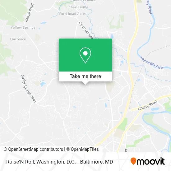
See Raise'N Roll, Washington, D.C. - Baltimore, MD, on the map
Public Transit to Raise'N Roll in Washington, D.C. - Baltimore, MD
Wondering how to get to Raise'N Roll in Washington, D.C. - Baltimore, MD? Moovit helps you find the best way to get to Raise'N Roll with step-by-step directions from the nearest public transit station.
Moovit provides free maps and live directions to help you navigate through your city. View schedules, routes, timetables, and find out how long does it take to get to Raise'N Roll in real time.
Looking for the nearest stop or station to Raise'N Roll? Check out this list of stops closest to your destination: Frederick Community College at Career And Technology Center.
Bus: 515, 60, 61, 80.
Want to see if there’s another route that gets you there at an earlier time? Moovit helps you find alternative routes or times. Get directions from and directions to Raise'N Roll easily from the Moovit App or Website.
We make riding to Raise'N Roll easy, which is why over 1.7 million users, including users in Washington, D.C. - Baltimore, MD, trust Moovit as the best app for public transit. You don’t need to download an individual bus app or train app, Moovit is your all-in-one transit app that helps you find the best bus time or train time available.
For information on prices of bus, costs and ride fares to Raise'N Roll, please check the Moovit app.
Get to Raise'N Roll with public transit and pay for the ride in the Moovit app. In addition to all info you may need for your trip to Raise'N Roll, including live directions, real-time arrivals and fare prices, you can also buy public transit passes for your rides. No need for cash or paper tickets to get to Raise'N Roll - everything you need is accessible in the app with a click of the button.
Use the app to navigate to popular places including to the airport, hospital, stadium, grocery store, mall, coffee shop, school, college, and university.
Raise'N Roll Address: 7000 Summerfield Dr street in Washington, D.C. - Baltimore, MD
- Frederick Community College,
- Gc3 Church,
- Park at Walnut Ridge,
- Fort Detrick,
- Job Service,
- National Cancer Institute at Frederick,
- CSV/Pharmacy,
- Fort Detrick,
- Fort Detrick,
- Frederick Memorial Hospital,
- Thomas Johnson Dr Suite,
- Dla Troop Support,
- Yellow Springs Music Company,
- Monocacy Boulevard Park & Ride,
- Wegmans,
- Vista View Apartments,
- 8555 US-15,
- Gov Thomas Johnson High School ,
- Bainbridge Market Commons,
- Crumland Farms
Places Near Raise'N Roll (Washington, D.C. - Baltimore, MD)
- Rock Creek Tennis Center, Washington,
- National Theatre, Washington,
- The Anthem, Washington,
- Washington DC VA Medical Center, Washington,
- Sibley Memorial Hospital, Washington,
- Georgetown, Washington,
- Marriott Marquis Washington, DC, Washington,
- Basilica of the National Shrine, Washington,
- Warner Theatre, Washington,
- Camden Yards, Baltimore,
- Washington National Cathedral, Washington,
- National Museum of African American History and Culture, Washington,
- Pennsylvania Ave NW (3rd st and pennsylvania), Washington,
- PG Mall, Prince George's County,
- Museum Of The Bible, Washington,
- M&T Bank Stadium, Baltimore,
- Westfield Montgomery Mall, Montgomery County,
- Amazon Hq2, Arlington County,
- Capital One Arena, Washington,
- National Zoo, Washington
How to get to popular places in Washington, D.C. - Baltimore, MD with public transit
Get around Washington, D.C. - Baltimore, MD by public transit!
Traveling around Washington, D.C. - Baltimore, MD has never been so easy. See step by step directions as you travel to any attraction, street or major public transit station. View bus and train schedules, arrival times, service alerts and detailed routes on a map, so you know exactly how to get to anywhere in Washington, D.C. - Baltimore, MD.
When traveling to any destination around Washington, D.C. - Baltimore, MD use Moovit's Live Directions with Get Off Notifications to know exactly where and how far to walk, how long to wait for your line, and how many stops are left. Moovit will alert you when it's time to get off — no need to constantly re-check whether yours is the next stop.
Wondering how to use public transit in Washington, D.C. - Baltimore, MD or how to pay for public transit in Washington, D.C. - Baltimore, MD? Moovit public transit app can help you navigate your way with public transit easily, and at minimum cost. It includes public transit fees, ticket prices, and costs. Looking for a map of Washington, D.C. - Baltimore, MD public transit lines? Moovit public transit app shows all public transit maps in Washington, D.C. - Baltimore, MD with all Bus, Train, Metro, Light Rail and Ferry routes and stops on an interactive map.
Washington, D.C. - Baltimore, MD has 5 transit type(s), including: Bus, Train, Metro, Light Rail and Ferry, operated by several transit agencies, including WMATA, Montgomery County Ride On, Fairfax Connector, TheBus, PRTC, DASH - Alexandria, Arlington Transit (ART), RTA of Central Maryland, MDOT MTA, MDOT MTA Light RailLink, MDOT MTA Commuter Bus, MDOT MTA Local Bus, FXBGO!, Virginia Railway Express (VRE) and MARC