How to get to Raising Cane's by bus?
Click on the bus route to see step by step directions with maps, line arrival times and updated time schedules.
Bus stops near Raising Cane's in Modesto
Bus lines to Raising Cane's in Modesto
What are the closest stations to Raising Cane's?
The closest stations to Raising Cane's are:
- Sisk Rd & Vintage Dr is 332 yards away, 5 min walk.
- Bangs Ave & Enterprise Way is 737 yards away, 9 min walk.
Which bus line stops near Raising Cane's?
31 (Mall Back Entrance→Bay D - Modesto Transit Center - Exit on)
What’s the nearest bus station to Raising Cane's in Modesto?
The nearest bus station to Raising Cane's in Modesto is Sisk Rd & Vintage Dr. It’s a 5 min walk away.
What time is the first bus to Raising Cane's in Modesto?
The 31 is the first bus that goes to Raising Cane's in Modesto. It stops nearby at 6:35 AM.
What time is the last bus to Raising Cane's in Modesto?
The 31 is the last bus that goes to Raising Cane's in Modesto. It stops nearby at 9:39 PM.
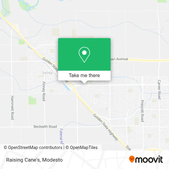
See Raising Cane's, Modesto, on the map
Public Transit to Raising Cane's in Modesto
Wondering how to get to Raising Cane's in Modesto? Moovit helps you find the best way to get to Raising Cane's with step-by-step directions from the nearest public transit station.
Moovit provides free maps and live directions to help you navigate through your city. View schedules, routes, timetables, and find out how long does it take to get to Raising Cane's in real time.
Looking for the nearest stop or station to Raising Cane's? Check out this list of stops closest to your destination: Sisk Rd & Vintage Dr; Bangs Ave & Enterprise Way.
Bus: 31, 48.
Want to see if there’s another route that gets you there at an earlier time? Moovit helps you find alternative routes or times. Get directions from and directions to Raising Cane's easily from the Moovit App or Website.
We make riding to Raising Cane's easy, which is why over 1.5 million users, including users in Modesto, trust Moovit as the best app for public transit. You don’t need to download an individual bus app or train app, Moovit is your all-in-one transit app that helps you find the best bus time or train time available.
For information on prices of bus, costs and ride fares to Raising Cane's, please check the Moovit app.
Use the app to navigate to popular places including to the airport, hospital, stadium, grocery store, mall, coffee shop, school, college, and university.
Raising Cane's Address: 3801 Pelandale Ave street in Modesto
- Costco,
- Christina Chantel Salon Suite,
- Ulta,
- Mildred Perkins Elementary School,
- Amazon Locker-Tamara,
- Samsonite,
- Target,
- Kaiser Permanente Modesto Medical Center,
- Kaiser Permanente,
- BTS,
- Bail by Phone Bail Bonds - Ramirez Bail Bonds,
- Kaiser Permanente Health Care,
- Kaiser Medical Offices,
- Samsonite,
- Kaiser Permanente Modesto, Code C Cafe,
- Salida Regional Library,
- Vintage Faire Mall,
- Simply Charming Italian Charm Bracelets,
- Go! Calendars,
- Vintage Mall at Dale Rd. & Veneman Ave.
Places Near Raising Cane's (Modesto)
- Vintage Faire Mall,
- Ceres CA USA, Ceres,
- Modesto Junior College,
- Black Oak Casino,
- Patterson,
- DMV,
- Tesla,
- Newman CA USA, Newman,
- Costco Wholesale, Turlock,
- Amazon Fulfillment Center,
- Costco,
- Emanuel Medical Center, Turlock,
- Modesto Junior College - West Campus, Modesto,
- Salida, Ca, Salida,
- Modesto Amtrak (MOD),
- Highway 99 South -Traffic,
- Turlock, CA, Turlock,
- Modesto Junior College-East Campus,
- Kaiser Permanente Modesto Medical Center,
- Modesto, Ca
How to get to popular places in Modesto with public transit
Get around Modesto by public transit!
Traveling around Modesto has never been so easy. See step by step directions as you travel to any attraction, street or major public transit station. View bus and train schedules, arrival times, service alerts and detailed routes on a map, so you know exactly how to get to anywhere in Modesto.
When traveling to any destination around Modesto use Moovit's Live Directions with Get Off Notifications to know exactly where and how far to walk, how long to wait for your line, and how many stops are left. Moovit will alert you when it's time to get off — no need to constantly re-check whether yours is the next stop.
Wondering how to use public transit in Modesto or how to pay for public transit in Modesto? Moovit public transit app can help you navigate your way with public transit easily, and at minimum cost. It includes public transit fees, ticket prices, and costs. Looking for a map of Modesto public transit lines? Moovit public transit app shows all public transit maps in Modesto with all bus routes and stops on an interactive map.
Modesto has 1 transit type(s), including: bus, operated by several transit agencies, including The S, Turlock Transit, Greyhound-us and FlixBus-us