How to get to Raj Prakash Sweets by bus?
Click on the bus route to see step by step directions with maps, line arrival times and updated time schedules.
From PMC Armed Force Medical College(Afmc), Pune & Velhe
63 minFrom Vikhe Patil Memorial School, Pune & Velhe
44 minFrom Khadakwasla Dam, Pune & Velhe
49 minFrom Ruby Hall Clinic, Pune & Velhe
59 minFrom AFMC, Pune & Velhe
61 minFrom Kendriya Vidyalaya, Pune & Velhe
72 minFrom ISB&M, Paud
54 minFrom Shivajinagar District Sessions Court, Pune & Velhe
42 minFrom Guruwar Peth, Pune & Velhe
53 minFrom Shivajinagar Railway Station, Pune & Velhe
41 min
Bus stops near Raj Prakash Sweets in Pune & Velhe
Metro station near Raj Prakash Sweets in Pune & Velhe
- Vanaz, 30 min walk,VIEW
Bus lines to Raj Prakash Sweets in Pune & Velhe
- 43, Nigdi Bhakti Shakti Terminal - Katraj,VIEW
- 44, Akurdi Railway Station - Katraj,VIEW
- 45, Radha Chowk (Mhalunge Phata) - Katraj,VIEW
- 80, Ma.Na.Pa Bhavan ⟲ Ma.Na.Pa Bhavan Via Rahul Park (Circular),VIEW
- 228, Katraj - Vadgaon Mawal,VIEW
- 43A, Hinjawadi Maan Phase 3 - Katraj,VIEW
- 64A, Shewalewadi Depot - Aditya Garden City Dnyaneshwari Udyan,VIEW
- 144A, Aditya Garden City Dnyaneshwari Udyan - Pune Station,VIEW
- 228B, Balewadi Depot - Katraj,VIEW
- METRO SHUTTLE 3, Sutardara - Ganpati Matha,VIEW
- 50N, Nigdi Bhakti Shakti Terminal - Sinhgad Paytha,VIEW
- 80A, Ma.Na.Pa Bhavan,VIEW
- 64, Bhekrainagar Depot - NDA Gate No.10,VIEW
- 66, Thakarwadi - Marketyard,VIEW
- 72, Sukhsagarnagar - NDA Gate No.10,VIEW
- 77, Hinjawadi Maan Phase 3 - Ganpati Matha,VIEW
- 78, Marketyard - NDA Gate No.10,VIEW
- 82, NDA Gate No.10 ⟲ NDA Gate No.10 Via Ma.Na.Pa Bhavan (Circular),VIEW
- 83, NDA Gate No.10 - Alandi ST Stand,VIEW
- 84, Deccan Gymkhana - Mutha Gaon,VIEW
What are the closest stations to Raj Prakash Sweets?
The closest stations to Raj Prakash Sweets are:
- Cipla Center Atul Nagar is 54 meters away, 1 min walk.
- Atulnagar Warje is 56 meters away, 1 min walk.
- Malwadi is 830 meters away, 11 min walk.
- Warje Pul is 860 meters away, 12 min walk.
- Vanaz is 2314 meters away, 30 min walk.
Which bus lines stop near Raj Prakash Sweets?
These bus lines stop near Raj Prakash Sweets: 174, 202, 228, 43A, 64A, 80, 98.
What’s the nearest metro station to Raj Prakash Sweets in Pune & Velhe?
The nearest metro station to Raj Prakash Sweets in Pune & Velhe is Vanaz. It’s a 30 min walk away.
What’s the nearest bus station to Raj Prakash Sweets in Pune & Velhe?
The nearest bus stations to Raj Prakash Sweets in Pune & Velhe are Cipla Center Atul Nagar and Atulnagar Warje. The closest one is a 1 min walk away.
What time is the first metro to Raj Prakash Sweets in Pune & Velhe?
The AQUA is the first metro that goes to Raj Prakash Sweets in Pune & Velhe. It stops nearby at 6:00 AM.
What time is the last metro to Raj Prakash Sweets in Pune & Velhe?
The AQUA is the last metro that goes to Raj Prakash Sweets in Pune & Velhe. It stops nearby at 11:36 PM.
What time is the first bus to Raj Prakash Sweets in Pune & Velhe?
The RATRANI 7 is the first bus that goes to Raj Prakash Sweets in Pune & Velhe. It stops nearby at 4:37 AM.
What time is the last bus to Raj Prakash Sweets in Pune & Velhe?
The RATRANI 7 is the last bus that goes to Raj Prakash Sweets in Pune & Velhe. It stops nearby at 2:04 AM.
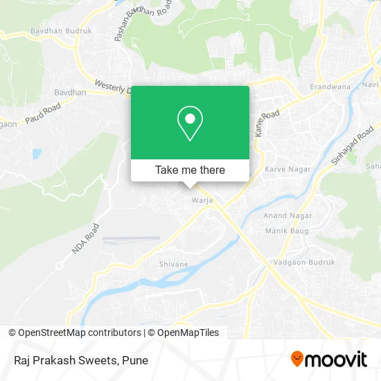
See Raj Prakash Sweets, Pune & Velhe, on the map
Public Transit to Raj Prakash Sweets in Pune & Velhe
Wondering how to get to Raj Prakash Sweets in Pune & Velhe? Moovit helps you find the best way to get to Raj Prakash Sweets with step-by-step directions from the nearest public transit station.
Moovit provides free maps and live directions to help you navigate through your city. View schedules, routes, timetables, and find out how long does it take to get to Raj Prakash Sweets in real time.
Looking for the nearest stop or station to Raj Prakash Sweets? Check out this list of stops closest to your destination: Cipla Center Atul Nagar; Atulnagar Warje; Malwadi; Warje Pul; Vanaz.
Bus: 174, 202, 228, 43A, 64A, 80, 98, 43, 44, 45, 80A, 64, 66, 72, 77, 78, K7, K7A, 84AC, 84B, 276B.Metro: AQUA.
Want to see if there’s another route that gets you there at an earlier time? Moovit helps you find alternative routes or times. Get directions from and directions to Raj Prakash Sweets easily from the Moovit App or Website.
We make riding to Raj Prakash Sweets easy, which is why over 1.5 million users, including users in Pune & Velhe, trust Moovit as the best app for public transit. You don’t need to download an individual bus app or train app, Moovit is your all-in-one transit app that helps you find the best bus time or train time available.
For information on prices of bus, costs and ride fares to Raj Prakash Sweets, please check the Moovit app.
Use the app to navigate to popular places including to the airport, hospital, stadium, grocery store, mall, coffee shop, school, college, and university.
Raj Prakash Sweets Address: Popular Nagar Road पुणे 411058 MH street in Pune & Velhe
- Modern Pre Primary English Medium School,
- Suryamukhi Ganesh,
- Pandit Jawaharlal Nehru Prathamik Vidyamandir,
- Ishani Complex,
- Malshe Clinic,
- Bhor Electrical Work,
- Runwal Meadows,
- Modern High School,
- Dhyeyavede,
- Washing Machine Repairing MDS Enterprises,
- Satyam Super Market,
- Giridhar Nagar D14,
- Gagan Ashish Residency,
- Om Medical,
- Gurunath Car Care,
- Home Design Furniture & All Interior Works,
- Universal Society Hall & Temple,
- Nitesh Auto Garage,
- Giridhar Club,
- Royal Furniture
Places Near Raj Prakash Sweets (Pune & Velhe)
- Dagadusheth Halwai Ganapati Temple, Pune & Velhe,
- Symbiosis Lavale Bus Stop, Pune & Velhe,
- Swaminarayan Mandir, Pune & Velhe,
- Pvr Icon - Pavilion Mall, Pune & Velhe,
- M G Road, Pune & Velhe,
- Cognizant Deccan Campus (CDC), Paud,
- Westend Mall, Pune & Velhe,
- Senapati Bapat Road, Pune & Velhe,
- Dagdusheth Halwai Ganpati Mandir, Pune & Velhe,
- Fc Road, Pune & Velhe,
- Tulshibaug, Pune & Velhe,
- Chaturshringi Temple, Pune & Velhe,
- ISKCON Nvcc Temple, Pune & Velhe,
- Vishwakarma Institute Of Technology (Vit), Pune & Velhe,
- BAPS Shri Swaminarayan Mandir, Pune & Velhe,
- Ion Digital Zone, Pune & Velhe,
- Pune Okayama Friendship Garden, Pune & Velhe,
- ISKCON Pune, Pune & Velhe,
- Laxmi Road, Pune & Velhe,
- Sarasbaug, Pune & Velhe
How to get to popular places in Pune with public transit
Get around Pune & Velhe by public transit!
Traveling around Pune & Velhe has never been so easy. See step by step directions as you travel to any attraction, street or major public transit station. View bus and train schedules, arrival times, service alerts and detailed routes on a map, so you know exactly how to get to anywhere in Pune & Velhe.
When traveling to any destination around Pune & Velhe use Moovit's Live Directions with Get Off Notifications to know exactly where and how far to walk, how long to wait for your line, and how many stops are left. Moovit will alert you when it's time to get off — no need to constantly re-check whether yours is the next stop.
Wondering how to use public transit in Pune & Velhe or how to pay for public transit in Pune & Velhe? Moovit public transit app can help you navigate your way with public transit easily, and at minimum cost. It includes public transit fees, ticket prices, and costs. Looking for a map of Pune & Velhe public transit lines? Moovit public transit app shows all public transit maps in Pune & Velhe with all Bus, Train and Metro routes and stops on an interactive map.
Pune has 3 transit type(s), including: Bus, Train and Metro, operated by several transit agencies, including Pune Metro (Maha Metro), PMPML, PMPML Night Bus Service (Ratrani) and Central Railways (Indian Railways)