Directions to Rajah Sulayman Park (Manila) with public transportation
The following transit lines have routes that pass near Rajah Sulayman Park
 Bus: BUS, JEEP, P2P, 27.
- Train: LRT 1, PNR MC.
How to get to Rajah Sulayman Park by bus?
Click on the bus route to see step by step directions with maps, line arrival times and updated time schedules.
How to get to Rajah Sulayman Park by train?
Click on the train route to see step by step directions with maps, line arrival times and updated time schedules.
Bus stops near Rajah Sulayman Park in Manila
- A.Mabini, Manila, 2 min walk,
- Gen M Malvar / M Adriatico Intersection, Manila, 2 min walk,
- Pan Pacific Hotel, 3 min walk,
- Roxas Blvd/President Querino Av, Manila, 4 min walk,
- Marcelo H. Del Pilar / Sinagoga Intersection, Manila, 5 min walk,
- Remedios / Jorge Bocobo Intersection, Manila, 7 min walk,
- M Adriatico / San Andres Intersection, Manila, 8 min walk,
Train stations near Rajah Sulayman Park in Manila
- Quirino Ave Lrt, 15 min walk,
- San Andres Pnr, 27 min walk,
Bus lines to Rajah Sulayman Park in Manila
- JEEP, Blumentrit Vito Cruz via Quiapo Mabini,
- JEEP, BACLARAN - MCU via MABINI,
- JEEP, BACLARAN - QUIAPO,
- JEEP, Blumentrit Vito Cruz via L Guinto Sta C,
- JEEP, CUBAO - V CRUZ,
- JEEP, Escolta-Libertad via Mabini,
- JEEP, Kamuning - Vito Cruz via E. Rodriguez, Mabini,
- JEEP, MCU-PASAY RTDA, MABINI,
- JEEP, Monumento - Vito C ruz via Rizal Ave., Mabini,
- JEEP, BLUMENTRITT - PASAY RTDA via MABINI,
- JEEP, Libertad MCU via Mabini,
- JEEP, FRISCO-VITO CRUZvia MABINI,
- JEEP, Blumentritt - Vito Cruz via Quiapo, Mabini,
- JEEP, Blumentritt - Libertad via Sta. Cruz, Mabini,
- JEEP, Baclaran - Q.I.via Mabini,
- JEEP, Baclaran - P. Campa via Mabini,
- JEEP, LIBERTAD-PIER SOUTH,
- JEEP, Libertad QI via Mabini,
- JEEP, Baclaran - Divisoria via Mabini,
- JEEP, Blumentrit Mabini via Quiapo,
What are the closest stations to Rajah Sulayman Park?
The closest stations to Rajah Sulayman Park are:
- A.Mabini, Manila stop is 66 meters away, 2 min walk.
- Gen M Malvar / M Adriatico Intersection, Manila stop is 86 meters away, 2 min walk.
- Pan Pacific Hotel stop is 112 meters away, 3 min walk.
- Roxas Blvd/President Querino Av, Manila stop is 258 meters away, 4 min walk.
- Marcelo H. Del Pilar / Sinagoga Intersection, Manila stop is 277 meters away, 5 min walk.
- Remedios / Jorge Bocobo Intersection, Manila stop is 457 meters away, 7 min walk.
- M Adriatico / San Andres Intersection, Manila stop is 623 meters away, 8 min walk.
- Quirino Ave Lrt station is 1077 meters away, 15 min walk.
- San Andres Pnr station is 2020 meters away, 27 min walk.
Which bus lines stop near Rajah Sulayman Park?
These bus lines stop near Rajah Sulayman Park: BUS, JEEP, P2P.
Which train lines stop near Rajah Sulayman Park?
These train lines stop near Rajah Sulayman Park: LRT 1, PNR MC.
What’s the nearest train station to Rajah Sulayman Park in Manila?
The nearest train station to Rajah Sulayman Park in Manila is Quirino Ave Lrt. It’s a 15 min walk away.
What’s the nearest bus station to Rajah Sulayman Park in Manila?
The nearest bus stations to Rajah Sulayman Park in Manila are A.Mabini, Manila and Gen M Malvar / M Adriatico Intersection, Manila. The closest one is a 2 min walk away.
What time is the first train to Rajah Sulayman Park in Manila?
The LRT 1 is the first train that goes to Rajah Sulayman Park in Manila. It stops nearby at 5:09 AM.
What time is the last train to Rajah Sulayman Park in Manila?
The PNR MC is the last train that goes to Rajah Sulayman Park in Manila. It stops nearby at 1:16 AM.
What time is the first bus to Rajah Sulayman Park in Manila?
The P2P is the first bus that goes to Rajah Sulayman Park in Manila. It stops nearby at 6:16 AM.
What time is the last bus to Rajah Sulayman Park in Manila?
The BUS is the last bus that goes to Rajah Sulayman Park in Manila. It stops nearby at 2:50 AM.
See Rajah Sulayman Park, Manila, on the map
Public Transit to Rajah Sulayman Park in Manila
Wondering how to get to Rajah Sulayman Park in Manila? Moovit helps you find the best way to get to Rajah Sulayman Park with step-by-step directions from the nearest public transit station.
Moovit provides free maps and live directions to help you navigate through your city. View schedules, routes, timetables, and find out how long does it take to get to Rajah Sulayman Park in real time.
Looking for the nearest stop or station to Rajah Sulayman Park? Check out this list of stops closest to your destination: A.Mabini; Gen M Malvar / M Adriatico Intersection; Pan Pacific Hotel; Roxas Blvd/President Querino Av; Marcelo H. Del Pilar / Sinagoga Intersection; Remedios / Jorge Bocobo Intersection; M Adriatico / San Andres Intersection; Quirino Ave Lrt; San Andres Pnr.
Bus: BUS, JEEP, P2P, 27.Train: LRT 1, PNR MC.
Want to see if there’s another route that gets you there at an earlier time? Moovit helps you find alternative routes or times. Get directions from and directions to Rajah Sulayman Park easily from the Moovit App or Website.
We make riding to Rajah Sulayman Park easy, which is why over 1.7 billion users, including users in Manila, trust Moovit as the best app for public transit. You don’t need to download an individual bus app or train app, Moovit is your all-in-one transit app that helps you find the best bus time or train time available.
For information on prices of bus and train, costs and ride fares to Rajah Sulayman Park, please check the Moovit app.
Use the app to navigate to popular places including to the airport, hospital, stadium, grocery store, mall, coffee shop, school, college, and university.
Rajah Sulayman Park Address: San Andres Street street in Manila
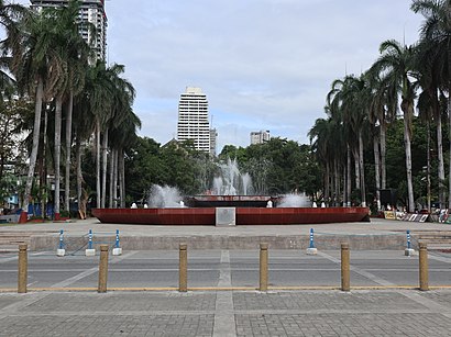
- Plaza Rajah Sulayman,
- Shakey's (Shakey's -Malate),
- Max's Restaurant (Max's Malate),
- Church of Malate (Malate Church - Our Lady of Remedies Parish Church),
- Philtrust Bank,
- The Aristocrat,
- Roxas Blvd,
- Malate Church - Our Lady of Remedies Parish Church,
- M. H. Del Pilar Street & San Andres Street,
- The Aristocrat Restaurant (Aristocrat (Malate)),
- The Aristocrat Restaurant,
- Baywalk,
- Patio lounge,
- Mostafa Spa,
- Cafe Roo,
- Patio de manila,
- jose reyes memorial medical center urology Department,
- Photoism Box,
- Bay Park Basketball Court,
- Malate Catholic Church
Places Near Rajah Sulayman Park (Manila)
- PSA - East Ave, Quezon City,
- CCF Center Main, Pasig City,
- U.S. Embassy, Manila Philippines, Manila,
- Jose R. Reyes Memorial Medical Center, Manila,
- Farmers Plaza Cubao, Quezon City,
- Dfa Aseana, Parañaque,
- Ayala Malls Feliz, Pasig City,
- Civil Service Commission NCR Office, Quezon City,
- Ynares Sports Arena, Pasig City,
- East Avenue Medical Center, Quezon City,
- Lemon Square Munoz QC, Quezon City,
- SM City North EDSA, Quezon City,
- Fisher Mall, Quezon City,
- WWW.Youjizz.Com, Antipolo City,
- Eton Centris, Quezon City,
- Parqal Mall, Parañaque,
- SB Park, Tandang Sora, Q.C., Quezon City,
- Double Dragon Plaza,
- Jones Bridge, Manila,
- Bridgetowne, Quezon City
How to get to popular places in Manila with public transit
Get around Manila by public transit!
Traveling around Manila has never been so easy. See step by step directions as you travel to any attraction, street or major public transit station. View bus and train schedules, arrival times, service alerts and detailed routes on a map, so you know exactly how to get to anywhere in Manila.
When traveling to any destination around Manila use Moovit's Live Directions with Get Off Notifications to know exactly where and how far to walk, how long to wait for your line, and how many stops are left. Moovit will alert you when it's time to get off — no need to constantly re-check whether yours is the next stop.
Wondering how to use public transit in Manila or how to pay for public transit in Manila? Moovit public transit app can help you navigate your way with public transit easily, and at minimum cost. It includes public transit fees, ticket prices, and costs. Looking for a map of Manila public transit lines? Moovit public transit app shows all public transit maps in Manila with all Bus and Train routes and stops on an interactive map.
Manila has 2 transit type(s), including: Bus and Train, operated by several transit agencies, including MRTC, LRTA, PNR, LTFRB, BGC Bus, P2P and UV Express