How to get to Rajender Macha, Od by bus?
Click on the bus route to see step by step directions with maps, line arrival times and updated time schedules.
From 38th North Dr / N Hawthorne Ln, Indianapolis City (Balance)
65 minFrom 16th Street and Shadeland Ave., Indianapolis City (Balance)
63 minFrom Madison & Stop 10, Indianapolis City (Balance)
36 minFrom Penske Auto Center, Indianapolis City (Balance)
46 minFrom Marian University, Indianapolis City (Balance)
59 minFrom Cathedral Of Faith Christian Life Center, Indianapolis City (Balance)
36 minFrom My Indy Dental Center, Indianapolis City (Balance)
39 minFrom Ross Hall Front Desk, Indianapolis City (Balance)
51 minFrom Indiana State Police West Information Booth, Indianapolis City (Balance)
47 minFrom I-65 & Southport Rd, Indianapolis City (Balance)
53 min
Bus stops near Rajender Macha, Od in Indianapolis City (Balance)
Bus lines to Rajender Macha, Od in Indianapolis City (Balance)
What are the closest stations to Rajender Macha, Od?
The closest stations to Rajender Macha, Od are:
- East St & Orange St is 257 yards away, 4 min walk.
- Prospect St & Olive St is 727 yards away, 9 min walk.
- Pleasant Run Station Nb is 1012 yards away, 12 min walk.
Which bus lines stop near Rajender Macha, Od?
These bus lines stop near Rajender Macha, Od: 26, 90.
What’s the nearest bus station to Rajender Macha, Od in Indianapolis City (Balance)?
The nearest bus station to Rajender Macha, Od in Indianapolis City (Balance) is East St & Orange St. It’s a 4 min walk away.
What time is the first bus to Rajender Macha, Od in Indianapolis City (Balance)?
The 13 is the first bus that goes to Rajender Macha, Od in Indianapolis City (Balance). It stops nearby at 4:52 AM.
What time is the last bus to Rajender Macha, Od in Indianapolis City (Balance)?
The 90 is the last bus that goes to Rajender Macha, Od in Indianapolis City (Balance). It stops nearby at 12:48 AM.
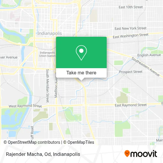
See Rajender Macha, Od, Indianapolis City (Balance), on the map
Public Transit to Rajender Macha, Od in Indianapolis City (Balance)
Wondering how to get to Rajender Macha, Od in Indianapolis City (Balance)? Moovit helps you find the best way to get to Rajender Macha, Od with step-by-step directions from the nearest public transit station.
Moovit provides free maps and live directions to help you navigate through your city. View schedules, routes, timetables, and find out how long does it take to get to Rajender Macha, Od in real time.
Looking for the nearest stop or station to Rajender Macha, Od? Check out this list of stops closest to your destination: East St & Orange St; Prospect St & Olive St; Pleasant Run Station Nb.
Bus: 26, 90, 13.
Want to see if there’s another route that gets you there at an earlier time? Moovit helps you find alternative routes or times. Get directions from and directions to Rajender Macha, Od easily from the Moovit App or Website.
We make riding to Rajender Macha, Od easy, which is why over 1.5 million users, including users in Indianapolis City (Balance), trust Moovit as the best app for public transit. You don’t need to download an individual bus app or train app, Moovit is your all-in-one transit app that helps you find the best bus time or train time available.
For information on prices of bus, costs and ride fares to Rajender Macha, Od, please check the Moovit app.
Use the app to navigate to popular places including to the airport, hospital, stadium, grocery store, mall, coffee shop, school, college, and university.
Rajender Macha, Od Address: 1429 Shelby St Ste B street in Indianapolis City (Balance)
- Voices Corp.,
- USPS Collection Box - Blue Box,
- 317 Juicery,
- Cavity Factory,
- Elf 'n Moon,
- Phillips 66,
- Crystal Ball Printing,
- Sauna Social,
- Orange Hill Media,
- Nexxus Movement,
- Community Justice Campus,
- Goodwill,
- PNC Bank,
- Singh Constructions,
- Rockitcoin,
- Indianapolis Metropolitan Police Department Southeast District,
- Crazy Neighborhood Grill and Bar,
- Axcess PC Consulting,
- The Visionaries,
- Fountain Square Dental Clinic
Places Near Rajender Macha, Od (Indianapolis City (Balance))
- Indiana, Indianapolis City (Balance),
- Plainfield, IN, Plainfield,
- Indiana Convention Center, Indianapolis City (Balance),
- THE BALT, Indianapolis City (Balance),
- Lucas Oil Stadium, Indianapolis City (Balance),
- I U Health Methodist Hospital, Indianapolis City (Balance),
- 119 W 19th St Parking, Indianapolis City (Balance),
- Eskenazi Hospital, Indianapolis City (Balance),
- Lilly Corporate Center (Eli Lilly & Co), Indianapolis City (Balance),
- Castleton Square Mall, Indianapolis,
- Gainbridge Fieldhouse, Indianapolis City (Balance),
- St. Vincent Hospital - Indianapolis, Indianapolis City (Balance),
- Cotter's Massage Parlor With Happy Endings, Indianapolis City (Balance),
- Jersey Barn, Indianapolis City (Balance),
- Train Ride At Castleton Mall, Indianapolis City (Balance),
- I-465 / I-65 Interchange, Indianapolis City (Balance),
- Indianapolis Airport Zone 2, Indianapolis City (Balance),
- Indianapolis Motor Speedway, Speedway,
- St. Vincent entrance #1, Indianapolis City (Balance),
- Methodist Hospital of Indianapolis, Indianapolis City (Balance)
How to get to popular places in Indianapolis with public transit
Get around Indianapolis City (Balance) by public transit!
Traveling around Indianapolis City (Balance) has never been so easy. See step by step directions as you travel to any attraction, street or major public transit station. View bus and train schedules, arrival times, service alerts and detailed routes on a map, so you know exactly how to get to anywhere in Indianapolis City (Balance).
When traveling to any destination around Indianapolis City (Balance) use Moovit's Live Directions with Get Off Notifications to know exactly where and how far to walk, how long to wait for your line, and how many stops are left. Moovit will alert you when it's time to get off — no need to constantly re-check whether yours is the next stop.
Wondering how to use public transit in Indianapolis City (Balance) or how to pay for public transit in Indianapolis City (Balance)? Moovit public transit app can help you navigate your way with public transit easily, and at minimum cost. It includes public transit fees, ticket prices, and costs. Looking for a map of Indianapolis City (Balance) public transit lines? Moovit public transit app shows all public transit maps in Indianapolis City (Balance) with all bus routes and stops on an interactive map.
Indianapolis has 1 transit type(s), including: bus, operated by several transit agencies, including IndyGo, FlixBus-us and Greyhound-us