How to get to Rajendra Photography by bus?
Click on the bus route to see step by step directions with maps, line arrival times and updated time schedules.
From Vajreshwari Temple in Vasai West, Vasai
45 minFrom Vasai Fort, Vasai
47 minFrom Jivdani Temple in Virar East, Nalasopara
56 minFrom Shyam Baba Mandir, Mira Bhayandar
106 minFrom Anand Nagar, Mira Bhayandar
107 minFrom Jivdani Mandir Virar, Vasai
59 minFrom Suruchi Beach, Vasai
52 minFrom Netaji Subhash Chandra Bose Ground, Mira Bhayandar
113 minFrom Maxus Mall, Mira Bhayandar
103 min
How to get to Rajendra Photography by train?
Click on the train route to see step by step directions with maps, line arrival times and updated time schedules.
Bus stops near Rajendra Photography in Vasai
Train stations near Rajendra Photography in Vasai
Bus lines to Rajendra Photography in Vasai
What are the closest stations to Rajendra Photography?
The closest stations to Rajendra Photography are:
- Panchvati Naka is 603 meters away, 9 min walk.
- 60 Feet Road is 1082 meters away, 15 min walk.
- Indian Oil Corporation Limited is 1213 meters away, 16 min walk.
- Nala Sopara is 1805 meters away, 24 min walk.
- Vasai Road is 4813 meters away, 62 min walk.
Which bus lines stop near Rajendra Photography?
These bus lines stop near Rajendra Photography: 101, 105, 110, 112, 115.
Which train lines stop near Rajendra Photography?
These train lines stop near Rajendra Photography: CGDR, WR.
What’s the nearest train station to Rajendra Photography in Vasai?
The nearest train station to Rajendra Photography in Vasai is Nala Sopara. It’s a 24 min walk away.
What’s the nearest bus station to Rajendra Photography in Vasai?
The nearest bus station to Rajendra Photography in Vasai is Panchvati Naka. It’s a 9 min walk away.
What time is the first train to Rajendra Photography in Vasai?
The WR is the first train that goes to Rajendra Photography in Vasai. It stops nearby at 3:32 AM.
What time is the last train to Rajendra Photography in Vasai?
The WR is the last train that goes to Rajendra Photography in Vasai. It stops nearby at 2:27 AM.
What time is the first bus to Rajendra Photography in Vasai?
The 101 is the first bus that goes to Rajendra Photography in Vasai. It stops nearby at 5:07 AM.
What time is the last bus to Rajendra Photography in Vasai?
The 101 is the last bus that goes to Rajendra Photography in Vasai. It stops nearby at 12:43 AM.
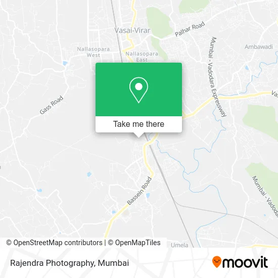
See Rajendra Photography, Vasai, on the map
Public Transit to Rajendra Photography in Vasai
Wondering how to get to Rajendra Photography in Vasai? Moovit helps you find the best way to get to Rajendra Photography with step-by-step directions from the nearest public transit station.
Moovit provides free maps and live directions to help you navigate through your city. View schedules, routes, timetables, and find out how long does it take to get to Rajendra Photography in real time.
Looking for the nearest stop or station to Rajendra Photography? Check out this list of stops closest to your destination: Panchvati Naka; 60 Feet Road; Indian Oil Corporation Limited; Nala Sopara; Vasai Road.
Bus: 101, 105, 110, 112, 115, 130, 306, 128, 102, 106.Train: CGDR, WR, WR-AC, WR-AC, WR-AC, WR-AC, BVDR, MEMU, MEMU, MEMU.
Want to see if there’s another route that gets you there at an earlier time? Moovit helps you find alternative routes or times. Get directions from and directions to Rajendra Photography easily from the Moovit App or Website.
We make riding to Rajendra Photography easy, which is why over 1.5 million users, including users in Vasai, trust Moovit as the best app for public transit. You don’t need to download an individual bus app or train app, Moovit is your all-in-one transit app that helps you find the best bus time or train time available.
For information on prices of bus and train, costs and ride fares to Rajendra Photography, please check the Moovit app.
Use the app to navigate to popular places including to the airport, hospital, stadium, grocery store, mall, coffee shop, school, college, and university.
Rajendra Photography Address: Vasai 401202 MH street in Vasai
- TCS,
- Parshva Sharnam Apartment,
- Anvi Voyages,
- Harlife Product for Weight Loose,
- Oven Story Pizza,
- Behrouz Biryani Vasai,
- Web & Graphic Designer,
- Sharon Fellowship Church Vasai Road West,
- Anjali Estate Consultancy,
- Malwani Church,
- Sandeep Dry Cleaners,
- Digital Marketer Nikhat Khan,
- Faasos (Vasai),
- Om Sagar Cooperative Housing Society,
- First Gents Parlour,
- BCB Shekhar P Poojari,
- Prajwal Real Estate Consultants,
- Patel Pul Sidhi MP,
- Vasai Gomantak,
- Moonlight Production
Places Near Rajendra Photography (Vasai)
- Gateway Of India,
- Oberoi Mall, Dindoshi,
- Worli Sea Face,
- R CITY MALL, Ghatkopar East,
- INFINITI Mall (Infinity Mall, andheri), Versova,
- Govardhan Ecovillage, Palghar (St),
- Malabar Hill, Malabar Hill,
- Bombay Exhibition Center, Goregaon,
- Dome @ Nsci - Svp Stadium Mumbai, Worli,
- NESCO, Goregaon,
- Inorbit Mall, Malad West,
- Bhaucha Dhakka,
- TCS Olympus, Thane,
- Mumbai University, Kalina,
- Rani Baug, Byculla,
- Oberoi Sky City, Borivali East,
- Juhu Beach,
- Ikea, Worli,
- J. J. Hospital, Byculla,
- Hinduja Hospital, Mahim
How to get to popular places in Mumbai with public transit
Get around Vasai by public transit!
Traveling around Vasai has never been so easy. See step by step directions as you travel to any attraction, street or major public transit station. View bus and train schedules, arrival times, service alerts and detailed routes on a map, so you know exactly how to get to anywhere in Vasai.
When traveling to any destination around Vasai use Moovit's Live Directions with Get Off Notifications to know exactly where and how far to walk, how long to wait for your line, and how many stops are left. Moovit will alert you when it's time to get off — no need to constantly re-check whether yours is the next stop.
Wondering how to use public transit in Vasai or how to pay for public transit in Vasai? Moovit public transit app can help you navigate your way with public transit easily, and at minimum cost. It includes public transit fees, ticket prices, and costs. Looking for a map of Vasai public transit lines? Moovit public transit app shows all public transit maps in Vasai with all Bus, Train, Metro and Ferry routes and stops on an interactive map.
Mumbai has 4 transit type(s), including: Bus, Train, Metro and Ferry, operated by several transit agencies, including MMMOCL (Maha Mumbai Metro Operation Corporation Ltd.), NMM CIDCO (Navi Mumbai Metro Maha Metro), Reliance Mumbai Metro, MMRCL (Mumbai Metro Rail Corporation Ltd), BEST (Brihanmumbai Electricity Supply & Transport), BEST AC Services, A.C.Trains (Air-Conditioning Trains), W.R. (Western Railways), C.R. (Central Railways), C.R.MEMU (Central Railways Shuttle MEMU Trains), H.R. (Harbour Railways), T.R.(Trans Harbour Railways), U.R.(Uran-Ulwe Railways), I.R.(Indian Railways) and TMT (Thane Municipal Transport)