How to get to Rajmata Mobile Shopee by bus?
Click on the bus route to see step by step directions with maps, line arrival times and updated time schedules.
From Sant Tukaram Maharaj Mandir, Pune & Velhe
40 minFrom Bird Valley, Pune & Velhe
58 minFrom Markal, Pune & Velhe
47 minFrom Dudulgaon, Pune & Velhe
72 minFrom Talawade Road, Pune & Velhe
40 minFrom RTO Pimpri Chinchwad, Pune & Velhe
76 minFrom Thermax Chowk, Pune & Velhe
52 minFrom Capgemini, Pune & Velhe
37 minFrom Ghoradeshwar, Pune & Velhe
51 minFrom Bajaj Auto Yamunanagar Gate, Pune & Velhe
46 min
Bus stops near Rajmata Mobile Shopee in Rajgurunagar
Bus lines to Rajmata Mobile Shopee in Rajgurunagar
- 314, Nigdi,VIEW
- 120, Bhosari - Mhalunge Endurance Systems (Chakan),VIEW
- 343, Maruti Mandir Talegaon Dabhade - Chakan Ambethan Chowk,VIEW
- 385, Chakan Ambethan Chowk ⟲ Chakan Ambethan Chowk (Circular),VIEW
- 343A, Bhosari - Maruti Mandir Talegaon Dabhade,VIEW
- 343C, Samarth Vidyalaya Talegaon Dabhade To Chakan Ambethan Chowk,VIEW
- 384, Chakan Ambethan Chowk (Circular),VIEW
- 343B, Samarth Vidyalaya Talegaon Dabhade,VIEW
What are the closest stations to Rajmata Mobile Shopee?
The closest stations to Rajmata Mobile Shopee are:
- Shiv Krupa Hospital is 115 meters away, 2 min walk.
- Mhalunge Phata Chakan is 645 meters away, 9 min walk.
Which bus lines stop near Rajmata Mobile Shopee?
These bus lines stop near Rajmata Mobile Shopee: 314, 329.
What’s the nearest bus station to Rajmata Mobile Shopee in Rajgurunagar?
The nearest bus station to Rajmata Mobile Shopee in Rajgurunagar is Shiv Krupa Hospital. It’s a 2 min walk away.
What time is the first bus to Rajmata Mobile Shopee in Rajgurunagar?
The 314 is the first bus that goes to Rajmata Mobile Shopee in Rajgurunagar. It stops nearby at 5:13 AM.
What time is the last bus to Rajmata Mobile Shopee in Rajgurunagar?
The 120 is the last bus that goes to Rajmata Mobile Shopee in Rajgurunagar. It stops nearby at 11:26 PM.
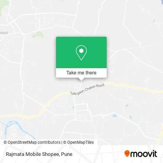
See Rajmata Mobile Shopee, Rajgurunagar, on the map
Public Transit to Rajmata Mobile Shopee in Rajgurunagar
Wondering how to get to Rajmata Mobile Shopee in Rajgurunagar? Moovit helps you find the best way to get to Rajmata Mobile Shopee with step-by-step directions from the nearest public transit station.
Moovit provides free maps and live directions to help you navigate through your city. View schedules, routes, timetables, and find out how long does it take to get to Rajmata Mobile Shopee in real time.
Looking for the nearest stop or station to Rajmata Mobile Shopee? Check out this list of stops closest to your destination: Shiv Krupa Hospital; Mhalunge Phata Chakan.
Bus: 314, 329, 120, 343, 385, 343A, 343C, 384, 343B.
Want to see if there’s another route that gets you there at an earlier time? Moovit helps you find alternative routes or times. Get directions from and directions to Rajmata Mobile Shopee easily from the Moovit App or Website.
We make riding to Rajmata Mobile Shopee easy, which is why over 1.5 million users, including users in Rajgurunagar, trust Moovit as the best app for public transit. You don’t need to download an individual bus app or train app, Moovit is your all-in-one transit app that helps you find the best bus time or train time available.
For information on prices of bus, costs and ride fares to Rajmata Mobile Shopee, please check the Moovit app.
Use the app to navigate to popular places including to the airport, hospital, stadium, grocery store, mall, coffee shop, school, college, and university.
Rajmata Mobile Shopee Address: Mahalungkar Chowk खेड 410501 MH street in Rajgurunagar
- Rahul Biryani Center,
- Shri Datta Medical Stores,
- Akshita Fashion,
- Bhosale Fiber Network,
- Sarkar Menswear,
- Ghar Sansar Sale,
- Omsai Laundry,
- Taj Caterers,
- Munishwar Cargo Movers,
- R K Caterers,
- Brandhub,
- Khushi Shoes and General Store,
- Sakhi Ladies Shopy Cosmetics and Gift House,
- Annapurna Khanawal,
- DSB Mobile Shoppee & Repairing Center,
- Shreepati Medical,
- K Mart,
- Mahalunge Gram Panchayat,
- Aapla Bazaar,
- Shri Dharmanath Maharaj Mandir
Places Near Rajmata Mobile Shopee (Rajgurunagar)
- BAPS Shri Swaminarayan Mandir, Pune & Velhe,
- Dagdusheth Halwai Ganpati Mandir, Pune & Velhe,
- Cognizant Deccan Campus (CDC), Paud,
- Laxmi Road, Pune & Velhe,
- Tulshibaug, Pune & Velhe,
- ISKCON Pune, Pune & Velhe,
- Westend Mall, Pune & Velhe,
- Vishwakarma Institute Of Technology (Vit), Pune & Velhe,
- Fc Road, Pune & Velhe,
- Pvr Icon - Pavilion Mall, Pune & Velhe,
- M G Road, Pune & Velhe,
- Symbiosis Lavale Bus Stop, Pune & Velhe,
- Swaminarayan Mandir, Pune & Velhe,
- Ion Digital Zone, Pune & Velhe,
- Chaturshringi Temple, Pune & Velhe,
- Senapati Bapat Road, Pune & Velhe,
- Pune Okayama Friendship Garden, Pune & Velhe,
- Dagadusheth Halwai Ganapati Temple, Pune & Velhe,
- Sarasbaug, Pune & Velhe,
- ISKCON Nvcc Temple, Pune & Velhe
How to get to popular places in Pune with public transit
Get around Rajgurunagar by public transit!
Traveling around Rajgurunagar has never been so easy. See step by step directions as you travel to any attraction, street or major public transit station. View bus and train schedules, arrival times, service alerts and detailed routes on a map, so you know exactly how to get to anywhere in Rajgurunagar.
When traveling to any destination around Rajgurunagar use Moovit's Live Directions with Get Off Notifications to know exactly where and how far to walk, how long to wait for your line, and how many stops are left. Moovit will alert you when it's time to get off — no need to constantly re-check whether yours is the next stop.
Wondering how to use public transit in Rajgurunagar or how to pay for public transit in Rajgurunagar? Moovit public transit app can help you navigate your way with public transit easily, and at minimum cost. It includes public transit fees, ticket prices, and costs. Looking for a map of Rajgurunagar public transit lines? Moovit public transit app shows all public transit maps in Rajgurunagar with all Bus, Train and Metro routes and stops on an interactive map.
Pune has 3 transit type(s), including: Bus, Train and Metro, operated by several transit agencies, including Pune Metro (Maha Metro), PMPML, PMPML Night Bus Service (Ratrani) and Central Railways (Indian Railways)