Directions to Rajwadi Pointe (Wichita) with public transportation
The following transit lines have routes that pass near Rajwadi Pointe
How to get to Rajwadi Pointe by bus?
Click on the bus route to see step by step directions with maps, line arrival times and updated time schedules.
From Anything Heat & Air, Wichita
52 minFrom Allstar, Wichita
58 minFrom Trailer Sales & Service, Wichita
29 minFrom Karman Auto Sales, Wichita
29 minFrom Wichita State Food Truck Plaza, Wichita
32 minFrom Estes Express Lines, Wichita
34 minFrom Kenmore Factory Certified Appliance Repair, Wichita
24 minFrom Reflection Ridge Golf Course (Golf Bar), Wichita
70 minFrom DAD'S ROOT BEER, Wichita
27 min
Bus stops near Rajwadi Pointe in Wichita
Bus lines to Rajwadi Pointe in Wichita
What are the closest stations to Rajwadi Pointe?
The closest stations to Rajwadi Pointe are:
- Topeka And Orme is 183 yards away, 3 min walk.
- Broadway And Orme Ib is 312 yards away, 4 min walk.
- Emporia & Orme Inbd is 419 yards away, 6 min walk.
- Waterman And Market Ib is 595 yards away, 8 min walk.
Which bus lines stop near Rajwadi Pointe?
These bus lines stop near Rajwadi Pointe: ROUTE22: S BDWY-, ROUTE23: PWNEPLA, ROUTE26: PWNEPLA.
What’s the nearest bus station to Rajwadi Pointe in Wichita?
The nearest bus station to Rajwadi Pointe in Wichita is Topeka And Orme. It’s a 3 min walk away.
What time is the first bus to Rajwadi Pointe in Wichita?
The ROUTE22: S BDWY- is the first bus that goes to Rajwadi Pointe in Wichita. It stops nearby at 5:02 AM.
What time is the last bus to Rajwadi Pointe in Wichita?
The ROUTE22: S BDWY- is the last bus that goes to Rajwadi Pointe in Wichita. It stops nearby at 10:22 PM.
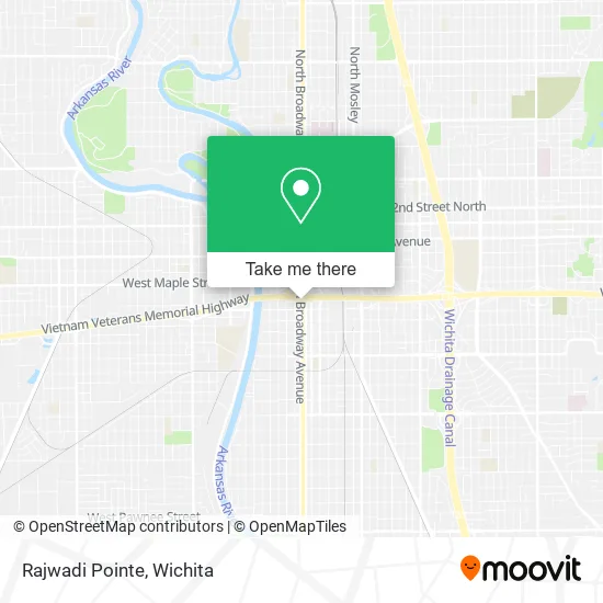
See Rajwadi Pointe, Wichita, on the map
Public Transit to Rajwadi Pointe in Wichita
Wondering how to get to Rajwadi Pointe in Wichita? Moovit helps you find the best way to get to Rajwadi Pointe with step-by-step directions from the nearest public transit station.
Moovit provides free maps and live directions to help you navigate through your city. View schedules, routes, timetables, and find out how long does it take to get to Rajwadi Pointe in real time.
Looking for the nearest stop or station to Rajwadi Pointe? Check out this list of stops closest to your destination: Topeka And Orme; Broadway And Orme Ib; Emporia & Orme Inbd; Waterman And Market Ib.
Bus: ROUTE22: S BDWY-, ROUTE23: PWNEPLA, ROUTE26: PWNEPLA, ROUTE16: S BDWY-, SOUTH HIGH, ROUTE11: MAPLE-R, ROUTE15: DOUGLAS.
Want to see if there’s another route that gets you there at an earlier time? Moovit helps you find alternative routes or times. Get directions from and directions to Rajwadi Pointe easily from the Moovit App or Website.
We make riding to Rajwadi Pointe easy, which is why over 1.5 million users, including users in Wichita, trust Moovit as the best app for public transit. You don’t need to download an individual bus app or train app, Moovit is your all-in-one transit app that helps you find the best bus time or train time available.
For information on prices of bus, costs and ride fares to Rajwadi Pointe, please check the Moovit app.
Use the app to navigate to popular places including to the airport, hospital, stadium, grocery store, mall, coffee shop, school, college, and university.
Rajwadi Pointe Address: 221 E Kellogg St Wichita, KS 67202 street in Wichita
- Amelia's Grill and Bar,
- Spinemed Specialists,
- Wyndham Garden-Wichita,
- Wyndham,
- Amazon Locker-Cheese,
- Behind the Wheel Defensive Driving,
- 206 E Kellogg St,
- Dub-K Blacksabbath MC,
- LDF Food Group,
- Eck Agency, Inc,
- Express Mart,
- Cowley Co Bookstore,
- Pit Stop,
- Improvements Roofing,
- Triple J Locksmith Services,
- Bristol Crown Property Management,
- 3 Witches & A Warlock,
- Davenport Recovery - Wichita,
- Main and Dewey,
- Mental Health Association of South Central Kansas
Places Near Rajwadi Pointe (Wichita)
- Spirit AeroSystems, Bldg 2-280J (Section 9),
- Total Card Solutions, Wichita,
- McConnell Air Force Base, Mcconnell Afb,
- North High School, Wichita,
- Lopez Services, Wichita,
- Spirit Aerosystems,
- 21st & Maize, Wichita,
- Wichita Dwight D. Eisenhower National Airport (ICT) (Wichita Eisenhower National Airport), Wichita,
- Westside Athletic Field (Friends University Baseball Field), Wichita,
- Towne East Mall, Wichita,
- Ratcliff Auto and Truck Repair, Wichita,
- Spirit Aerosystems Inc, Building 1-198D,
- East 21st Street North and Webb Road, Wichita,
- Four Corners Cafe @ Wesley Medical Center, Wichita,
- Ascencion Via Christi Hospital St Francis, Wichita,
- Bmer Tech Automotive, Wichita,
- Hubb's glory hole, Wichita,
- Afghan Halal Market, Wichita,
- Paige Place Apartments, Wichita,
- Sena African Hair Braiding LLC, Wichita
How to get to popular places in Wichita with public transit
Get around Wichita by public transit!
Traveling around Wichita has never been so easy. See step by step directions as you travel to any attraction, street or major public transit station. View bus and train schedules, arrival times, service alerts and detailed routes on a map, so you know exactly how to get to anywhere in Wichita.
When traveling to any destination around Wichita use Moovit's Live Directions with Get Off Notifications to know exactly where and how far to walk, how long to wait for your line, and how many stops are left. Moovit will alert you when it's time to get off — no need to constantly re-check whether yours is the next stop.
Wondering how to use public transit in Wichita or how to pay for public transit in Wichita? Moovit public transit app can help you navigate your way with public transit easily, and at minimum cost. It includes public transit fees, ticket prices, and costs. Looking for a map of Wichita public transit lines? Moovit public transit app shows all public transit maps in Wichita with all bus routes and stops on an interactive map.
Wichita has 1 transit type(s), including: bus, operated by several transit agencies, including Wichita Transit, Greyhound-us and FlixBus-us