How to get to Rakovsky Brovar by bus?
Click on the bus route to see step by step directions with maps, line arrival times and updated time schedules.
From Uborevich Street, Factory District
58 minFrom Traffic Police Department, Minsk
52 minFrom Nordin Medical Center, Factory District
54 minFrom Belarusian State Aviation Academy, Factory District
60 minFrom St. Elizabeth Monastery, Central District
43 minFrom Vostok Metro Station, Pervomaisky District
52 minFrom 10th Hospital, Factory District
56 minFrom Kopishche, Minsk
72 minFrom Senitsa Trade Gallery, Minsk
42 minFrom Life City, Valeryanovo
67 min
How to get to Rakovsky Brovar by metro?
Click on the metro route to see step by step directions with maps, line arrival times and updated time schedules.
Trolleybus stations near Rakovsky Brovar in Central District
Bus stops near Rakovsky Brovar in Central District
Bus lines to Rakovsky Brovar in Central District
- 40, Landera,VIEW
- 163, Sukharava-5 Terminal,VIEW
- 24, Varanianskaha,VIEW
- 57, Siamashki,VIEW
- 73, DS Syarova,VIEW
- 23, To Park (From Gorodskoy Val),VIEW
- 65, Chyzhouka Station,VIEW
- 74S, Gorodskoy Val,VIEW
- 1, DS Viasnianka - Railway Station,VIEW
- 119S, Railway Station - Zhdanovichi Station,VIEW
- 69, Railway Station - Masyukoushchyna,VIEW
- 91, DS Kalinouski - Vesninka,VIEW
- 188S, School No. 188,VIEW
What are the closest stations to Rakovsky Brovar?
The closest stations to Rakovsky Brovar are:
- Romanovskaya Sloboda is 291 meters away, 4 min walk.
- Nemiga Metro Station is 316 meters away, 5 min walk.
- Zamchyshcha is 576 meters away, 8 min walk.
Which bus lines stop near Rakovsky Brovar?
These bus lines stop near Rakovsky Brovar: 24, 40, 65, 74S.
Which metro line stops near Rakovsky Brovar?
2 (Kamennaya Gorka)
Which Trolleybus line stops near Rakovsky Brovar?
53 (Malinovka-4 Terminal)
What’s the nearest bus station to Rakovsky Brovar in Central District?
The nearest bus station to Rakovsky Brovar in Central District is Romanovskaya Sloboda. It’s a 4 min walk away.
What’s the nearest Trolleybus station to Rakovsky Brovar in Central District?
The nearest Trolleybus station to Rakovsky Brovar in Central District is Romanovskaya Sloboda. It’s a 4 min walk away.
What time is the first bus to Rakovsky Brovar in Central District?
The 65 is the first bus that goes to Rakovsky Brovar in Central District. It stops nearby at 5:19 AM.
What time is the last bus to Rakovsky Brovar in Central District?
The 57 is the last bus that goes to Rakovsky Brovar in Central District. It stops nearby at 12:57 AM.
What time is the first Trolleybus to Rakovsky Brovar in Central District?
The 53 is the first Trolleybus that goes to Rakovsky Brovar in Central District. It stops nearby at 5:17 AM.
What time is the last Trolleybus to Rakovsky Brovar in Central District?
The 53 is the last Trolleybus that goes to Rakovsky Brovar in Central District. It stops nearby at 1:17 AM.
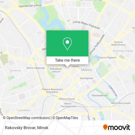
See Rakovsky Brovar, Central District, on the map
Public Transit to Rakovsky Brovar in Central District
Wondering how to get to Rakovsky Brovar in Central District? Moovit helps you find the best way to get to Rakovsky Brovar with step-by-step directions from the nearest public transit station.
Moovit provides free maps and live directions to help you navigate through your city. View schedules, routes, timetables, and find out how long does it take to get to Rakovsky Brovar in real time.
Looking for the nearest stop or station to Rakovsky Brovar? Check out this list of stops closest to your destination: Romanovskaya Sloboda; Nemiga Metro Station; Zamchyshcha.
Bus: 24, 40, 65, 74S, 163, 57, 73, 23, 74S, 1, 119S, 69, 91, 188S.Metro: 2.Trolleybus: 53, 9, 9K, 13, 14.
Want to see if there’s another route that gets you there at an earlier time? Moovit helps you find alternative routes or times. Get directions from and directions to Rakovsky Brovar easily from the Moovit App or Website.
We make riding to Rakovsky Brovar easy, which is why over 1.5 million users, including users in Central District, trust Moovit as the best app for public transit. You don’t need to download an individual bus app or train app, Moovit is your all-in-one transit app that helps you find the best bus time or train time available.
For information on prices of bus, metro and Trolleybus, costs and ride fares to Rakovsky Brovar, please check the Moovit app.
Use the app to navigate to popular places including to the airport, hospital, stadium, grocery store, mall, coffee shop, school, college, and university.
Rakovsky Brovar Address: Витебская улица 10 Мінск street in Central District
- Rakovsky Brewery,
- Vitebskaya Street,
- Chekhov,
- Vitebskaya Street 11,
- Rakovskaya, 17a,
- Vitebskaya 21,
- Minsk Regional Executive Committee Minoblmyasomolprom Enterprise,
- Social Protection Fund,
- Turkmen-Belarusian Trade House,
- Rakovskaya Street 18,
- Pansky Dranik,
- Social Security Fund of the Central District of Minsk,
- NCEU,
- Rakovskaya,
- Pirogova Bakery,
- On Nemiga, Trading House,
- Nine 22 Beauty,
- Notary,
- Eden,
- Rakovsky Suburb
Places Near Rakovsky Brovar (Central District)
- Makaenka Street 17, Pervomaisky District,
- N.N. Alexandrov Oncology and Radiology Research Center, Forest,
- 10th City Clinical Hospital, Factory District,
- 4th City Clinical Hospital Named After N.E. Savchenko, Moskovskiy District,
- Belexpo Exhibition Complex, Central District,
- Republican Clinical Medical Center, Minsk,
- Expobel, Minsk,
- Dana Mall, Pervomaisky District,
- Shopping Center Zamok, Central District,
- Military Unit 07147. Central Command Point of Air Force-Air Defense, Minsk,
- Minsk Consultation and Diagnostic Center Semashko Street, 10, Moskovskiy District,
- Shopping Center «Zhdanovichi», Central District,
- Expobel Shopping Mall, Minsk,
- 11th City Clinical Hospital, Oktyabrsky District,
- Shopping Center Zamok, Central District,
- 24th Special Medical Examination Polyclinic, Pervomaisky District,
- 6th City Clinical Hospital, Partizansky District,
- Diamond City, Minsk,
- Lebyazhy, Minsk,
- Republican Scientific and Practical Center 'Mother and Child', Central District
How to get to popular places in Minsk with public transit
Get around Central District by public transit!
Traveling around Central District has never been so easy. See step by step directions as you travel to any attraction, street or major public transit station. View bus and train schedules, arrival times, service alerts and detailed routes on a map, so you know exactly how to get to anywhere in Central District.
When traveling to any destination around Central District use Moovit's Live Directions with Get Off Notifications to know exactly where and how far to walk, how long to wait for your line, and how many stops are left. Moovit will alert you when it's time to get off — no need to constantly re-check whether yours is the next stop.
Wondering how to use public transit in Central District or how to pay for public transit in Central District? Moovit public transit app can help you navigate your way with public transit easily, and at minimum cost. It includes public transit fees, ticket prices, and costs. Looking for a map of Central District public transit lines? Moovit public transit app shows all public transit maps in Central District with all Bus, Train, Metro, Light Rail and Trolleybus routes and stops on an interactive map.
Minsk has 5 transit type(s), including: Bus, Train, Metro, Light Rail and Trolleybus, operated by several transit agencies, including Capital Transport and Communications and Belarusian Railways
