How to get to Ralf Allekotte by bus?
Click on the bus route to see step by step directions with maps, line arrival times and updated time schedules.
From Möbel Höffner, Schwetzingen
100 minFrom Hauptfeuerwache, Berufsfeuerwehr Mannheim, Neckarau
137 minFrom SAP Headquarters, Walldorf
78 minFrom GRN-Klinik Schwetzingen, Schwetzingen
77 minFrom SAP Campus, Walldorf
75 minFrom Friedhof Käfertal, Käfertal
173 minFrom MVV Energie Ladestation, Käfertal
170 minFrom SAP Walldorf P18, Walldorf
79 min
How to get to Ralf Allekotte by train?
Click on the train route to see step by step directions with maps, line arrival times and updated time schedules.
Light Rail stations near Ralf Allekotte in Handschuhsheim
Bus stop near Ralf Allekotte in Handschuhsheim
- Hans-Thoma-Platz, 8 min walk,VIEW
Bus lines to Ralf Allekotte in Handschuhsheim
- 38, Hans-Thoma-Platz,VIEW
What are the closest stations to Ralf Allekotte?
The closest stations to Ralf Allekotte are:
- Handschuhsheim, H.-Thoma-Pl. is 147 meters away, 3 min walk.
- Johann-Fischer-Straße is 163 meters away, 3 min walk.
- Hans-Thoma-Platz is 170 meters away, 3 min walk.
Which bus lines stop near Ralf Allekotte?
These bus lines stop near Ralf Allekotte: 713, 721, RNV 39A.
Which train lines stop near Ralf Allekotte?
These train lines stop near Ralf Allekotte: RB68, S3.
Which light rail lines stop near Ralf Allekotte?
These light rail lines stop near Ralf Allekotte: 21, 5, RNV 24, RNV 5.
What’s the nearest light rail station to Ralf Allekotte in Handschuhsheim?
The nearest light rail stations to Ralf Allekotte in Handschuhsheim are Handschuhsheim, H.-Thoma-Pl., Johann-Fischer-Straße and Hans-Thoma-Platz. The closest one is a 3 min walk away.
What’s the nearest bus station to Ralf Allekotte in Handschuhsheim?
The nearest bus station to Ralf Allekotte in Handschuhsheim is Hans-Thoma-Platz. It’s a 8 min walk away.
What time is the first light rail to Ralf Allekotte in Handschuhsheim?
The RNV 5 is the first light rail that goes to Ralf Allekotte in Handschuhsheim. It stops nearby at 4:39 AM.
What time is the last light rail to Ralf Allekotte in Handschuhsheim?
The RNV 5 is the last light rail that goes to Ralf Allekotte in Handschuhsheim. It stops nearby at 1:11 AM.
What time is the first bus to Ralf Allekotte in Handschuhsheim?
The RNV 38 is the first bus that goes to Ralf Allekotte in Handschuhsheim. It stops nearby at 6:40 AM.
What time is the last bus to Ralf Allekotte in Handschuhsheim?
The RNV 1008 is the last bus that goes to Ralf Allekotte in Handschuhsheim. It stops nearby at 9:07 PM.
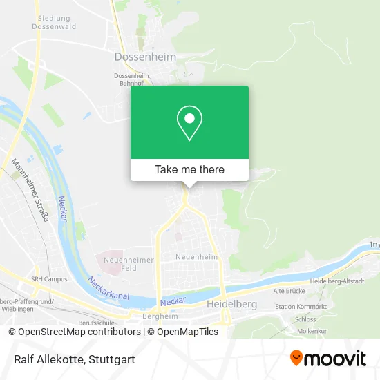
See Ralf Allekotte, Handschuhsheim, on the map
Public Transit to Ralf Allekotte in Handschuhsheim
Wondering how to get to Ralf Allekotte in Handschuhsheim? Moovit helps you find the best way to get to Ralf Allekotte with step-by-step directions from the nearest public transit station.
Moovit provides free maps and live directions to help you navigate through your city. View schedules, routes, timetables, and find out how long does it take to get to Ralf Allekotte in real time.
Looking for the nearest stop or station to Ralf Allekotte? Check out this list of stops closest to your destination: Handschuhsheim, H.-Thoma-Pl.; Johann-Fischer-Straße; Hans-Thoma-Platz.
Bus: 713, 721, RNV 39A, 38.Train: RB68, S3.Light Rail: 21, 5, RNV 24, RNV 5.
Want to see if there’s another route that gets you there at an earlier time? Moovit helps you find alternative routes or times. Get directions from and directions to Ralf Allekotte easily from the Moovit App or Website.
We make riding to Ralf Allekotte easy, which is why over 1.5 million users, including users in Handschuhsheim, trust Moovit as the best app for public transit. You don’t need to download an individual bus app or train app, Moovit is your all-in-one transit app that helps you find the best bus time or train time available.
For information on prices of bus, light rail and train, costs and ride fares to Ralf Allekotte, please check the Moovit app.
Use the app to navigate to popular places including to the airport, hospital, stadium, grocery store, mall, coffee shop, school, college, and university.
Ralf Allekotte Address: Kriegsstraße 9 Handschuhsheim, 69121 Heidelberg street in Handschuhsheim
- Jung und Dürr,
- Hofmanns Vermögensverwaltung,
- Steuerbuero Dr.Schröder,
- Bildbeweger,
- Lorenza Alberti,
- Kücherers Käse Ecke,
- Sicherheitstechnik Schwöbel GmbH (Ehemals Schlüssel Wink),
- Irene Pauly Heilpraktikerin / Physiotherapeutin,
- Greten Natalie Dr. med. Privatpraxis F. Homöopathie,
- Kosmetik U. Fußpflege Ursula Broska,
- Dipl.-Psych. Antje Wetzel,
- Heerlijk. Handmade Beer,
- Filiale Hanschuhsheim,
- Cafe Frisch,
- Mühltalstraße,
- Marx Heiztechnik,
- VRNnextbike,
- BBBank,
- Dr. med. Bettina Gonon-Junghanss,
- Praxishund
Places Near Ralf Allekotte (Handschuhsheim)
- Klinikum Stuttgart - Katharinenhospital, Stuttgart-Mitte,
- Hauptbahnhof Stuttgart, Stuttgart-Mitte,
- Gasometer Pforzheim, Pforzheim,
- FlixBus Haltestelle, Stuttgart,
- Hanns-Martin-Schleyer-Halle, Bad Cannstatt,
- Porsche-Arena, Bad Cannstatt,
- Im Wizemann (Halle), Bad Cannstatt,
- Mercedes-Benz Museum (Mercedes Museum Stuttgart), Bad Cannstatt,
- Mercedes-Benz Museum, Bad Cannstatt,
- Gleis 101/102 (tief), Stuttgart-Mitte,
- Waldfriedhof, Degerloch,
- Schleyerhalle, Bad Cannstatt,
- Wilhelma (U-Bahn Wilhelma), Bad Cannstatt,
- Porsche Museum, Zuffenhausen,
- SI-Centrum, Möhringen,
- Hanns-Martin-Schleyer-Halle (Stuttgart Hans-Martin-Schleyerhalle), Bad Cannstatt,
- Marmorsaal Im Weissenburgpark, Stuttgart-Süd,
- Mettingen Eros-Center Puff Laufhaus, Esslingen Am Neckar,
- Geilhaus Haus 33a, Reutlingen-Betzingen,
- Pariser Platz Stuttgart, Stuttgart-Mitte
How to get to popular places in Stuttgart with public transit
Get around Handschuhsheim by public transit!
Traveling around Handschuhsheim has never been so easy. See step by step directions as you travel to any attraction, street or major public transit station. View bus and train schedules, arrival times, service alerts and detailed routes on a map, so you know exactly how to get to anywhere in Handschuhsheim.
When traveling to any destination around Handschuhsheim use Moovit's Live Directions with Get Off Notifications to know exactly where and how far to walk, how long to wait for your line, and how many stops are left. Moovit will alert you when it's time to get off — no need to constantly re-check whether yours is the next stop.
Wondering how to use public transit in Handschuhsheim or how to pay for public transit in Handschuhsheim? Moovit public transit app can help you navigate your way with public transit easily, and at minimum cost. It includes public transit fees, ticket prices, and costs. Looking for a map of Handschuhsheim public transit lines? Moovit public transit app shows all public transit maps in Handschuhsheim with all Bus, Train, Subway, Light Rail, Ferry, S-Bahn and Funicular routes and stops on an interactive map.
Stuttgart has 7 transit type(s), including: Bus, Train, Subway, Light Rail, Ferry, S-Bahn and Funicular, operated by several transit agencies, including SSB - Stadtbahn, SSB, SSB - Seilbahn / Zacke, S-Bahn Stuttgart, Rhein-Neckar-Verkehr GmbH (rnv), Karlsruher Verkehrsverbund, DB AG, DB Regiobus BW, Arverio Baden-Württemberg GmbH, DB RegioNetz Verkehrs GmbH Westfrankenbahn, DB Regio AG Baden-Württemberg, Südwestdeutsche Verkehrs-AG, DB Regio AG Mitte Region Hessen, DB and Bodensee-Oberschwaben-Bahn