How to get to Ralf Ganter by bus?
Click on the bus route to see step by step directions with maps, line arrival times and updated time schedules.
Bus stop near Ralf Ganter in Villingen-Schwenningen
- Pfaffenweiler Spohnplatzstr., 3 min walk,VIEW
Train stations near Ralf Ganter in Villingen-Schwenningen
Bus lines to Ralf Ganter in Villingen-Schwenningen
- 640, Pfaffenweiler Im Oberdorf,VIEW
What are the closest stations to Ralf Ganter?
The closest stations to Ralf Ganter are:
- Pfaffenweiler Spohnplatzstr. is 210 meters away, 3 min walk.
- Marbach West (Zug) is 4956 meters away, 64 min walk.
- Marbach West is 4956 meters away, 64 min walk.
Which bus lines stop near Ralf Ganter?
These bus lines stop near Ralf Ganter: 1, 640.
What’s the nearest bus station to Ralf Ganter in Villingen-Schwenningen?
The nearest bus station to Ralf Ganter in Villingen-Schwenningen is Pfaffenweiler Spohnplatzstr.. It’s a 3 min walk away.
What time is the first light rail to Ralf Ganter in Villingen-Schwenningen?
The S1 is the first light rail that goes to Ralf Ganter in Villingen-Schwenningen. It stops nearby at 7:14 AM.
What time is the last light rail to Ralf Ganter in Villingen-Schwenningen?
The S1 is the last light rail that goes to Ralf Ganter in Villingen-Schwenningen. It stops nearby at 7:14 AM.
What time is the first train to Ralf Ganter in Villingen-Schwenningen?
The RB 42 is the first train that goes to Ralf Ganter in Villingen-Schwenningen. It stops nearby at 5:16 AM.
What time is the last train to Ralf Ganter in Villingen-Schwenningen?
The RB42 is the last train that goes to Ralf Ganter in Villingen-Schwenningen. It stops nearby at 11:26 PM.
What time is the first bus to Ralf Ganter in Villingen-Schwenningen?
The 640 is the first bus that goes to Ralf Ganter in Villingen-Schwenningen. It stops nearby at 5:09 AM.
What time is the last bus to Ralf Ganter in Villingen-Schwenningen?
The 640 is the last bus that goes to Ralf Ganter in Villingen-Schwenningen. It stops nearby at 10:51 PM.
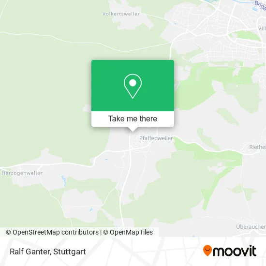
See Ralf Ganter, Villingen-Schwenningen, on the map
Public Transit to Ralf Ganter in Villingen-Schwenningen
Wondering how to get to Ralf Ganter in Villingen-Schwenningen? Moovit helps you find the best way to get to Ralf Ganter with step-by-step directions from the nearest public transit station.
Moovit provides free maps and live directions to help you navigate through your city. View schedules, routes, timetables, and find out how long does it take to get to Ralf Ganter in real time.
Looking for the nearest stop or station to Ralf Ganter? Check out this list of stops closest to your destination: Pfaffenweiler Spohnplatzstr.; Marbach West (Zug); Marbach West.
Bus: 1, 640.Train: S10, RB42, RE42, RE55, RB 42, RE 55, S1.
Want to see if there’s another route that gets you there at an earlier time? Moovit helps you find alternative routes or times. Get directions from and directions to Ralf Ganter easily from the Moovit App or Website.
We make riding to Ralf Ganter easy, which is why over 1.5 million users, including users in Villingen-Schwenningen, trust Moovit as the best app for public transit. You don’t need to download an individual bus app or train app, Moovit is your all-in-one transit app that helps you find the best bus time or train time available.
For information on prices of bus, train and light rail, costs and ride fares to Ralf Ganter, please check the Moovit app.
Use the app to navigate to popular places including to the airport, hospital, stadium, grocery store, mall, coffee shop, school, college, and university.
Ralf Ganter Address: Spohnplatzstraße 7 Pfaffenweiler, 78052 Villingen-Schwenningen street in Villingen-Schwenningen
- Rg Reisemobil Regalbau,
- Schultz Bauunternehmen,
- Merz Reisen und Fuhrbetrieb,
- Lippl Bau,
- Egon Kratt Transporte,
- Friseur Luci's Hairshop,
- Luci's Hairshop,
- Megaplast Gmbh & Co. Kg,
- Salon Elke Morriello,
- a. Straßacker,
- Haircut Service Elke Moriello,
- Beisswenger - Schulungskonzepte,
- Fliesenlegerbetrieb Hummel,
- Gewerbepark Pfaffenweiler,
- Reiko-Trenkle,
- Dr. Med. Michalski,
- Tannhäuser Fenster,
- Pension Im Neubrunnenring,
- Dr. Cornelia Schlenker,
- Dr. med. Ulrich Michalski
Places Near Ralf Ganter (Villingen-Schwenningen)
- Im Wizemann (Halle), Bad Cannstatt,
- Schleyerhalle, Bad Cannstatt,
- SI-Centrum, Möhringen,
- Klinikum Stuttgart - Katharinenhospital, Stuttgart-Mitte,
- Gleis 101/102 (tief), Stuttgart-Mitte,
- Hauptbahnhof Stuttgart, Stuttgart-Mitte,
- Hanns-Martin-Schleyer-Halle (Stuttgart Hans-Martin-Schleyerhalle), Bad Cannstatt,
- Porsche-Arena, Bad Cannstatt,
- Mercedes-Benz Museum, Bad Cannstatt,
- Gasometer Pforzheim, Pforzheim,
- Pariser Platz Stuttgart, Stuttgart-Mitte,
- Mercedes-Benz Museum (Mercedes Museum Stuttgart), Bad Cannstatt,
- Hanns-Martin-Schleyer-Halle, Bad Cannstatt,
- Waldfriedhof, Degerloch,
- Mettingen Eros-Center Puff Laufhaus, Esslingen Am Neckar,
- FlixBus Haltestelle, Stuttgart,
- Geilhaus Haus 33a, Reutlingen-Betzingen,
- Porsche Museum, Zuffenhausen,
- Wilhelma (U-Bahn Wilhelma), Bad Cannstatt,
- Marmorsaal Im Weissenburgpark, Stuttgart-Süd
How to get to popular places in Stuttgart with public transit
Get around Villingen-Schwenningen by public transit!
Traveling around Villingen-Schwenningen has never been so easy. See step by step directions as you travel to any attraction, street or major public transit station. View bus and train schedules, arrival times, service alerts and detailed routes on a map, so you know exactly how to get to anywhere in Villingen-Schwenningen.
When traveling to any destination around Villingen-Schwenningen use Moovit's Live Directions with Get Off Notifications to know exactly where and how far to walk, how long to wait for your line, and how many stops are left. Moovit will alert you when it's time to get off — no need to constantly re-check whether yours is the next stop.
Wondering how to use public transit in Villingen-Schwenningen or how to pay for public transit in Villingen-Schwenningen? Moovit public transit app can help you navigate your way with public transit easily, and at minimum cost. It includes public transit fees, ticket prices, and costs. Looking for a map of Villingen-Schwenningen public transit lines? Moovit public transit app shows all public transit maps in Villingen-Schwenningen with all Bus, Train, Subway, Light Rail, Ferry, S-Bahn and Funicular routes and stops on an interactive map.
Stuttgart has 7 transit type(s), including: Bus, Train, Subway, Light Rail, Ferry, S-Bahn and Funicular, operated by several transit agencies, including SSB - Stadtbahn, SSB, SSB - Seilbahn / Zacke, S-Bahn Stuttgart, Rhein-Neckar-Verkehr GmbH (rnv), Karlsruher Verkehrsverbund, DB AG, DB Regiobus BW, Arverio Baden-Württemberg GmbH, DB RegioNetz Verkehrs GmbH Westfrankenbahn, DB Regio AG Baden-Württemberg, Südwestdeutsche Verkehrs-AG, DB Regio AG Mitte Region Hessen, DB and Bodensee-Oberschwaben-Bahn