How to get to Ralf Pfersching by bus?
Click on the bus route to see step by step directions with maps, line arrival times and updated time schedules.
From Karlsruher Straße, Pforzheim
96 minFrom Gartencenter Streb, Pforzheim
71 minFrom Hauptfriedhof Pforzheim, Pforzheim
73 minFrom Kaufland Pforzheim Wilhelm-Becker-Str., Pforzheim
94 minFrom Möbelzentrum Pforzheim, Eutingen
66 minFrom POCO Einrichtungsmärkte, Pforzheim
97 minFrom Wartbergbad, Pforzheim
71 minFrom Pforzheim Wartberg Freibad (Wartbergfreibad), Pforzheim
74 minFrom Amazon Fulfillment Center - STR1, Eutingen
73 minFrom Enzkreisklinik Mühlacker, Vvg Der Stadt Mühlacker
102 min
How to get to Ralf Pfersching by train?
Click on the train route to see step by step directions with maps, line arrival times and updated time schedules.
From Karlsruher Straße, Pforzheim
144 minFrom Gartencenter Streb, Pforzheim
109 minFrom Hauptfriedhof Pforzheim, Pforzheim
97 minFrom Kaufland Pforzheim Wilhelm-Becker-Str., Pforzheim
139 minFrom Möbelzentrum Pforzheim, Eutingen
105 minFrom POCO Einrichtungsmärkte, Pforzheim
145 minFrom Wartbergbad, Pforzheim
108 minFrom Pforzheim Wartberg Freibad (Wartbergfreibad), Pforzheim
112 minFrom Enzkreisklinik Mühlacker, Vvg Der Stadt Mühlacker
87 min
Bus stops near Ralf Pfersching in Neibsheim
- Neibsheim Große Gasse, 6 min walk,VIEW
Train stations near Ralf Pfersching in Neibsheim
Bus lines to Ralf Pfersching in Neibsheim
- 161, Bretten Im Grüner,VIEW
What are the closest stations to Ralf Pfersching?
The closest stations to Ralf Pfersching are:
- Neibsheim Große Gasse is 392 meters away, 6 min walk.
- Gondelsheim (Baden) is 2497 meters away, 32 min walk.
- Gondelsheim Schlossstadion Gleis 1 is 2525 meters away, 33 min walk.
Which bus line stops near Ralf Pfersching?
161 (Gondelsheim In den Buchen)
Which train lines stop near Ralf Pfersching?
These train lines stop near Ralf Pfersching: MEX 17C, RB71.
What’s the nearest bus station to Ralf Pfersching in Neibsheim?
The nearest bus station to Ralf Pfersching in Neibsheim is Neibsheim Große Gasse. It’s a 6 min walk away.
What time is the first train to Ralf Pfersching in Neibsheim?
The RB71 is the first train that goes to Ralf Pfersching in Neibsheim. It stops nearby at 4:18 AM.
What time is the last train to Ralf Pfersching in Neibsheim?
The RB71 is the last train that goes to Ralf Pfersching in Neibsheim. It stops nearby at 1:50 AM.
What time is the first bus to Ralf Pfersching in Neibsheim?
The 161 is the first bus that goes to Ralf Pfersching in Neibsheim. It stops nearby at 5:26 AM.
What time is the last bus to Ralf Pfersching in Neibsheim?
The 161 is the last bus that goes to Ralf Pfersching in Neibsheim. It stops nearby at 11:28 PM.
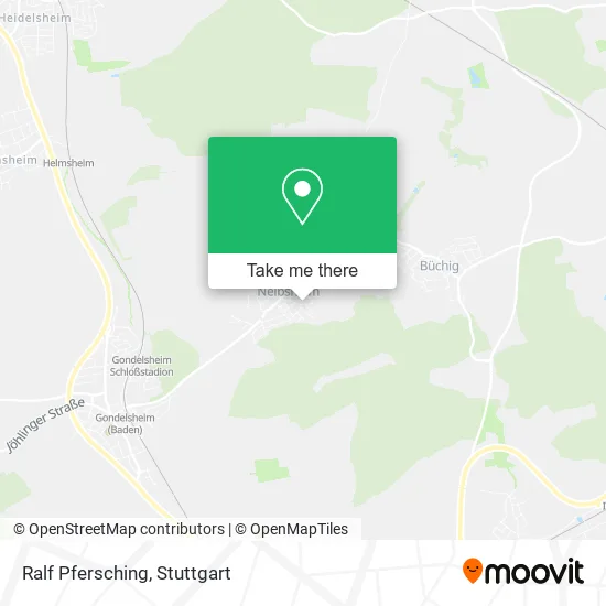
See Ralf Pfersching, Neibsheim, on the map
Public Transit to Ralf Pfersching in Neibsheim
Wondering how to get to Ralf Pfersching in Neibsheim? Moovit helps you find the best way to get to Ralf Pfersching with step-by-step directions from the nearest public transit station.
Moovit provides free maps and live directions to help you navigate through your city. View schedules, routes, timetables, and find out how long does it take to get to Ralf Pfersching in real time.
Looking for the nearest stop or station to Ralf Pfersching? Check out this list of stops closest to your destination: Neibsheim Große Gasse; Gondelsheim (Baden); Gondelsheim Schlossstadion Gleis 1.
Bus: 161.Train: MEX 17C, RB71, MEX17C.
Want to see if there’s another route that gets you there at an earlier time? Moovit helps you find alternative routes or times. Get directions from and directions to Ralf Pfersching easily from the Moovit App or Website.
We make riding to Ralf Pfersching easy, which is why over 1.5 million users, including users in Neibsheim, trust Moovit as the best app for public transit. You don’t need to download an individual bus app or train app, Moovit is your all-in-one transit app that helps you find the best bus time or train time available.
For information on prices of bus and train, costs and ride fares to Ralf Pfersching, please check the Moovit app.
Use the app to navigate to popular places including to the airport, hospital, stadium, grocery store, mall, coffee shop, school, college, and university.
Ralf Pfersching Address: Adlersberg 1 Neibsheim, 75015 Bretten street in Neibsheim
- Wohnsinn Nordische Wohn-Accessoires Inh. Margit Weniger,
- Wolfgang Weniger,
- Therapierbar Neibsheim,
- Klötzer,
- Realis Immobilien,
- Amexxa Handels,
- Blc Ingenieure,
- Luisa Klein Hair & Beauty,
- Günter Herb,
- Klein Luisa Hair and Beauty Friseursalon,
- Dipl.-Ing.(FH) Achim Ganz Ingenieurbüro,
- Margit Kratzmeier Partyservice,
- Helga Dörrich,
- Udo Gamperl,
- Jomaca,
- Wolfgang Hauk Sanitäranlagenbau,
- Sparkasse Kraichgau,
- Karcher,
- Metzgerei Karcher,
- Gerweck
Places Near Ralf Pfersching (Neibsheim)
- Hauptbahnhof Stuttgart, Stuttgart-Mitte,
- Porsche Museum, Zuffenhausen,
- Mercedes-Benz Museum, Bad Cannstatt,
- Schleyerhalle, Bad Cannstatt,
- Porsche-Arena, Bad Cannstatt,
- Marmorsaal Im Weissenburgpark, Stuttgart-Süd,
- Mettingen Eros-Center Puff Laufhaus, Esslingen Am Neckar,
- Hanns-Martin-Schleyer-Halle (Stuttgart Hans-Martin-Schleyerhalle), Bad Cannstatt,
- Wilhelma (U-Bahn Wilhelma), Bad Cannstatt,
- SI-Centrum, Möhringen,
- Im Wizemann (Halle), Bad Cannstatt,
- Pariser Platz Stuttgart, Stuttgart-Mitte,
- Gasometer Pforzheim, Pforzheim,
- Hanns-Martin-Schleyer-Halle, Bad Cannstatt,
- FlixBus Haltestelle, Stuttgart,
- Klinikum Stuttgart - Katharinenhospital, Stuttgart-Mitte,
- Geilhaus Haus 33a, Reutlingen-Betzingen,
- Mercedes-Benz Museum (Mercedes Museum Stuttgart), Bad Cannstatt,
- Gleis 101/102 (tief), Stuttgart-Mitte,
- Waldfriedhof, Degerloch
How to get to popular places in Stuttgart with public transit
Get around Neibsheim by public transit!
Traveling around Neibsheim has never been so easy. See step by step directions as you travel to any attraction, street or major public transit station. View bus and train schedules, arrival times, service alerts and detailed routes on a map, so you know exactly how to get to anywhere in Neibsheim.
When traveling to any destination around Neibsheim use Moovit's Live Directions with Get Off Notifications to know exactly where and how far to walk, how long to wait for your line, and how many stops are left. Moovit will alert you when it's time to get off — no need to constantly re-check whether yours is the next stop.
Wondering how to use public transit in Neibsheim or how to pay for public transit in Neibsheim? Moovit public transit app can help you navigate your way with public transit easily, and at minimum cost. It includes public transit fees, ticket prices, and costs. Looking for a map of Neibsheim public transit lines? Moovit public transit app shows all public transit maps in Neibsheim with all Bus, Train, Subway, Light Rail, Ferry, S-Bahn and Funicular routes and stops on an interactive map.
Stuttgart has 7 transit type(s), including: Bus, Train, Subway, Light Rail, Ferry, S-Bahn and Funicular, operated by several transit agencies, including SSB - Stadtbahn, SSB, SSB - Seilbahn / Zacke, S-Bahn Stuttgart, Rhein-Neckar-Verkehr GmbH (rnv), Karlsruher Verkehrsverbund, DB AG, DB Regiobus BW, Arverio Baden-Württemberg GmbH, DB RegioNetz Verkehrs GmbH Westfrankenbahn, DB Regio AG Baden-Württemberg, Südwestdeutsche Verkehrs-AG, DB Regio AG Mitte Region Hessen, DB and Bodensee-Oberschwaben-Bahn