How to get to Raltru by bus?
Click on the bus route to see step by step directions with maps, line arrival times and updated time schedules.
From Tanatorio Getafe, Getafe
91 minFrom Cobo Calleja, Fuenlabrada
85 minFrom Piscinas Municipales De Fuenlabrada, Área Metropolitana De Madrid Y Corredor Del Henares
94 minFrom Sector 3 - Getafe, Getafe
94 minFrom Loranca, Área Metropolitana De Madrid Y Corredor Del Henares
88 minFrom Poligono Industrial Aimayr, San Martín De La Vega
42 minFrom Hospital Infanta Cristina., Área Metropolitana De Madrid Y Corredor Del Henares
86 minFrom Desguaces La Torre, Comarca Sur
98 minFrom The Style Outlets Getafe, Getafe
33 minFrom Costco, Área Metropolitana De Madrid Y Corredor Del Henares
70 min
How to get to Raltru by train?
Click on the train route to see step by step directions with maps, line arrival times and updated time schedules.
Bus stops near Raltru in Valdemoro
Bus lines to Raltru in Valdemoro
- 1, Circular (FF.CC. - Ambulatorio - FF.CC.),VIEW
- 3, Circular (El Restón - Av. de Andalucía - El Restón),VIEW
- 422, P.º Delicias - Plaza De Legazpi,VIEW
- 428, Glorieta A-42 - Hospital De Getafe,VIEW
- N401, Río Manzanares - Plaza De Toros,VIEW
- 4, Circular (Polígonos Norte - Estación FF.CC.),VIEW
- 7, Hospital - El Restón - Estación FF.CC.,VIEW
- C3, Pinto,VIEW
- C3, Madrid-Atocha Cercanías,VIEW
What are the closest stations to Raltru?
The closest stations to Raltru are:
- Luis Planelles - Seseña is 129 meters away, 2 min walk.
- Pío Baroja - Miguel Hernández is 394 meters away, 6 min walk.
- San Vicente De Paúl - Tenerías is 419 meters away, 6 min walk.
- Dalí - Cristo De La Salud is 487 meters away, 7 min walk.
- Dalí - Colegios Guardias Jóvenes is 570 meters away, 8 min walk.
- Valdemoro is 1665 meters away, 22 min walk.
Which bus lines stop near Raltru?
These bus lines stop near Raltru: 1, 422, 428.
Which train line stops near Raltru?
C3 (Aranjuez)
What’s the nearest bus station to Raltru in Valdemoro?
The nearest bus station to Raltru in Valdemoro is Luis Planelles - Seseña. It’s a 2 min walk away.
What time is the first train to Raltru in Valdemoro?
The C3 is the first train that goes to Raltru in Valdemoro. It stops nearby at 5:29 AM.
What time is the last train to Raltru in Valdemoro?
The C3 is the last train that goes to Raltru in Valdemoro. It stops nearby at 12:23 AM.
What time is the first bus to Raltru in Valdemoro?
The N401 is the first bus that goes to Raltru in Valdemoro. It stops nearby at 3:25 AM.
What time is the last bus to Raltru in Valdemoro?
The N401 is the last bus that goes to Raltru in Valdemoro. It stops nearby at 2:30 AM.
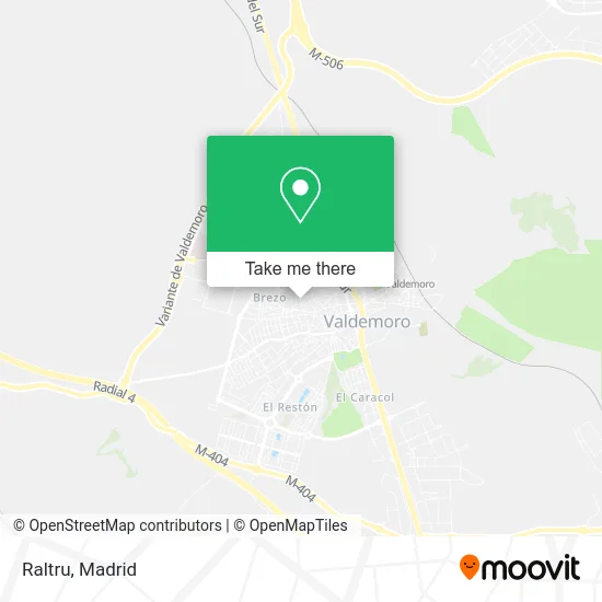
See Raltru, Valdemoro, on the map
Public Transit to Raltru in Valdemoro
Wondering how to get to Raltru in Valdemoro? Moovit helps you find the best way to get to Raltru with step-by-step directions from the nearest public transit station.
Moovit provides free maps and live directions to help you navigate through your city. View schedules, routes, timetables, and find out how long does it take to get to Raltru in real time.
Looking for the nearest stop or station to Raltru? Check out this list of stops closest to your destination: Luis Planelles - Seseña; Pío Baroja - Miguel Hernández; San Vicente De Paúl - Tenerías; Dalí - Cristo De La Salud; Dalí - Colegios Guardias Jóvenes; Valdemoro.
Bus: 1, 422, 428, 3, N401, 4, 7, C3, C3.Train: C3.
Want to see if there’s another route that gets you there at an earlier time? Moovit helps you find alternative routes or times. Get directions from and directions to Raltru easily from the Moovit App or Website.
We make riding to Raltru easy, which is why over 1.5 million users, including users in Valdemoro, trust Moovit as the best app for public transit. You don’t need to download an individual bus app or train app, Moovit is your all-in-one transit app that helps you find the best bus time or train time available.
For information on prices of bus, train and metro, costs and ride fares to Raltru, please check the Moovit app.
Use the app to navigate to popular places including to the airport, hospital, stadium, grocery store, mall, coffee shop, school, college, and university.
Raltru Address: Calle Río Júcar, 4 28342 Valdemoro street in Valdemoro
- Covigraf S.L.,
- Monzon Espinosa Alberto,
- Elena Bertol Barreales,
- Pescados y Mariscos Rio y Mar,
- Pescadería Rioymar,
- Mercadicalti Valdemoro,
- Salon de Belleza Carme,
- Café Bar Camuñas,
- La Aby Covrigarie Pastelería,
- Agencia de Santalucía Seguros,
- Clicategia,
- Cofradía Santísimo Cristo de la Salud Valdemoro,
- Iglesia de Nuestra Señora de la Asunción (Valdemoro),
- Obispado de Getafe,
- Centro Comercial,
- Karaoke Sala 8,
- Abogados y Asesoría Alonso,
- Notaría Villaamil Amor L J,
- Notaría de Valdemoro - Jose Manuel Vara GonzáLez,
- Sahra Danza del Vientre
Places Near Raltru (Valdemoro)
- Centro Comercial La Vaguada, Área Metropolitana De Madrid Y Corredor Del Henares,
- Rastro De Madrid, Área Metropolitana De Madrid Y Corredor Del Henares,
- Estadio Wanda Metropolitano, Área Metropolitana De Madrid Y Corredor Del Henares,
- Calle de López de Hoyos 169, Madrid,
- Hospital Universitario La Paz, Madrid,
- Estacion de Chamartin, Madrid,
- Palacio De Vistalegre, Área Metropolitana De Madrid Y Corredor Del Henares,
- Mendez Alvaro, Madrid,
- Mercadillo de Majadahonda, Majadahonda,
- Sala La Riviera, Madrid,
- Tres Aguas, Alcorcón,
- Plaza Mayor, Madrid,
- Plenilunio, Área Metropolitana De Madrid Y Corredor Del Henares,
- Centro Comercial Islazul, Área Metropolitana De Madrid Y Corredor Del Henares,
- Hospital Clínico Universitario San Carlos, Madrid,
- Hospital Universitario Ramón y Cajal, Madrid,
- Centro Comercial Oasiz Madrid, Área Metropolitana De Madrid Y Corredor Del Henares,
- Centro Comercial La Gavia, Área Metropolitana De Madrid Y Corredor Del Henares,
- Wizink Center, Madrid,
- Nassica, Área Metropolitana De Madrid Y Corredor Del Henares
How to get to popular places in Madrid with public transit
Get around Valdemoro by public transit!
Traveling around Valdemoro has never been so easy. See step by step directions as you travel to any attraction, street or major public transit station. View bus and train schedules, arrival times, service alerts and detailed routes on a map, so you know exactly how to get to anywhere in Valdemoro.
When traveling to any destination around Valdemoro use Moovit's Live Directions with Get Off Notifications to know exactly where and how far to walk, how long to wait for your line, and how many stops are left. Moovit will alert you when it's time to get off — no need to constantly re-check whether yours is the next stop.
Wondering how to use public transit in Valdemoro or how to pay for public transit in Valdemoro? Moovit public transit app can help you navigate your way with public transit easily, and at minimum cost. It includes public transit fees, ticket prices, and costs. Looking for a map of Valdemoro public transit lines? Moovit public transit app shows all public transit maps in Valdemoro with all Bus, Train, Metro and Light Rail routes and stops on an interactive map.
Madrid has 4 transit type(s), including: Bus, Train, Metro and Light Rail, operated by several transit agencies, including Metro de Madrid, Metro Ligero, Tranvía de Parla, Renfe Cercanías - Servicios de Autobús especiales, Renfe Cercanias, Renfe Cercanías, EMT, Interurbanos, Urbanos de Alcalá de Henares, Urbanos de Alcobendas, Urbanos de Alcorcón, Urbanos de Algete, Urbanos de Aranjuez, Urbanos de Arganda del Rey and Urbanos de Arroyomolinos