How to get to Ramon A. Batson, Md by bus?
Click on the bus route to see step by step directions with maps, line arrival times and updated time schedules.
From Peekskill, NY, Peekskill
371 minFrom Hartford Healthcare Amphitheater, Bridgeport
152 minFrom The Sono Collection, Norwalk
107 minFrom GFFF, Stamford
168 minFrom White Plains, NY, White Plains
190 minFrom NBC Sports Shuttle, Stamford
132 minFrom Port Chester, NY, Port Chester
211 minFrom Westchester Mall, White Plains
191 min
How to get to Ramon A. Batson, Md by train?
Click on the train route to see step by step directions with maps, line arrival times and updated time schedules.
Bus stops near Ramon A. Batson, Md in Danbury
Train station near Ramon A. Batson, Md in Danbury
- Danbury, 58 min walk,VIEW
Bus lines to Ramon A. Batson, Md in Danbury
What are the closest stations to Ramon A. Batson, Md?
The closest stations to Ramon A. Batson, Md are:
- Locust Av - Hospital Av is 397 yards away, 6 min walk.
- Locust Av- Osborne St is 687 yards away, 9 min walk.
- Wcsu White Hall is 1098 yards away, 14 min walk.
- 12 Hayestown Av is 1534 yards away, 19 min walk.
- Danbury is 4965 yards away, 58 min walk.
Which bus lines stop near Ramon A. Batson, Md?
These bus lines stop near Ramon A. Batson, Md: 1, 3, 7, RIDGEFIELD - KATONAH SHUTTLE.
Which train line stops near Ramon A. Batson, Md?
5 (1816#| Danbury)
What’s the nearest bus station to Ramon A. Batson, Md in Danbury?
The nearest bus station to Ramon A. Batson, Md in Danbury is Locust Av - Hospital Av. It’s a 6 min walk away.
What time is the first train to Ramon A. Batson, Md in Danbury?
The 5 is the first train that goes to Ramon A. Batson, Md in Danbury. It stops nearby at 5:28 AM.
What time is the last train to Ramon A. Batson, Md in Danbury?
The 5 is the last train that goes to Ramon A. Batson, Md in Danbury. It stops nearby at 1:29 AM.
What time is the first bus to Ramon A. Batson, Md in Danbury?
The 1 is the first bus that goes to Ramon A. Batson, Md in Danbury. It stops nearby at 6:13 AM.
What time is the last bus to Ramon A. Batson, Md in Danbury?
The LOOP is the last bus that goes to Ramon A. Batson, Md in Danbury. It stops nearby at 10:35 PM.
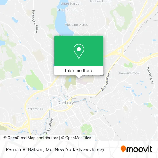
See Ramon A. Batson, Md, Danbury, on the map
Public Transit to Ramon A. Batson, Md in Danbury
Wondering how to get to Ramon A. Batson, Md in Danbury? Moovit helps you find the best way to get to Ramon A. Batson, Md with step-by-step directions from the nearest public transit station.
Moovit provides free maps and live directions to help you navigate through your city. View schedules, routes, timetables, and find out how long does it take to get to Ramon A. Batson, Md in real time.
Looking for the nearest stop or station to Ramon A. Batson, Md? Check out this list of stops closest to your destination: Locust Av - Hospital Av; Locust Av- Osborne St; Wcsu White Hall; 12 Hayestown Av; Danbury.
Bus: 1, 3, 7, RIDGEFIELD - KATONAH SHUTTLE, LOOP, 4, LOOP.Train: 5.
Want to see if there’s another route that gets you there at an earlier time? Moovit helps you find alternative routes or times. Get directions from and directions to Ramon A. Batson, Md easily from the Moovit App or Website.
We make riding to Ramon A. Batson, Md easy, which is why over 1.5 million users, including users in Danbury, trust Moovit as the best app for public transit. You don’t need to download an individual bus app or train app, Moovit is your all-in-one transit app that helps you find the best bus time or train time available.
For information on prices of bus and train, costs and ride fares to Ramon A. Batson, Md, please check the Moovit app.
Use the app to navigate to popular places including to the airport, hospital, stadium, grocery store, mall, coffee shop, school, college, and university.
Ramon A. Batson, Md Address: 33 Hospital Ave Ste 301 street in Danbury
- Jeffrey Gilligan, Md | Neurosurgeon at Elite Brain & Spine Of Connecticut,
- Shawn Finnegan, Pa | Physician Assistant at Elite Brain & Spine Of Connecticut,
- Scott P. Sanderson, Md | Neurosurgeon at Elite Brain & Spine Of Connecticut,
- Elite Brain & Spine of Connecticut - Danbury,
- Premiere Medical Connecticut,
- Jonathon Lebovitz,
- Nuvance Health Medical Practice - Neurosurgery - Danbury,
- Ct Family Orthopedics,
- Nuvance Health Medical Practice - Physical Medicine and Rehabilitation Danbury,
- Elite Brain and Spine,
- Notaro William A Md,
- Western Connecticut Medical Group,
- Evolve Foot & Wound Care,
- Applebee Family Chiropractic Center,
- Tech Innovation Roofing,
- Dr David Copen MD,
- Bartlett, Tehila, NP,
- Orthopaedic and Neurosurgery Specialists,
- USPS Collection Box - Blue Box,
- Orthopedic & Neurosurgery Speciaists (Ons)
Places Near Ramon A. Batson, Md (Danbury)
- Mountainside Hospital, Glen Ridge,
- Times Square, Manhattan,
- SoHo, Manhattan,
- Hudson Yards, Manhattan,
- 911 Memorial, Manhattan,
- Pier 83, Manhattan,
- 111 Centre New York City Supreme Court, Manhattan,
- 66 John Street, Manhattan,
- 3 Stone St, Manhattan,
- 1 Police Plaza, Manhattan,
- 26 Federal Plaza, Manhattan,
- qqqq, Manhattan,
- Wall Street, Manhattan,
- Bellevue Hospital, Manhattan,
- Katz's Deli, Manhattan,
- Rockefeller Center, Manhattan,
- San Gennaro Feast, Manhattan,
- Chinatown, Manhattan,
- Queens Center Mall, Queens,
- 376 Hudson Street, Manhattan
How to get to popular places in New York - New Jersey with public transit
Get around Danbury by public transit!
Traveling around Danbury has never been so easy. See step by step directions as you travel to any attraction, street or major public transit station. View bus and train schedules, arrival times, service alerts and detailed routes on a map, so you know exactly how to get to anywhere in Danbury.
When traveling to any destination around Danbury use Moovit's Live Directions with Get Off Notifications to know exactly where and how far to walk, how long to wait for your line, and how many stops are left. Moovit will alert you when it's time to get off — no need to constantly re-check whether yours is the next stop.
Wondering how to use public transit in Danbury or how to pay for public transit in Danbury? Moovit public transit app can help you navigate your way with public transit easily, and at minimum cost. It includes public transit fees, ticket prices, and costs. Looking for a map of Danbury public transit lines? Moovit public transit app shows all public transit maps in Danbury with all Bus, Train, Subway, Light Rail, Ferry and Cable Car routes and stops on an interactive map.
New York - New Jersey has 6 transit type(s), including: Bus, Train, Subway, Light Rail, Ferry and Cable Car, operated by several transit agencies, including MTA Subway, Metro-North Railroad, LIRR, PATH, MTA New York City Transit - Express routes, MTA Bus, NJ Transit, NYC Ferry, NICE bus, Bee-Line Bus, NJ Transit Rail, Norwalk Transit District, Hartford Line, River Valley Transit and HART