Directions to Rampart Control (Spruce Grove) with public transportation
The following transit lines have routes that pass near Rampart Control
 Bus: 560.
How to get to Rampart Control by bus?
Click on the bus route to see step by step directions with maps, line arrival times and updated time schedules.
Bus stop near Rampart Control in Spruce Grove
- Grove Drive & Spruce Village Way, 3 min walk,VIEW
Bus lines to Rampart Control in Spruce Grove
- 560, 560 Edmonton Via 158 St/118 Ave,VIEW
What are the closest stations to Rampart Control?
The closest stations to Rampart Control are:
- Grove Drive & Spruce Village Way is 177 meters away, 3 min walk.
Which bus line stops near Rampart Control?
560 (560 Spruce Grove)
What’s the nearest bus station to Rampart Control in Spruce Grove?
The nearest bus station to Rampart Control in Spruce Grove is Grove Drive & Spruce Village Way. It’s a 3 min walk away.
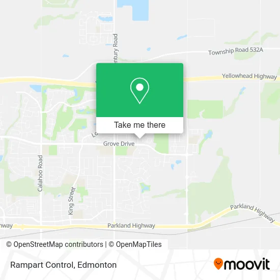
See Rampart Control, Spruce Grove, on the map
Public Transit to Rampart Control in Spruce Grove
Wondering how to get to Rampart Control in Spruce Grove? Moovit helps you find the best way to get to Rampart Control with step-by-step directions from the nearest public transit station.
Moovit provides free maps and live directions to help you navigate through your city. View schedules, routes, timetables, and find out how long does it take to get to Rampart Control in real time.
Looking for the nearest stop or station to Rampart Control? Check out this list of stops closest to your destination: Grove Drive & Spruce Village Way.
Bus: 560.
Want to see if there’s another route that gets you there at an earlier time? Moovit helps you find alternative routes or times. Get directions from and directions to Rampart Control easily from the Moovit App or Website.
We make riding to Rampart Control easy, which is why over 1.5 million users, including users in Spruce Grove, trust Moovit as the best app for public transit. You don’t need to download an individual bus app or train app, Moovit is your all-in-one transit app that helps you find the best bus time or train time available.
For information on prices of bus, costs and ride fares to Rampart Control, please check the Moovit app.
Use the app to navigate to popular places including to the airport, hospital, stadium, grocery store, mall, coffee shop, school, college, and university.
Rampart Control Address: Spruce Way Spruce Grove, AB T7X 0B2 street in Spruce Grove
- MK Tailor Dry Cleaning,
- H&R Block,
- Decks of Distinction,
- Joffre's Water,
- Sprucepark Builders,
- Matco Tools,
- Joes Handbags,
- E + S Accessories,
- Invision Optical,
- Dales Jewellers,
- Cozy Prairie Linens,
- Affordable Towing Serv,
- Beer Shak,
- Housing Programs Branch Hastings County,
- Exotix Candy Spruce,
- Vita Sana Naturopathic,
- Designs by Santos,
- High Arctic Seafoods,
- Catherine Marchand,
- Shades of Baby
Places Near Rampart Control (Spruce Grove)
- Edmonton Valley Zoo, Edmonton,
- University of Alberta, Edmonton,
- Londonderry Mall, Edmonton,
- West Edmonton Mall, Edmonton,
- Edmonton Commonwealth Stadium, Edmonton,
- Rogers Place, Edmonton,
- Alberta Legislature Building, Edmonton,
- Borden Park, Edmonton,
- Kaye Edmonton Clinic, Edmonton,
- Northgate Centre, Edmonton,
- Royal Alexandra Hospital, Edmonton,
- Canada Place Service Canada Centre, Edmonton,
- Kingsway Mall, Edmonton,
- Edmonton VIA Rail Station, Edmonton,
- Cross Cancer Institute, Edmonton,
- Grey Nuns Community Hospital, Edmonton,
- Whyte Avenue, Edmonton,
- Fort Edmonton Park, Edmonton,
- Edmonton EXPO Centre, Edmonton,
- MacEwan University, Edmonton
How to get to popular places in Edmonton with public transit
Get around Spruce Grove by public transit!
Traveling around Spruce Grove has never been so easy. See step by step directions as you travel to any attraction, street or major public transit station. View bus and train schedules, arrival times, service alerts and detailed routes on a map, so you know exactly how to get to anywhere in Spruce Grove.
When traveling to any destination around Spruce Grove use Moovit's Live Directions with Get Off Notifications to know exactly where and how far to walk, how long to wait for your line, and how many stops are left. Moovit will alert you when it's time to get off — no need to constantly re-check whether yours is the next stop.
Wondering how to use public transit in Spruce Grove or how to pay for public transit in Spruce Grove? Moovit public transit app can help you navigate your way with public transit easily, and at minimum cost. It includes public transit fees, ticket prices, and costs. Looking for a map of Spruce Grove public transit lines? Moovit public transit app shows all public transit maps in Spruce Grove with all Bus and Light Rail routes and stops on an interactive map.
Edmonton has 2 transit type(s), including: Bus and Light Rail, operated by several transit agencies, including ETS LRT, ETS, Strathcona County Transit, St. Albert Transit, Spruce Grove Transit, Fort Saskatchewan Transit, Beaumont Transit and Leduc Transit