How to get to Rampinha by bus?
Click on the bus route to see step by step directions with maps, line arrival times and updated time schedules.
From Marinha Da Noeirinha (Salinas), Glória e Vera Cruz
54 minFrom Parque de Exposições de Aveiro, Aveiro
104 minFrom Estação Ferroviária de Aveiro, Glória e Vera Cruz
48 minFrom Glicínias, Aveiro
45 minFrom Feira de Março, Aveiro
104 minFrom Piscina Exterior de Oliveirinha, Oliveirinha
61 minFrom Rua de Artur de Almeida Eça, Aveiro
47 minFrom CENTRO COMERCIAL GLICÍNIAS PLAZA, Aveiro
46 minFrom MERCADONA, Aveiro
39 minFrom Terminal Rodoviário de Aveiro, Glória e Vera Cruz
45 min
Bus lines to Rampinha in Sosa
What are the closest stations to Rampinha?
The closest stations to Rampinha are:
- Junta de Soza is 707 meters away, 9 min walk.
- Soza Centro is 1020 meters away, 13 min walk.
Which bus line stops near Rampinha?
18 (Vagos (Bombeiros))
What’s the nearest bus station to Rampinha in Sosa?
The nearest bus station to Rampinha in Sosa is Junta de Soza. It’s a 9 min walk away.
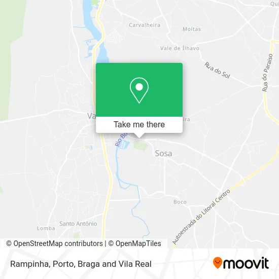
See Rampinha, Sosa, on the map
Public Transit to Rampinha in Sosa
Wondering how to get to Rampinha in Sosa? Moovit helps you find the best way to get to Rampinha with step-by-step directions from the nearest public transit station.
Moovit provides free maps and live directions to help you navigate through your city. View schedules, routes, timetables, and find out how long does it take to get to Rampinha in real time.
Looking for the nearest stop or station to Rampinha? Check out this list of stops closest to your destination: Junta de Soza; Soza Centro.
Bus: 18, 103, 104, 107, 111.
Want to see if there’s another route that gets you there at an earlier time? Moovit helps you find alternative routes or times. Get directions from and directions to Rampinha easily from the Moovit App or Website.
We make riding to Rampinha easy, which is why over 1.5 million users, including users in Sosa, trust Moovit as the best app for public transit. You don’t need to download an individual bus app or train app, Moovit is your all-in-one transit app that helps you find the best bus time or train time available.
For information on prices of bus, costs and ride fares to Rampinha, please check the Moovit app.
Use the app to navigate to popular places including to the airport, hospital, stadium, grocery store, mall, coffee shop, school, college, and university.
Rampinha Address: Ladeira do Prado 3840-353 Vagos street in Sosa
- Restaurante Rampinha,
- Mário Ferreira Martins dos Santos,
- Qlp - Horse Training & Equestrian Tourism,
- Autoworks,
- Cemitério de Sosa,
- Igreja de Sosa,
- Igreja Matriz de Soza,
- Praça S. Miguel,
- Baltazar a Matias Santos,
- Jardim de Infância de Soza,
- Cruzeiro de Sosa,
- Multibanco,
- SOCIEDADE INTERBANCARIA DE SERVICOS S A SIBS,
- Junta de Freguesia de Sosa,
- Farmácia Santos Costa,
- Quinta das Maias,
- Morais & Azevedo Lda,
- Cemitério de Vagos,
- Escola do Ensino Básico do 1° Ciclo de Sosa,
- Associação Desportiva e Cultural Sosense
Places Near Rampinha (Sosa)
- MAR Shopping, Matosinhos e Leça da Palmeira,
- Maia, Maia,
- Valongo, Valongo,
- Canidelo, Vila Nova De Gaia,
- Arrábida Shopping, Santa Marinha e São Pedro da Afurada,
- Senhor de Matosinhos, Matosinhos e Leça da Palmeira,
- Hospital de Santo António, Cedofeita, Santo Ildefonso, Sé, Miragaia, São Nicolau e Vitória,
- Parque Aquatico Amarante - Aqua Aventura, Amarante,
- Zoo Santo Inácio, Vila Nova De Gaia,
- Hospital da Prelada, Ramalde,
- Leça da Palmeira, Matosinhos e Leça da Palmeira,
- Avintes, Vila Nova De Gaia,
- Hospital Santos Silva, Vila Nova De Gaia,
- VILA do CONDE PORTO FASHION OUTLET, Modivas,
- Palácio de Cristal, Lordelo do Ouro e Massarelos,
- Rua Calouste Gulbenkian, Lordelo do Ouro e Massarelos,
- El Corte Inglés de Gaia, Mafamude e Vilar do Paraíso,
- Exponor, Matosinhos e Leça da Palmeira,
- Acesso ao Shopping Parque Nascente, Campanhã,
- Espinho, Espinho
How to get to popular places in Porto, Braga and Vila Real with public transit
Get around Sosa by public transit!
Traveling around Sosa has never been so easy. See step by step directions as you travel to any attraction, street or major public transit station. View bus and train schedules, arrival times, service alerts and detailed routes on a map, so you know exactly how to get to anywhere in Sosa.
When traveling to any destination around Sosa use Moovit's Live Directions with Get Off Notifications to know exactly where and how far to walk, how long to wait for your line, and how many stops are left. Moovit will alert you when it's time to get off — no need to constantly re-check whether yours is the next stop.
Wondering how to use public transit in Sosa or how to pay for public transit in Sosa? Moovit public transit app can help you navigate your way with public transit easily, and at minimum cost. It includes public transit fees, ticket prices, and costs. Looking for a map of Sosa public transit lines? Moovit public transit app shows all public transit maps in Sosa with all Bus, Train, Metro, Ferry, Funicular and Gondola routes and stops on an interactive map.
Porto, Braga and Vila Real has 6 transit type(s), including: Bus, Train, Metro, Ferry, Funicular and Gondola, operated by several transit agencies, including Metro do Porto, Metro do Porto - Metrobus, CP - Comboios de Portugal, STCP, UNIR Mobilidade da Area Metropolitana do Porto, Getbus - Aerobus, Mobiave, Valpibus, TUB - Transportes Urbanos de Braga, TuViana, Guimabus, Ave Mobilidade, Cávado Mobilidade, Transdev and Câmara Municipal de Santo Tirso