How to get to Ramsaru Heights by bus?
Click on the bus route to see step by step directions with maps, line arrival times and updated time schedules.
From Asian Eye Hospital, Pune & Velhe
49 minFrom Morwadi Court, Pune & Velhe
50 minFrom General Post Office (GPO), Pune & Velhe
43 minFrom D Y Patil Medical College, Pune & Velhe
46 minFrom ISKCON Govind dham,Nigdi, Pune & Velhe
72 minFrom Inox, Pune & Velhe
53 minFrom Post Office-SP BNPL Hub Pune, Pune & Velhe
44 minFrom Ness Wadia College, Pune & Velhe
54 minFrom Wipro Phase 2, Paud
44 minFrom RTO Pimpri Chinchwad, Pune & Velhe
63 min
Bus stop near Ramsaru Heights in Pune & Velhe
- Pimple Nilakh, 3 min walk,VIEW
Bus lines to Ramsaru Heights in Pune & Velhe
What are the closest stations to Ramsaru Heights?
The closest stations to Ramsaru Heights are:
- Pimple Nilakh is 194 meters away, 3 min walk.
Which bus lines stop near Ramsaru Heights?
These bus lines stop near Ramsaru Heights: 333, 344, 344A.
What’s the nearest bus station to Ramsaru Heights in Pune & Velhe?
The nearest bus station to Ramsaru Heights in Pune & Velhe is Pimple Nilakh. It’s a 3 min walk away.
What time is the first bus to Ramsaru Heights in Pune & Velhe?
The 333 is the first bus that goes to Ramsaru Heights in Pune & Velhe. It stops nearby at 5:12 AM.
What time is the last bus to Ramsaru Heights in Pune & Velhe?
The 333 is the last bus that goes to Ramsaru Heights in Pune & Velhe. It stops nearby at 11:31 PM.
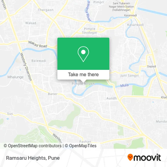
See Ramsaru Heights, Pune & Velhe, on the map
Public Transit to Ramsaru Heights in Pune & Velhe
Wondering how to get to Ramsaru Heights in Pune & Velhe? Moovit helps you find the best way to get to Ramsaru Heights with step-by-step directions from the nearest public transit station.
Moovit provides free maps and live directions to help you navigate through your city. View schedules, routes, timetables, and find out how long does it take to get to Ramsaru Heights in real time.
Looking for the nearest stop or station to Ramsaru Heights? Check out this list of stops closest to your destination: Pimple Nilakh.
Bus: 333, 344, 344A, 93, 126.
Want to see if there’s another route that gets you there at an earlier time? Moovit helps you find alternative routes or times. Get directions from and directions to Ramsaru Heights easily from the Moovit App or Website.
We make riding to Ramsaru Heights easy, which is why over 1.5 million users, including users in Pune & Velhe, trust Moovit as the best app for public transit. You don’t need to download an individual bus app or train app, Moovit is your all-in-one transit app that helps you find the best bus time or train time available.
For information on prices of bus, costs and ride fares to Ramsaru Heights, please check the Moovit app.
Use the app to navigate to popular places including to the airport, hospital, stadium, grocery store, mall, coffee shop, school, college, and university.
Ramsaru Heights Address: पिंपरी-चिंचवड 411027 MH street in Pune & Velhe
- Avadhut Prasad General Stores,
- Mauli Traders,
- Nirmiti Classic,
- Pimple Nilakh,
- Sachin Auto Center,
- Vikrant Cable & Broadband,
- Haji Chicken Centre,
- Vidya Traders,
- Om Flour Mill,
- Avdhut Prasad Ganpati Murti Stall,
- Shreeram Medical,
- Keskar Clinic,
- Kapilamrut Doodh Dairy,
- New Big Bazar,
- Flora Kids,
- Dhanashree Clinic,
- Vijay Kirana Store,
- Shri Swami Samarth Hardware,
- Vijay Super Market,
- Krishna Mobile at Pimpri
Places Near Ramsaru Heights (Pune & Velhe)
- Fc Road, Pune & Velhe,
- Symbiosis Lavale Bus Stop, Pune & Velhe,
- Senapati Bapat Road, Pune & Velhe,
- Chaturshringi Temple, Pune & Velhe,
- BAPS Shri Swaminarayan Mandir, Pune & Velhe,
- Tulshibaug, Pune & Velhe,
- ISKCON Nvcc Temple, Pune & Velhe,
- Sarasbaug, Pune & Velhe,
- Pvr Icon - Pavilion Mall, Pune & Velhe,
- Swaminarayan Mandir, Pune & Velhe,
- Laxmi Road, Pune & Velhe,
- Ion Digital Zone, Pune & Velhe,
- Dagadusheth Halwai Ganapati Temple, Pune & Velhe,
- Dagdusheth Halwai Ganpati Mandir, Pune & Velhe,
- M G Road, Pune & Velhe,
- Vishwakarma Institute Of Technology (Vit), Pune & Velhe,
- ISKCON Pune, Pune & Velhe,
- Westend Mall, Pune & Velhe,
- Pune Okayama Friendship Garden, Pune & Velhe,
- Cognizant Deccan Campus (CDC), Paud
How to get to popular places in Pune with public transit
Get around Pune & Velhe by public transit!
Traveling around Pune & Velhe has never been so easy. See step by step directions as you travel to any attraction, street or major public transit station. View bus and train schedules, arrival times, service alerts and detailed routes on a map, so you know exactly how to get to anywhere in Pune & Velhe.
When traveling to any destination around Pune & Velhe use Moovit's Live Directions with Get Off Notifications to know exactly where and how far to walk, how long to wait for your line, and how many stops are left. Moovit will alert you when it's time to get off — no need to constantly re-check whether yours is the next stop.
Wondering how to use public transit in Pune & Velhe or how to pay for public transit in Pune & Velhe? Moovit public transit app can help you navigate your way with public transit easily, and at minimum cost. It includes public transit fees, ticket prices, and costs. Looking for a map of Pune & Velhe public transit lines? Moovit public transit app shows all public transit maps in Pune & Velhe with all Bus, Train and Metro routes and stops on an interactive map.
Pune has 3 transit type(s), including: Bus, Train and Metro, operated by several transit agencies, including Pune Metro (Maha Metro), PMPML, PMPML Night Bus Service (Ratrani) and Central Railways (Indian Railways)