How to get to Ran by bus?
Click on the bus route to see step by step directions with maps, line arrival times and updated time schedules.
How to get to Ran by train?
Click on the train route to see step by step directions with maps, line arrival times and updated time schedules.
Bus stops near Ran in Verwaltungsverband Donaueschingen
Train stations near Ran in Verwaltungsverband Donaueschingen
- Donaueschingen Mitte/Siedlung, 11 min walk,VIEW
Bus lines to Ran in Verwaltungsverband Donaueschingen
- 620, Überauchen Rathausstraße - Bad Dürrheim Realschule,VIEW
- 850, Donaueschingen Busbahnhof - Langenbach Langenbach,VIEW
- 855, Mistelbrunn Mistelbrunn - Donaueschingen Busbahnhof,VIEW
- DS2, Donaueschingen Steinweg/Kindergart. - Donaueschingen Busbahnhof,VIEW
- DS1, Donaueschingen Steinweg/Kindergart.,VIEW
- 810, Donaueschingen Busbahnhof,VIEW
- 820, Gutmadingen Ortsmitte,VIEW
What are the closest stations to Ran?
The closest stations to Ran are:
- Donaueschingen Neue Wolterdinger Str is 123 meters away, 2 min walk.
- Donaueschingen Unterer Steinweg is 783 meters away, 11 min walk.
- Donaueschingen Mitte/Siedlung is 803 meters away, 11 min walk.
- Donaueschingen Siedlersteg is 979 meters away, 13 min walk.
Which train lines stop near Ran?
These train lines stop near Ran: RB42, RE2.
Which bus lines stop near Ran?
These bus lines stop near Ran: 800, 850, DS2.
What’s the nearest train station to Ran in Verwaltungsverband Donaueschingen?
The nearest train station to Ran in Verwaltungsverband Donaueschingen is Donaueschingen Mitte/Siedlung. It’s a 11 min walk away.
What’s the nearest bus station to Ran in Verwaltungsverband Donaueschingen?
The nearest bus station to Ran in Verwaltungsverband Donaueschingen is Donaueschingen Neue Wolterdinger Str. It’s a 2 min walk away.
What time is the first light rail to Ran in Verwaltungsverband Donaueschingen?
The S10 is the first light rail that goes to Ran in Verwaltungsverband Donaueschingen. It stops nearby at 5:38 AM.
What time is the last light rail to Ran in Verwaltungsverband Donaueschingen?
The S1 is the last light rail that goes to Ran in Verwaltungsverband Donaueschingen. It stops nearby at 7:05 AM.
What time is the first train to Ran in Verwaltungsverband Donaueschingen?
The RB42 is the first train that goes to Ran in Verwaltungsverband Donaueschingen. It stops nearby at 5:04 AM.
What time is the last train to Ran in Verwaltungsverband Donaueschingen?
The RB42 is the last train that goes to Ran in Verwaltungsverband Donaueschingen. It stops nearby at 11:38 PM.
What time is the first bus to Ran in Verwaltungsverband Donaueschingen?
The 850 is the first bus that goes to Ran in Verwaltungsverband Donaueschingen. It stops nearby at 5:24 AM.
What time is the last bus to Ran in Verwaltungsverband Donaueschingen?
The DS2 is the last bus that goes to Ran in Verwaltungsverband Donaueschingen. It stops nearby at 11:20 PM.
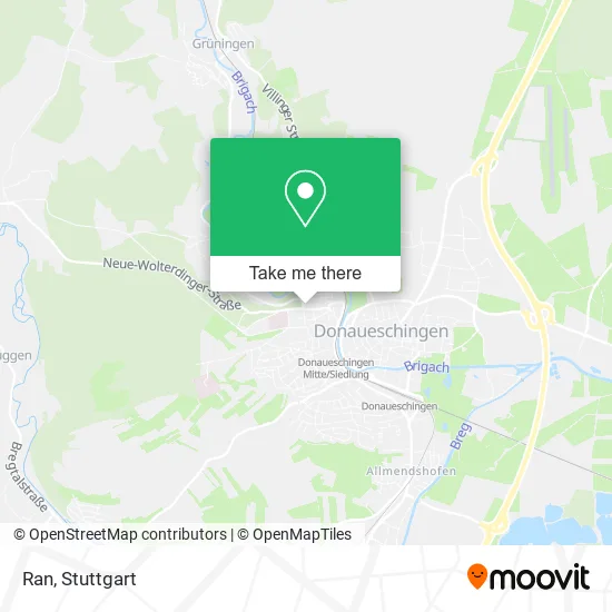
See Ran, Verwaltungsverband Donaueschingen, on the map
Public Transit to Ran in Verwaltungsverband Donaueschingen
Wondering how to get to Ran in Verwaltungsverband Donaueschingen? Moovit helps you find the best way to get to Ran with step-by-step directions from the nearest public transit station.
Moovit provides free maps and live directions to help you navigate through your city. View schedules, routes, timetables, and find out how long does it take to get to Ran in real time.
Looking for the nearest stop or station to Ran? Check out this list of stops closest to your destination: Donaueschingen Neue Wolterdinger Str; Donaueschingen Unterer Steinweg; Donaueschingen Mitte/Siedlung; Donaueschingen Siedlersteg.
Train: RB42, RE2, S10, RE42, RE55, RB 42, S10, RE 55, S1.Bus: 800, 850, DS2, 620, 855, DS1, 810, 820.
Want to see if there’s another route that gets you there at an earlier time? Moovit helps you find alternative routes or times. Get directions from and directions to Ran easily from the Moovit App or Website.
We make riding to Ran easy, which is why over 1.5 million users, including users in Verwaltungsverband Donaueschingen, trust Moovit as the best app for public transit. You don’t need to download an individual bus app or train app, Moovit is your all-in-one transit app that helps you find the best bus time or train time available.
For information on prices of bus, train and light rail, costs and ride fares to Ran, please check the Moovit app.
Use the app to navigate to popular places including to the airport, hospital, stadium, grocery store, mall, coffee shop, school, college, and university.
Ran Address: Neue-Wolterdinger-Straße 26 78166 Donaueschingen street in Verwaltungsverband Donaueschingen
- Edwin Lewandowski Fahrrä,
- Kessler Heiztechnik,
- Neue Wolterdinger Straße,
- Ab Audio Veranstaltungstechnik a. Benz,
- Service-Point,
- Scherzinger Fensterbau,
- Weinfirma - Wein Shop,
- Fotograf Richard,
- Fischbach Beteiligungs,
- Raiffeisen Zentral- Genossenschaft,
- Acus Drive System,
- Binefeld Immo-Bau,
- Michaela Wehrle,
- Teleconsult Stein Inh. Rolf Catterfeld,
- Gartenwelt-Lon,
- Heinrich Limberger Anzeigenberater,
- Karlheinz Klein,
- Kastanienhof Bauträger,
- Steuerberater Betz & Partner,
- Bbl Bernsau Brockdorff Insolvenz- und Zwangsverwalter GbR Donaueschingen
Places Near Ran (Verwaltungsverband Donaueschingen)
- Mercedes-Benz Museum (Mercedes Museum Stuttgart), Bad Cannstatt,
- Im Wizemann (Halle), Bad Cannstatt,
- SI-Centrum, Möhringen,
- Porsche Museum, Zuffenhausen,
- Gasometer Pforzheim, Pforzheim,
- Wilhelma (U-Bahn Wilhelma), Bad Cannstatt,
- Gleis 101/102 (tief), Stuttgart-Mitte,
- Marmorsaal Im Weissenburgpark, Stuttgart-Süd,
- Waldfriedhof, Degerloch,
- Geilhaus Haus 33a, Reutlingen-Betzingen,
- Klinikum Stuttgart - Katharinenhospital, Stuttgart-Mitte,
- Pariser Platz Stuttgart, Stuttgart-Mitte,
- Mettingen Eros-Center Puff Laufhaus, Esslingen Am Neckar,
- FlixBus Haltestelle, Stuttgart,
- Hauptbahnhof Stuttgart, Stuttgart-Mitte,
- Mercedes-Benz Museum, Bad Cannstatt,
- Porsche-Arena, Bad Cannstatt,
- Hanns-Martin-Schleyer-Halle, Bad Cannstatt,
- Schleyerhalle, Bad Cannstatt,
- Hanns-Martin-Schleyer-Halle (Stuttgart Hans-Martin-Schleyerhalle), Bad Cannstatt
How to get to popular places in Stuttgart with public transit
Get around Verwaltungsverband Donaueschingen by public transit!
Traveling around Verwaltungsverband Donaueschingen has never been so easy. See step by step directions as you travel to any attraction, street or major public transit station. View bus and train schedules, arrival times, service alerts and detailed routes on a map, so you know exactly how to get to anywhere in Verwaltungsverband Donaueschingen.
When traveling to any destination around Verwaltungsverband Donaueschingen use Moovit's Live Directions with Get Off Notifications to know exactly where and how far to walk, how long to wait for your line, and how many stops are left. Moovit will alert you when it's time to get off — no need to constantly re-check whether yours is the next stop.
Wondering how to use public transit in Verwaltungsverband Donaueschingen or how to pay for public transit in Verwaltungsverband Donaueschingen? Moovit public transit app can help you navigate your way with public transit easily, and at minimum cost. It includes public transit fees, ticket prices, and costs. Looking for a map of Verwaltungsverband Donaueschingen public transit lines? Moovit public transit app shows all public transit maps in Verwaltungsverband Donaueschingen with all Bus, Train, Subway, Light Rail, Ferry, S-Bahn and Funicular routes and stops on an interactive map.
Stuttgart has 7 transit type(s), including: Bus, Train, Subway, Light Rail, Ferry, S-Bahn and Funicular, operated by several transit agencies, including SSB - Stadtbahn, SSB, SSB - Seilbahn / Zacke, S-Bahn Stuttgart, Rhein-Neckar-Verkehr GmbH (rnv), Karlsruher Verkehrsverbund, DB AG, DB Regiobus BW, Arverio Baden-Württemberg GmbH, DB RegioNetz Verkehrs GmbH Westfrankenbahn, DB Regio AG Baden-Württemberg, Südwestdeutsche Verkehrs-AG, DB Regio AG Mitte Region Hessen, DB and Bodensee-Oberschwaben-Bahn