How to get to Rana Ibadi by bus?
Click on the bus route to see step by step directions with maps, line arrival times and updated time schedules.
From South Campus/Fort Edmonton Park Transit Centre, Edmonton
37 minFrom Abbottsfield Mall, Edmonton
55 minFrom 10365 97 Street Northwest, Edmonton
43 minFrom Edmonton Downtown Farmers Market, Edmonton
39 minFrom Saville Community Sports Centre, Edmonton
40 minFrom Concordia University College Of Alberta, Edmonton
53 minFrom Mark Panizzon - Mortgage Connection, Edmonton
44 minFrom Austin O'brien, Edmonton
59 minFrom Crestwood School, Edmonton
31 min
Bus stops near Rana Ibadi in Edmonton
Bus lines to Rana Ibadi in Edmonton
What are the closest stations to Rana Ibadi?
The closest stations to Rana Ibadi are:
- 127 Street & 132 Avenue is 210 meters away, 3 min walk.
- 124 Street & 135 Avenue is 528 meters away, 7 min walk.
Which bus lines stop near Rana Ibadi?
These bus lines stop near Rana Ibadi: 051, 054, 103, 106.
What’s the nearest bus station to Rana Ibadi in Edmonton?
The nearest bus station to Rana Ibadi in Edmonton is 127 Street & 132 Avenue. It’s a 3 min walk away.
What time is the first bus to Rana Ibadi in Edmonton?
The 103 is the first bus that goes to Rana Ibadi in Edmonton. It stops nearby at 6:19 AM.
What time is the last bus to Rana Ibadi in Edmonton?
The 106 is the last bus that goes to Rana Ibadi in Edmonton. It stops nearby at 12:41 AM.
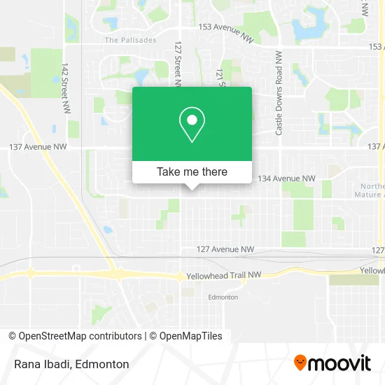
See Rana Ibadi, Edmonton, on the map
Public Transit to Rana Ibadi in Edmonton
Wondering how to get to Rana Ibadi in Edmonton? Moovit helps you find the best way to get to Rana Ibadi with step-by-step directions from the nearest public transit station.
Moovit provides free maps and live directions to help you navigate through your city. View schedules, routes, timetables, and find out how long does it take to get to Rana Ibadi in real time.
Looking for the nearest stop or station to Rana Ibadi? Check out this list of stops closest to your destination: 127 Street & 132 Avenue; 124 Street & 135 Avenue.
Bus: 051, 054, 103, 106, 124, 140X, 127, 625.
Want to see if there’s another route that gets you there at an earlier time? Moovit helps you find alternative routes or times. Get directions from and directions to Rana Ibadi easily from the Moovit App or Website.
We make riding to Rana Ibadi easy, which is why over 1.5 million users, including users in Edmonton, trust Moovit as the best app for public transit. You don’t need to download an individual bus app or train app, Moovit is your all-in-one transit app that helps you find the best bus time or train time available.
For information on prices of bus and light rail, costs and ride fares to Rana Ibadi, please check the Moovit app.
Use the app to navigate to popular places including to the airport, hospital, stadium, grocery store, mall, coffee shop, school, college, and university.
Rana Ibadi Address: 12522 132 Ave NW Edmonton, AB T5L 3P9 street in Edmonton
- Fresh Nuts,
- Calder Library (EPL),
- Lush Nails - Edmonton,
- Success Accounting,
- Mugs and Dough,
- Stepping Stones Academy & Child Development Centre,
- Fish and Fish,
- Blood Sweat & Sheers Inc,
- Kensington Bingo,
- Lifemark,
- Envy Hair & Nail,
- Botox Course,
- Successful Cleaning,
- Old Hippy Wood Product,
- Lawless Botanist,
- Lynk Services,
- Oikonomos Chartered Professional Accountants,
- Bao Painting,
- Healing Arts Company,
- Kensington Physical Thrpy & SPRTS
Places Near Rana Ibadi (Edmonton)
- Kaye Edmonton Clinic, Edmonton,
- Grey Nuns Community Hospital, Edmonton,
- Fort Edmonton Park, Edmonton,
- Canada Place Service Canada Centre, Edmonton,
- Londonderry Mall, Edmonton,
- Royal Alexandra Hospital, Edmonton,
- Edmonton EXPO Centre, Edmonton,
- Rogers Place, Edmonton,
- MacEwan University, Edmonton,
- Edmonton Commonwealth Stadium, Edmonton,
- Kingsway Mall, Edmonton,
- Borden Park, Edmonton,
- Alberta Legislature Building, Edmonton,
- Edmonton VIA Rail Station, Edmonton,
- Northgate Centre, Edmonton,
- West Edmonton Mall, Edmonton,
- University of Alberta, Edmonton,
- Edmonton Valley Zoo, Edmonton,
- Cross Cancer Institute, Edmonton,
- Whyte Avenue, Edmonton
How to get to popular places in Edmonton with public transit
Get around Edmonton by public transit!
Traveling around Edmonton has never been so easy. See step by step directions as you travel to any attraction, street or major public transit station. View bus and train schedules, arrival times, service alerts and detailed routes on a map, so you know exactly how to get to anywhere in Edmonton.
When traveling to any destination around Edmonton use Moovit's Live Directions with Get Off Notifications to know exactly where and how far to walk, how long to wait for your line, and how many stops are left. Moovit will alert you when it's time to get off — no need to constantly re-check whether yours is the next stop.
Wondering how to use public transit in Edmonton or how to pay for public transit in Edmonton? Moovit public transit app can help you navigate your way with public transit easily, and at minimum cost. It includes public transit fees, ticket prices, and costs. Looking for a map of Edmonton public transit lines? Moovit public transit app shows all public transit maps in Edmonton with all Bus and Light Rail routes and stops on an interactive map.
Edmonton has 2 transit type(s), including: Bus and Light Rail, operated by several transit agencies, including ETS LRT, ETS, Strathcona County Transit, St. Albert Transit, Spruce Grove Transit, Fort Saskatchewan Transit, Beaumont Transit and Leduc Transit