How to get to Rancho de Meco by bus?
Click on the bus route to see step by step directions with maps, line arrival times and updated time schedules.
From Hospital Príncipe De Asturias
22 minFrom El Corte Inglés
41 minFrom Centro Comercial Oasiz Madrid
74 minFrom Oasiz Madrid
73 minFrom Hospital De Torrejon De Ardoz
54 minFrom Cementerio Jardín
43 minFrom C.C. Cuadernillos
47 minFrom Centro Comercial Alcalá Magna
32 minFrom Dirección General de Tráfico (DGT)
39 minFrom Azuqueca de Henares
73 min
Bus stop near Rancho de Meco
- Av. Cervantes - C.º Valdeavero, 2 min walk,VIEW
Train station near Rancho de Meco
- Meco, 50 min walk,VIEW
Bus lines to Rancho de Meco
What are the closest stations to Rancho de Meco?
The closest stations to Rancho de Meco are:
- Av. Cervantes - C.º Valdeavero is 94 meters away, 2 min walk.
- Meco is 3939 meters away, 50 min walk.
Which bus line stops near Rancho de Meco?
250 (Vía Complutense - Atienza→Ctra. Camarma - Mármol)
What’s the nearest bus station to Rancho de Meco?
The nearest bus station to Rancho de Meco is Av. Cervantes - C.º Valdeavero. It’s a 2 min walk away.
What time is the first train to Rancho de Meco?
The C2 is the first train that goes to Rancho de Meco. It stops nearby at 5:42 AM.
What time is the last train to Rancho de Meco?
The C2 is the last train that goes to Rancho de Meco. It stops nearby at 12:37 AM.
What time is the first bus to Rancho de Meco?
The N202 is the first bus that goes to Rancho de Meco. It stops nearby at 3:00 AM.
What time is the last bus to Rancho de Meco?
The N202 is the last bus that goes to Rancho de Meco. It stops nearby at 3:36 AM.
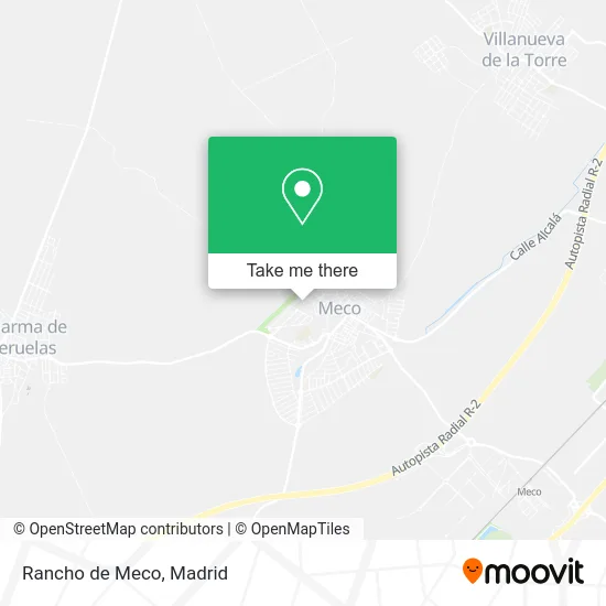
See Rancho de Meco on the map
Public Transportation to Rancho de Meco
Wondering how to get to Rancho de Meco? Moovit helps you find the best way to get to Rancho de Meco with step-by-step directions from the nearest public transit station.
Moovit provides free maps and live directions to help you navigate through your city. View schedules, routes, timetables, and find out how long does it take to get to Rancho de Meco in real time.
Looking for the nearest stop or station to Rancho de Meco? Check out this list of stops closest to your destination: Av. Cervantes - C.º Valdeavero; Meco.
Bus: 250, N202.Train: C2, C7.
Want to see if there’s another route that gets you there at an earlier time? Moovit helps you find alternative routes or times. Get directions from and directions to Rancho de Meco easily from the Moovit App or Website.
We make riding to Rancho de Meco easy, which is why over 1.5 million users, including users in Meco, trust Moovit as the best app for public transit. You don’t need to download an individual bus app or train app, Moovit is your all-in-one transit app that helps you find the best bus time or train time available.
For information on prices of bus, costs and ride fares to Rancho de Meco, please check the Moovit app.
Use the app to navigate to popular places including to the airport, hospital, stadium, grocery store, mall, coffee shop, school, college, and university.
Rancho de Meco Address: Calle Alcalá, 8 28880 Meco street in Meco
- Manu Márquez,
- Avenida Cervantes / Calle Alcalá,
- Armería-Meco,
- Ana y Celedoni,
- Tuktukcompany,
- Jorge Alonso a,
- Amrl Seguros y Servicios,
- Meco - Avenida de Cervantes 4,
- Labella Decoración y Aislamiento,
- Guns & Jara,
- Jetislarent Ibiza,
- Ayuntamiento De Meco,
- Alfonso Cantero Gómez,
- Plaza España, 6,
- Eom Actividades,
- Natur House,
- Belus,
- Rústica - Carpintería / Ebanistería,
- Colegio Chesterton,
- Ergoteca
Places Near Rancho de Meco
- Mercadillo de Majadahonda, Majadahonda,
- Estacion de Chamartin, Madrid,
- Plenilunio, Área Metropolitana De Madrid Y Corredor Del Henares,
- Hospital Universitario La Paz, Madrid,
- Plaza Mayor, Madrid,
- Tres Aguas, Alcorcón,
- Calle de López de Hoyos 169, Madrid,
- Rastro De Madrid, Área Metropolitana De Madrid Y Corredor Del Henares,
- Estadio Wanda Metropolitano, Área Metropolitana De Madrid Y Corredor Del Henares,
- Centro Comercial La Vaguada, Área Metropolitana De Madrid Y Corredor Del Henares,
- Sala La Riviera, Madrid,
- Nassica, Área Metropolitana De Madrid Y Corredor Del Henares,
- Centro Comercial Oasiz Madrid, Área Metropolitana De Madrid Y Corredor Del Henares,
- Hospital Universitario Ramón y Cajal, Madrid,
- Wizink Center, Madrid,
- Centro Comercial Islazul, Área Metropolitana De Madrid Y Corredor Del Henares,
- Hospital Clínico Universitario San Carlos, Madrid,
- Palacio De Vistalegre, Área Metropolitana De Madrid Y Corredor Del Henares,
- Mendez Alvaro, Madrid,
- Centro Comercial La Gavia, Área Metropolitana De Madrid Y Corredor Del Henares
How to get to popular places in Madrid with public transit
Get around Meco by public transit!
Traveling around Meco has never been so easy. See step by step directions as you travel to any attraction, street or major public transit station. View bus and train schedules, arrival times, service alerts and detailed routes on a map, so you know exactly how to get to anywhere in Meco.
When traveling to any destination around Meco use Moovit's Live Directions with Get Off Notifications to know exactly where and how far to walk, how long to wait for your line, and how many stops are left. Moovit will alert you when it's time to get off — no need to constantly re-check whether yours is the next stop.
Wondering how to use public transit in Meco or how to pay for public transit in Meco? Moovit public transit app can help you navigate your way with public transit easily, and at minimum cost. It includes public transit fees, ticket prices, and costs. Looking for a map of Meco public transit lines? Moovit public transit app shows all public transit maps in Meco with all Bus, Train, Metro and Light Rail routes and stops on an interactive map.
Madrid has 4 transit type(s), including: Bus, Train, Metro and Light Rail, operated by several transit agencies, including Metro de Madrid, Metro Ligero, Tranvía de Parla, Renfe Cercanías - Servicios de Autobús especiales, Renfe Cercanias, Renfe Cercanías, EMT, Interurbanos, Urbanos de Alcalá de Henares, Urbanos de Alcobendas, Urbanos de Alcorcón, Urbanos de Algete, Urbanos de Aranjuez, Urbanos de Arganda del Rey and Urbanos de Arroyomolinos