How to get to Rancho do Beto Macarrao by bus?
Click on the bus route to see step by step directions with maps, line arrival times and updated time schedules.
From Santo Aleixo, Magé
31 minFrom Piabetá, Magé
49 minFrom Terminal Rodoviário de Piabetá, Magé
49 minFrom Praça de Piabetá, Magé
51 minFrom Petrópolis, Petrópolis
131 minFrom Alto da Serra, Petrópolis
100 minFrom Quitandinha, Petrópolis
148 minFrom Hipershopping ABC, Petrópolis
104 minFrom Magé, Magé
30 minFrom Guapimirim, Guapimirim
39 min
How to get to Rancho do Beto Macarrao by train?
Click on the train route to see step by step directions with maps, line arrival times and updated time schedules.
Bus stops near Rancho do Beto Macarrao in Magé
Train station near Rancho do Beto Macarrao in Magé
- Jororó, 31 min walk,VIEW
Bus lines to Rancho do Beto Macarrao in Magé
- 1018, Piabetá,VIEW
- TZ08, Magé,VIEW
- 464C, Andorinhas (Direto - Parador),VIEW
- 465C, Andorinhas (Via Magé),VIEW
- 1001, Andorinhas,VIEW
- TERESÓPOLIS - MAGÉ, Teresópolis - Magé,VIEW
- MB15, Cachoeiras de Macacu - Magé (Via Guapimirim),VIEW
- MB16, Caxias - Guapimirim (Via Parada Modelo),VIEW
- 195C, Guapimirim - Central,VIEW
- MS201, Teresópolis - Magé,VIEW
- 800I, Magé - Caneca Fina,VIEW
- 805I, Magé - Paraíso,VIEW
- 2195C (EXECUTIVO), Guapimirim - Castelo,VIEW
- 1012, Vila Inca,VIEW
What are the closest stations to Rancho do Beto Macarrao?
The closest stations to Rancho do Beto Macarrao are:
- Rua Saputizeiro, 199 is 91 meters away, 2 min walk.
- Estrada Adam Blumer 5560 is 238 meters away, 4 min walk.
- Rod. Rio-Teresópolis (Passarela De Jororó) is 774 meters away, 11 min walk.
- Trevo Da Rio-Teresópolis/Estr. Adam Blummer is 1180 meters away, 16 min walk.
- Jororó is 2388 meters away, 31 min walk.
Which bus lines stop near Rancho do Beto Macarrao?
These bus lines stop near Rancho do Beto Macarrao: 1001, 1018, 805I.
Which train line stops near Rancho do Beto Macarrao?
EXTENSÃO GUAPIMIRIM (Guapimirim)
What’s the nearest bus station to Rancho do Beto Macarrao in Magé?
The nearest bus station to Rancho do Beto Macarrao in Magé is Rua Saputizeiro, 199. It’s a 2 min walk away.
What time is the first train to Rancho do Beto Macarrao in Magé?
The EXTENSÃO GUAPIMIRIM is the first train that goes to Rancho do Beto Macarrao in Magé. It stops nearby at 4:19 AM.
What time is the last train to Rancho do Beto Macarrao in Magé?
The EXTENSÃO GUAPIMIRIM is the last train that goes to Rancho do Beto Macarrao in Magé. It stops nearby at 8:21 PM.
What time is the first bus to Rancho do Beto Macarrao in Magé?
The 1001 is the first bus that goes to Rancho do Beto Macarrao in Magé. It stops nearby at 4:16 AM.
What time is the last bus to Rancho do Beto Macarrao in Magé?
The 196C is the last bus that goes to Rancho do Beto Macarrao in Magé. It stops nearby at 1:33 AM.
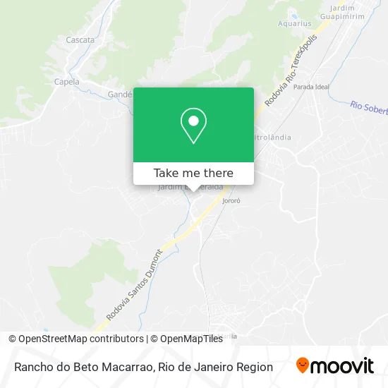
See Rancho do Beto Macarrao, Magé, on the map
Public Transit to Rancho do Beto Macarrao in Magé
Wondering how to get to Rancho do Beto Macarrao in Magé? Moovit helps you find the best way to get to Rancho do Beto Macarrao with step-by-step directions from the nearest public transit station.
Moovit provides free maps and live directions to help you navigate through your city. View schedules, routes, timetables, and find out how long does it take to get to Rancho do Beto Macarrao in real time.
Looking for the nearest stop or station to Rancho do Beto Macarrao? Check out this list of stops closest to your destination: Rua Saputizeiro; Estrada Adam Blumer 5560; Rod. Rio-Teresópolis (Passarela De Jororó); Trevo Da Rio-Teresópolis/Estr. Adam Blummer; Jororó.
Bus: 1001, 1018, 805I, TZ08, 464C, 465C, TERESÓPOLIS - MAGÉ, MB15, MB16, 195C, MS201, 1012.Train: EXTENSÃO GUAPIMIRIM.
Want to see if there’s another route that gets you there at an earlier time? Moovit helps you find alternative routes or times. Get directions from and directions to Rancho do Beto Macarrao easily from the Moovit App or Website.
We make riding to Rancho do Beto Macarrao easy, which is why over 1.5 million users, including users in Magé, trust Moovit as the best app for public transit. You don’t need to download an individual bus app or train app, Moovit is your all-in-one transit app that helps you find the best bus time or train time available.
For information on prices of bus and train, costs and ride fares to Rancho do Beto Macarrao, please check the Moovit app.
Use the app to navigate to popular places including to the airport, hospital, stadium, grocery store, mall, coffee shop, school, college, and university.
Rancho do Beto Macarrao Address: Rua Cabo Frio, 159 Jardim Esmeralda Magé-RJ 25908-704 street in Magé
- Beto Servicos,
- Af Deposito de Bebidas,
- Em Dr. Francisco Rondinelli,
- Club de Regatas do Flamengo Nossa Naçao,
- Jardim Esmeralda,
- Estrada Magé-Santo Aleixo,
- Antiga Estrada Magé | Santo Aleixo,
- Sítio Redil,
- Jardim Santo Antônio,
- Estrada Adam Blumer,
- Jardim Esmeralda,
- Bairro Andorinhas,
- Pedágio CRT,
- Pedágio Santo Aleixo (Sentido Magé / Santo Aleixo),
- Cachoeira Andorinhas,
- Estrada Magé-Santo Aleixo / Rua Teresopolis,
- Nilforty Distribuidora,
- Sítio do Vovô Tonho,
- Subestação Magé,
- Sao Jorge Futebol Clube
Places Near Rancho do Beto Macarrao (Magé)
- Shopping Downtown, Barra Da Tijuca,
- Rodoviária Novo Rio (Rodoviária do Rio de Janeiro), Santo Cristo,
- Feirão De Malhas, Duque De Caxias,
- Hospital Federal Do Andaraí, Andaraí,
- Hospital Pedro Ernesto, Vila Isabel,
- Hospital Federal Cardoso Fontes, Jacarepaguá,
- Shopping Nova América, Del Castilho,
- Praia do Arpoador, Ipanema,
- Museu Do Amanhã, Centro,
- Avenida Rio Branco, Centro,
- Shopping Rio Sul, Botafogo,
- Avenida Venezuela 134, Saúde,
- Norte Shopping, Cachambi,
- Rua Licínio Cardoso, São Francisco Xavier,
- Niterói, Niterói,
- Rio De Janeiro,
- Shopping RioSul, Botafogo,
- Hospital Municipal Ronaldo Gazolla, Acari,
- Rua Ulysses Guimarães 16, Cidade Nova,
- Feira Livre da Gloria, Glória
How to get to popular places in Rio de Janeiro Region with public transit
Get around Magé by public transit!
Traveling around Magé has never been so easy. See step by step directions as you travel to any attraction, street or major public transit station. View bus and train schedules, arrival times, service alerts and detailed routes on a map, so you know exactly how to get to anywhere in Magé.
When traveling to any destination around Magé use Moovit's Live Directions with Get Off Notifications to know exactly where and how far to walk, how long to wait for your line, and how many stops are left. Moovit will alert you when it's time to get off — no need to constantly re-check whether yours is the next stop.
Wondering how to use public transit in Magé or how to pay for public transit in Magé? Moovit public transit app can help you navigate your way with public transit easily, and at minimum cost. It includes public transit fees, ticket prices, and costs. Looking for a map of Magé public transit lines? Moovit public transit app shows all public transit maps in Magé with all Bus, Train, Metro, Light Rail, Ferry, Cable Car, Gondola and Funicular routes and stops on an interactive map.
Rio de Janeiro Region has 8 transit type(s), including: Bus, Train, Metro, Light Rail, Ferry, Cable Car, Gondola and Funicular, operated by several transit agencies, including TrensRJ, Metrô Rio, VLT Carioca, Barcas Rio, BRT MOBI-Rio, Auto Viação Alpha, Auto Viação Tijuca, Gire Transportes, Transurb, Viação Nossa Senhora das Graças, Consórcio INTERSUL, Braso Lisboa (Municipal), Caprichosa Auto Ônibus, Auto Viação Três Amigos and Rodoviária Âncora Matias