How to get to Randstad by bus?
Click on the bus route to see step by step directions with maps, line arrival times and updated time schedules.
From Créteil, Creteil
62 minFrom La Felicità, Paris
67 minFrom Rue de la Santé, Paris
66 minFrom MK2 Bibliothèque, Paris
67 minFrom Maison du Handball, Créteil
59 minFrom Clamart, Clamart
98 minFrom le 14 juillet, Paris
69 minFrom Arcueil, Arcueil
44 minFrom Vanves, Vanves
74 minFrom Rue du Chateau des Rentiers, Paris
60 min
How to get to Randstad by metro?
Click on the metro route to see step by step directions with maps, line arrival times and updated time schedules.
From Créteil, Creteil
87 minFrom La Felicità, Paris
46 minFrom Rue de la Santé, Paris
59 minFrom MK2 Bibliothèque, Paris
47 minFrom Maison du Handball, Créteil
80 minFrom Clamart, Clamart
96 minFrom le 14 juillet, Paris
80 minFrom Arcueil, Arcueil
60 minFrom Vanves, Vanves
95 minFrom Rue du Chateau des Rentiers, Paris
43 min
Light Rail stations near Randstad in Rungis
- Saarinen (Parc Silic Nord), 1 min walk,VIEW
Bus stops near Randstad in Rungis
RER station near Randstad in Rungis
- Rungis la Fraternelle, 17 min walk,VIEW
Bus lines to Randstad in Rungis
What are the closest stations to Randstad?
The closest stations to Randstad are:
- Saarinen (Parc Silic Nord) is 58 meters away, 1 min walk.
- Les Solets is 185 meters away, 3 min walk.
- Toronto is 403 meters away, 6 min walk.
- Lindbergh is 438 meters away, 6 min walk.
- Rue D'Arcueil is 497 meters away, 7 min walk.
- Les Avernaises is 926 meters away, 12 min walk.
- Rungis la Fraternelle is 1252 meters away, 17 min walk.
Which metro line stops near Randstad?
14 (Saint-Lazare)
Which bus lines stop near Randstad?
These bus lines stop near Randstad: 131, 396.
Which light rail line stops near Randstad?
T7 (Porte de L'Essonne)
What’s the nearest light rail station to Randstad in Rungis?
The nearest light rail station to Randstad in Rungis is Saarinen (Parc Silic Nord). It’s a 1 min walk away.
What’s the nearest bus station to Randstad in Rungis?
The nearest bus station to Randstad in Rungis is Les Solets. It’s a 3 min walk away.
What’s the nearest RER station to Randstad in Rungis?
The nearest RER station to Randstad in Rungis is Rungis la Fraternelle. It’s a 17 min walk away.
What time is the first light rail to Randstad in Rungis?
The T7 is the first light rail that goes to Randstad in Rungis. It stops nearby at 6:23 AM.
What time is the last light rail to Randstad in Rungis?
The T7 is the last light rail that goes to Randstad in Rungis. It stops nearby at 12:56 AM.
What time is the first bus to Randstad in Rungis?
The N22 is the first bus that goes to Randstad in Rungis. It stops nearby at 3:16 AM.
What time is the last bus to Randstad in Rungis?
The N31 is the last bus that goes to Randstad in Rungis. It stops nearby at 4:04 AM.
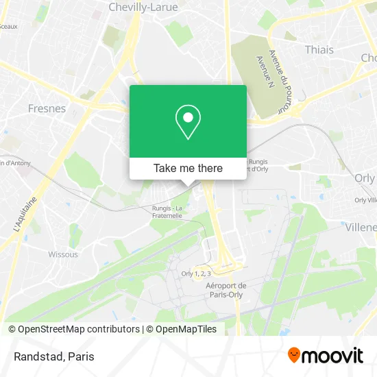
See Randstad, Rungis, on the map
Public Transit to Randstad in Rungis
Wondering how to get to Randstad in Rungis? Moovit helps you find the best way to get to Randstad with step-by-step directions from the nearest public transit station.
Moovit provides free maps and live directions to help you navigate through your city. View schedules, routes, timetables, and find out how long does it take to get to Randstad in real time.
Looking for the nearest stop or station to Randstad? Check out this list of stops closest to your destination: Saarinen (Parc Silic Nord); Les Solets; Toronto; Lindbergh; Rue D'Arcueil; Les Avernaises; Rungis la Fraternelle.
RER: C.Metro: 14.Bus: 131, 396, 319, 5154, N22, N31.Light Rail: T7.
Want to see if there’s another route that gets you there at an earlier time? Moovit helps you find alternative routes or times. Get directions from and directions to Randstad easily from the Moovit App or Website.
We make riding to Randstad easy, which is why over 1.5 million users, including users in Rungis, trust Moovit as the best app for public transit. You don’t need to download an individual bus app or train app, Moovit is your all-in-one transit app that helps you find the best bus time or train time available.
For information on prices of bus, metro, light rail and RER, costs and ride fares to Randstad, please check the Moovit app.
Use the app to navigate to popular places including to the airport, hospital, stadium, grocery store, mall, coffee shop, school, college, and university.
Randstad Address: Rue des Gémeaux 94150 Rungis street in Rungis
- Air Liquide Santé France,
- Derichebourg Interim,
- Rue du Sagittaire,
- ibis Styles Paris Orly Tech Airport,
- 47 Rue des Solets,
- Parc Icade,
- Venum Training Camp,
- Dragon Bleu,
- Espace Jean Monnet,
- Touré Samba,
- 20 Rue du Bélier,
- M6 Boutique,
- Universites des Mairies 94,
- 11 Rue du Lion,
- 34 Rue du Commandant Mouchotte,
- Gsf,
- Transavia.com France,
- Orlytech,
- 18 Avenue Louis Blériot,
- Bouygues Energies
Places Near Randstad (Rungis)
- Atelier Des Lumieres, Paris,
- Hôpital Saint-Joseph, Paris,
- Centre Hospitalier des 15/20, Paris,
- Théâtre Mogador, Paris,
- Hôpital Henri Mondor, Creteil,
- Hôpital Pitié Salpêtrière, Paris,
- Galeries Lafayette Haussmann, Paris,
- Hôpital Beaujon, Clichy,
- Galeries Lafayette, Paris,
- Marché Saint-Pierre, Paris,
- Hôpital de la Pitié-Salpêtrière, Paris,
- Institut Curie, Paris,
- Créteil Soleil, Creteil,
- Hopital Lariboisière, Paris,
- Hopital Foch, Suresnes,
- Fondation Louis Vuitton, Paris,
- Hôpital Cochin, Paris,
- Hôpital Necker, Paris,
- Gare Routière Flixbus, Paris,
- 29 Rue Manin, Paris
How to get to popular places in Paris with public transit
Get around Rungis by public transit!
Traveling around Rungis has never been so easy. See step by step directions as you travel to any attraction, street or major public transit station. View bus and train schedules, arrival times, service alerts and detailed routes on a map, so you know exactly how to get to anywhere in Rungis.
When traveling to any destination around Rungis use Moovit's Live Directions with Get Off Notifications to know exactly where and how far to walk, how long to wait for your line, and how many stops are left. Moovit will alert you when it's time to get off — no need to constantly re-check whether yours is the next stop.
Wondering how to use public transit in Rungis or how to pay for public transit in Rungis? Moovit public transit app can help you navigate your way with public transit easily, and at minimum cost. It includes public transit fees, ticket prices, and costs. Looking for a map of Rungis public transit lines? Moovit public transit app shows all public transit maps in Rungis with all Bus, Train, Metro, Light Rail, RER, Funicular and Gondola routes and stops on an interactive map.
Paris has 7 transit type(s), including: Bus, Train, Metro, Light Rail, RER, Funicular and Gondola, operated by several transit agencies, including RATP, RER, RER Bus de remplacement, Train, Train Bus de remplacement, Tramway Bus de remplacement, TER, ADP, Magical Shuttle, Argenteuil - Boucles de Seine, Autocars Dominique, Bièvre, Brie et 2 Morin, Le Bus - C.C. du Clermontois and Cœur d’Essonne