How to get to Randy Gubler Dpm by bus?
Click on the bus route to see step by step directions with maps, line arrival times and updated time schedules.
From Cheyenne Transportation Yard, North Las Vegas
34 minFrom College Of Southern Nevada Charleston Campus, Las Vegas
56 minFrom Oussama Hajal, Pac, Las Vegas
62 minFrom Martin Luther King and bonanza, Las Vegas
50 minFrom S Valley View Blvd / W Charleston Blvd, Las Vegas
45 minFrom Lee's Discount Liquor, North Las Vegas
69 minFrom Shopping Mall in Las Vegas, NV, Las Vegas
46 minFrom S Hualapai Way / W Charleston Blvd, Las Vegas
44 minFrom Marlons Closet and Bookstore, Las Vegas
37 minFrom Rancho @ Palomino (N), Las Vegas
41 min
Bus stops near Randy Gubler Dpm in Las Vegas
Bus lines to Randy Gubler Dpm in Las Vegas
What are the closest stations to Randy Gubler Dpm?
The closest stations to Randy Gubler Dpm are:
- Sb Cimarron Before Soaring Gulls is 86 yards away, 2 min walk.
- Wb Cheyenne After Buffalo is 179 yards away, 3 min walk.
- Sb Buffalo After Cheyenne is 190 yards away, 3 min walk.
- Eb Cheyenne After Tenaya is 212 yards away, 4 min walk.
Which bus lines stop near Randy Gubler Dpm?
These bus lines stop near Randy Gubler Dpm: 104, 121, 218.
What’s the nearest bus station to Randy Gubler Dpm in Las Vegas?
The nearest bus station to Randy Gubler Dpm in Las Vegas is Sb Cimarron Before Soaring Gulls. It’s a 2 min walk away.
What time is the first bus to Randy Gubler Dpm in Las Vegas?
The 218 is the first bus that goes to Randy Gubler Dpm in Las Vegas. It stops nearby at 4:06 AM.
What time is the last bus to Randy Gubler Dpm in Las Vegas?
The 121 is the last bus that goes to Randy Gubler Dpm in Las Vegas. It stops nearby at 1:37 AM.
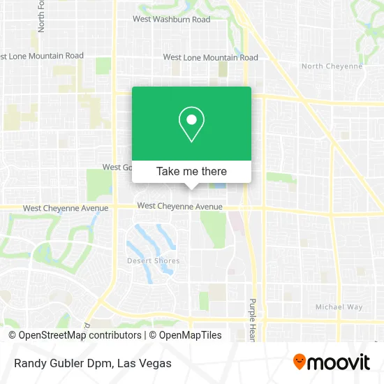
See Randy Gubler Dpm, Las Vegas, on the map
Public Transit to Randy Gubler Dpm in Las Vegas
Wondering how to get to Randy Gubler Dpm in Las Vegas? Moovit helps you find the best way to get to Randy Gubler Dpm with step-by-step directions from the nearest public transit station.
Moovit provides free maps and live directions to help you navigate through your city. View schedules, routes, timetables, and find out how long does it take to get to Randy Gubler Dpm in real time.
Looking for the nearest stop or station to Randy Gubler Dpm? Check out this list of stops closest to your destination: Sb Cimarron Before Soaring Gulls; Wb Cheyenne After Buffalo; Sb Buffalo After Cheyenne; Eb Cheyenne After Tenaya.
Bus: 104, 121, 218, 120.
Want to see if there’s another route that gets you there at an earlier time? Moovit helps you find alternative routes or times. Get directions from and directions to Randy Gubler Dpm easily from the Moovit App or Website.
We make riding to Randy Gubler Dpm easy, which is why over 1.7 million users, including users in Las Vegas, trust Moovit as the best app for public transit. You don’t need to download an individual bus app or train app, Moovit is your all-in-one transit app that helps you find the best bus time or train time available.
For information on prices of bus, costs and ride fares to Randy Gubler Dpm, please check the Moovit app.
Use the app to navigate to popular places including to the airport, hospital, stadium, grocery store, mall, coffee shop, school, college, and university.
Randy Gubler Dpm Address: 3320 N Buffalo Dr street in Las Vegas
- Ara Wellness,
- Cheyenne @ Cimarron (W),
- Junk Car Traders,
- Clark County Assessor & Recorder's Office,
- W Cheyenne Ave / N Tenaya Way,
- Molasky Junior High School (Molasky JHS Bands),
- Cheyenne & Tenaya,
- Target,
- Rainbow Library,
- MountainView Hospital,
- P3 Medical Group Business Park,
- Laboratory Corporation of America,
- Cheyenne Exit off the 95,
- Indian Springs,
- Good Shepherd Integrated Healthcare Services,
- Desert Shores Lake,
- Northwest Career College,
- Jollibee,
- cheyenne & rainbow,
- La Quinta Inn & Suites-Las Vegas
Places Near Randy Gubler Dpm (Las Vegas)
- Area15, Las Vegas,
- Walmart Supercenter, Las Vegas,
- The Palms Casino Resort, Paradise,
- Koolsville Tattoos, Las Vegas,
- Town Square, Enterprise,
- Lee Canyon, Las Vegas,
- Welcome To Fabulous Las Vegas Sign, Paradise,
- The Deuce Bus Stop at Fremont St, Las Vegas,
- The Neon Museum, Las Vegas,
- Allegiant Stadium, Paradise,
- Meow Wolf - Las Vegas (Meow Wolf's Omega Mart), Las Vegas,
- Arte Museum Las Vegas, Paradise,
- Trump International Hotel Las Vegas, Paradise,
- Omega Mart, Las Vegas,
- Zak Bagans Haunted Museum, Las Vegas,
- Gold & Silver Pawn Shop, Las Vegas,
- Las Vegas North Premium Outlets, Las Vegas,
- Las Vegas South Premium Outlets, Enterprise,
- Las Vegas Premium Outlets-North, Enterprise,
- Walmart, Las Vegas
How to get to popular places in Las Vegas with public transit
Get around Las Vegas by public transit!
Traveling around Las Vegas has never been so easy. See step by step directions as you travel to any attraction, street or major public transit station. View bus and train schedules, arrival times, service alerts and detailed routes on a map, so you know exactly how to get to anywhere in Las Vegas.
When traveling to any destination around Las Vegas use Moovit's Live Directions with Get Off Notifications to know exactly where and how far to walk, how long to wait for your line, and how many stops are left. Moovit will alert you when it's time to get off — no need to constantly re-check whether yours is the next stop.
Wondering how to use public transit in Las Vegas or how to pay for public transit in Las Vegas? Moovit public transit app can help you navigate your way with public transit easily, and at minimum cost. It includes public transit fees, ticket prices, and costs. Looking for a map of Las Vegas public transit lines? Moovit public transit app shows all public transit maps in Las Vegas with all Bus and Monorail routes and stops on an interactive map.
Las Vegas has 2 transit type(s), including: Bus and Monorail, operated by several transit agencies, including RTCSNV, City of Las Vegas, Alvand Transportation, Vegas Airporter, Las Vegas Monorail, FlixBus-us and Greyhound-us